HydroCore is the TENEVIA simulator that allows you to create virtual flow stations.
It is usually used in flood forecasting, hydropower facility operation, integrated water resource management, carrying out hydrological studies or diagnosing hydropower potential.
OVERVIEW OF HYDROCORE
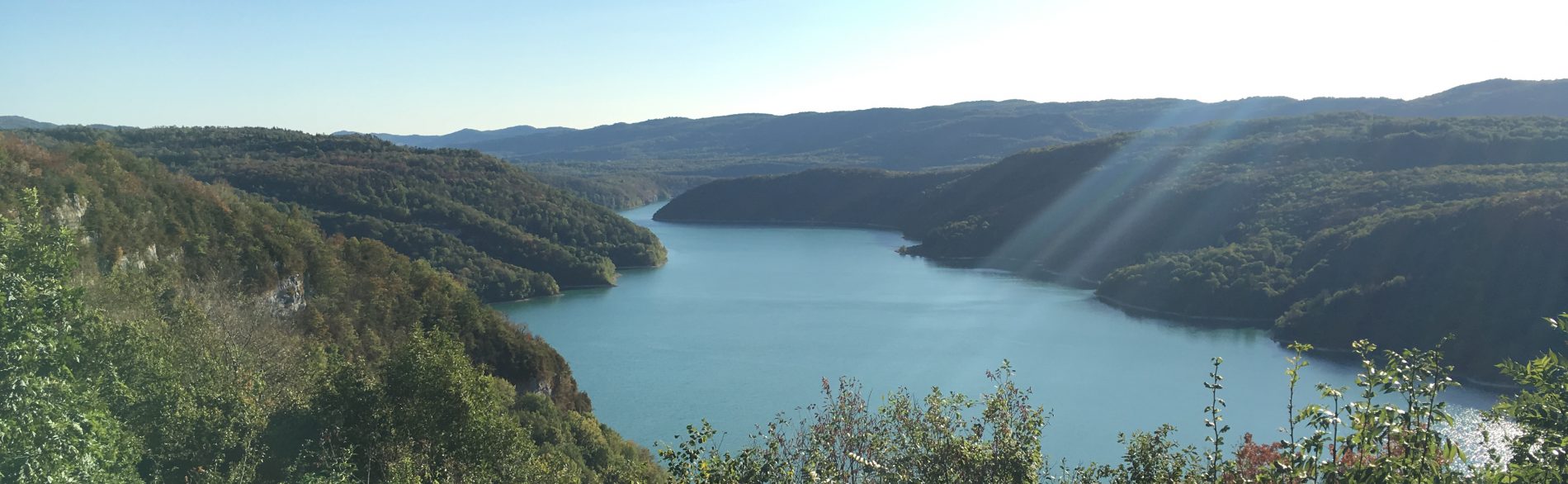
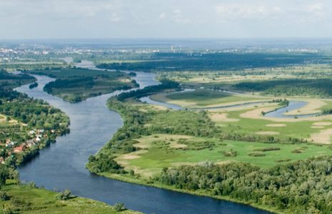
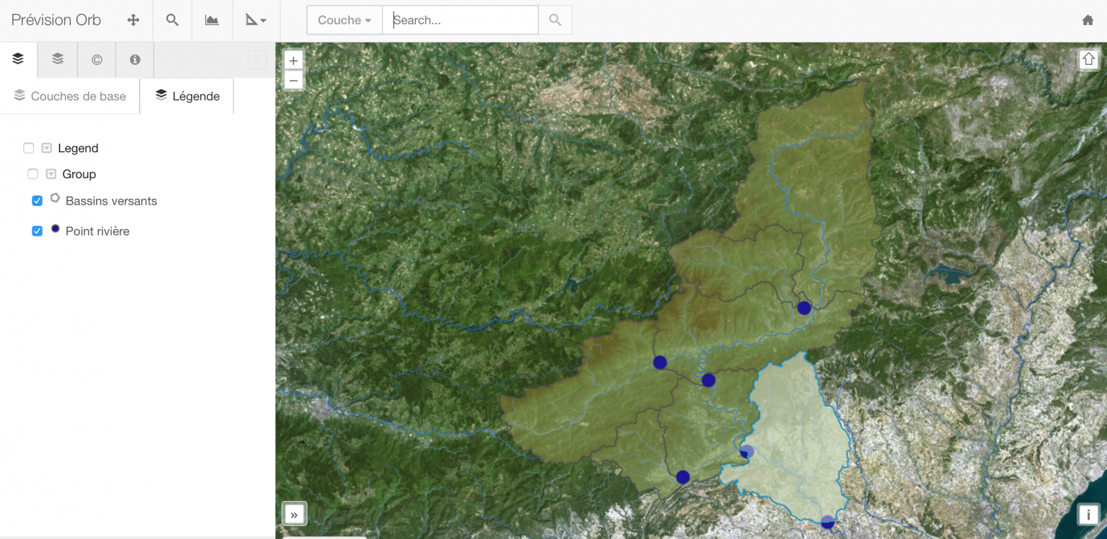
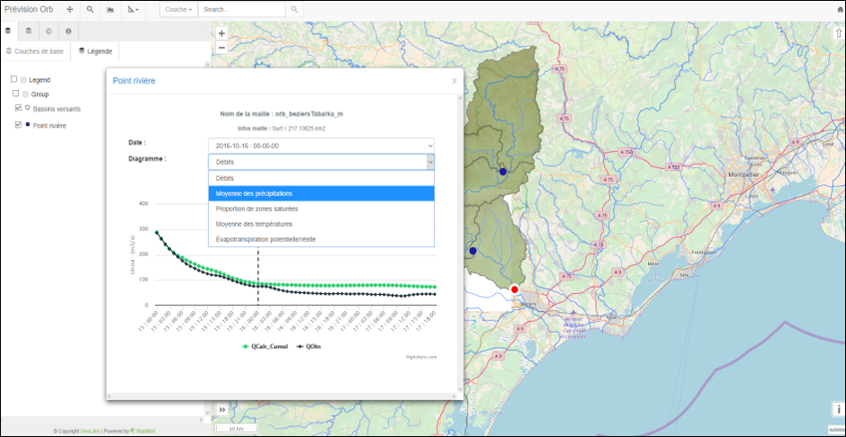
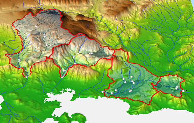
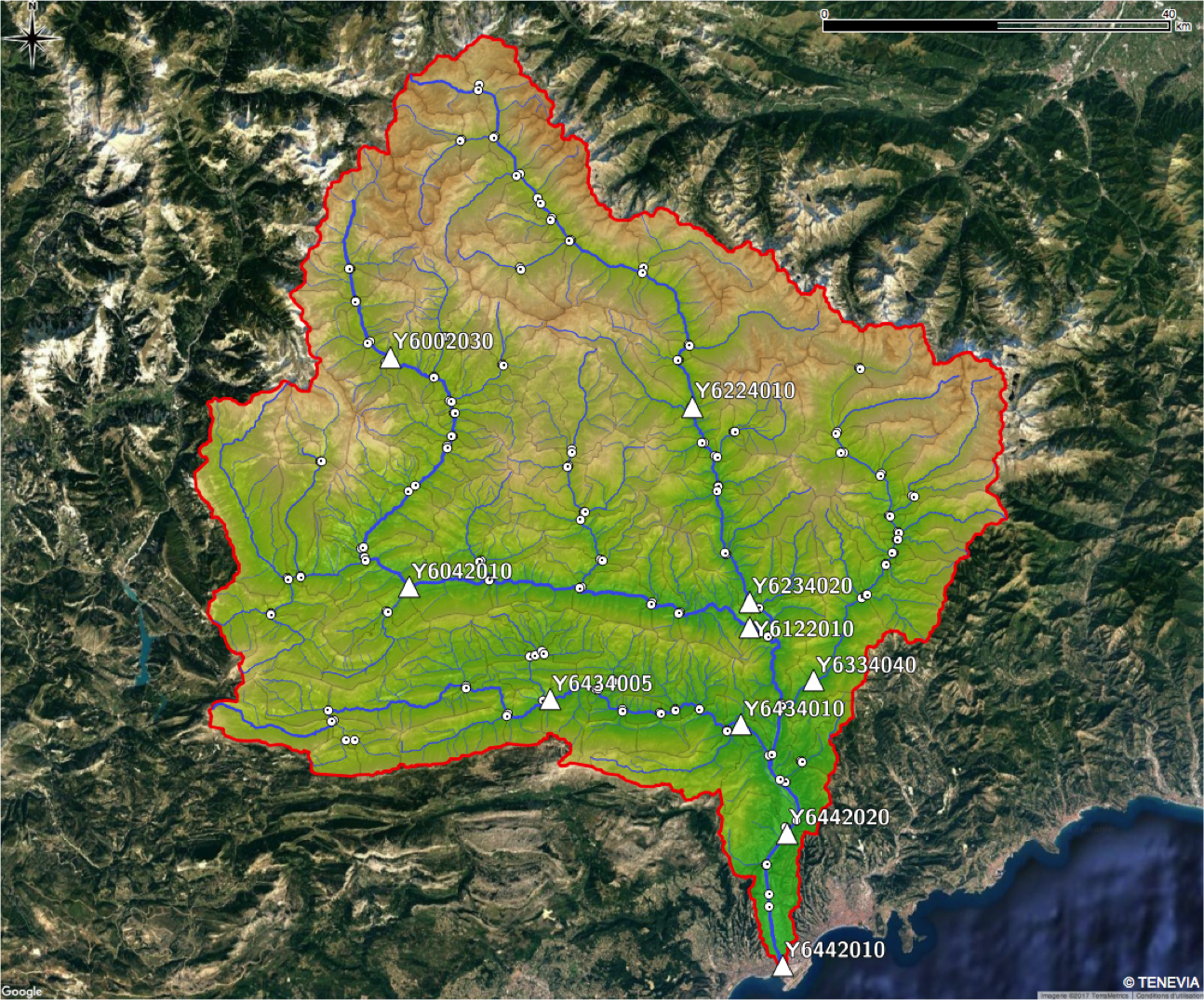
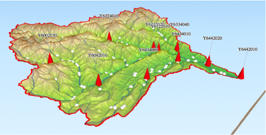
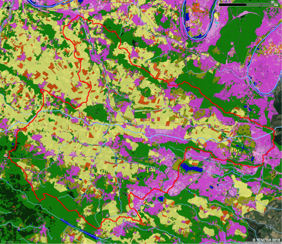
TENEVIA HydroCore® can be used to anticipate developments in the condition of waterways according to observed and/or forecast weather conditions. The simulator produces a flow of hydrological data at different points of a catchment area. Also called “virtual stations”, these points constitute an addition to a region’s physical monitoring stations (sensors). Positioned strategically across a hydrographic network, these virtual discharge stations characterize and quantity the flow dynamics for different locations of the hydrographic network.
Designed for operational hydrology, HydroCore is a process-based model representing the functioning of catchment areas for real time forecasts or post-analysis. To do this, it can use many sources of observed or forecast meteorological data. HydroCore also integrates different elements of a region’s spatial characterisation (topographical, geological, land use, etc.). The simulator is therefore a complete modelling system. It is modular and adapts to each problem, the available data and the specificities of the catchment area. The HydroCore simulator’s main uses are forecasting floods, the operational management of hydropower facilities, studying water resources and requirements, assessing hydropower potential and analysing water conditions (…)
HYDROCORE’S ADVANTAGES
Turnkey hydrological service
HydroCore offers easy access to a flow of hydrological data in real time. It is TENEVIA that manages the model’s operational function. Proposed as a service, its operation does not require any specific computer infrastructure
Operational function optimised
HydroCore has been designed for optimum functionality in operating conditions. With its highly-efficient numerical system, this spatialised model offers a rapid response, taking a few seconds to a few minutes according to the size of the area. Forecast refresh frequency can therefore reach 5 minutes.
A modular simulator that uses the available data
Designed to be modular, HydroCore adapts to each region’s specificities, operating from local to regional or country scales. The simulator can incorporate the spatial variability of topographic, pedological, geological and hydraulic properties, whilst keeping a reasoned representation of the main physical processes of the origin and propagation of flows. This reduces the need to resort to a long record of historical data to calibrate the model.
HydroCore also understands perfectly how to use a large quantity of existing data to improve the precision and strength of its simulations and forecasts. It can also function in a pertinent manner with little data.
Compatible with a large quantity of meteorological data
The hydrological response and therefore river reaction to meteorological conditions is location-sensitive, particularly for extreme events. HydroCore therefore takes the spatial variability of precipitation and temperature into account.
It exploits different sources of observed and simulated meteorological data, such as:
- measurements produced by a network of weather stations;
- quantitative precipitation estimation from weather radars;
- short-tem quantitative precipitation forecasting (e.g. from weather radar nowcasting);
- meteorological forecasts from high-resolution weather models.
TENEVIA collaborates with several weather station manufacturers and suppliers, radar measurement systems and forecast data from different weather models. For more information, please contact us.
Self-adjusting forecast through data assimilation
HydroCore is capable of using a hydrometric monitoring network to improve its forecasts. Assimilating measurements allows it to detect any drift and make the required adjustments. This type of technique has allowed significant progress to be made in operational meteorology.
Functions enriched by our web services
TENEVIA helps you to use flows of hydrological data through its TENEVIA OS monitoring service. Based on high-availability servers hosted in France, this service allows you to make full use of the advantages of a forecasting system:
- data storage;
- concentration of meteorological data input;
- concentration of hydrometric measurements (existing sensors, CamLevel, CamFlow, …)
- supervising model operation;
- access to an advance email and text alarm module;
- real-time consultation and access to historical data (dashboard).
Further information in our Web Services section.

request

Operation and service levels
| More details in technical information sheet | ESSENTIAL | ADVANCED | COMPLETE |
|---|---|---|---|
| Flow simulations / forecasts | |||
| Forecasts with data assimilation | |||
| Forecasts with uncertainties quantification |
| ESSENTIAL | |
|---|---|
| Flow simulations / forecasts | |
| Forecasts with data assimilation | |
| Forecasts with uncertainties quantification | |
| ADVANCED | |
|---|---|
| Flow simulations / forecasts | |
| Forecasts with data assimilation | |
| Forecasts with uncertainties quantification | |
| COMPLETE | |
|---|---|
| Flow simulations / forecasts | |
| Forecasts with data assimilation | |
| Forecasts with uncertainties quantification | |
ADDITIONAL PRODUCTS


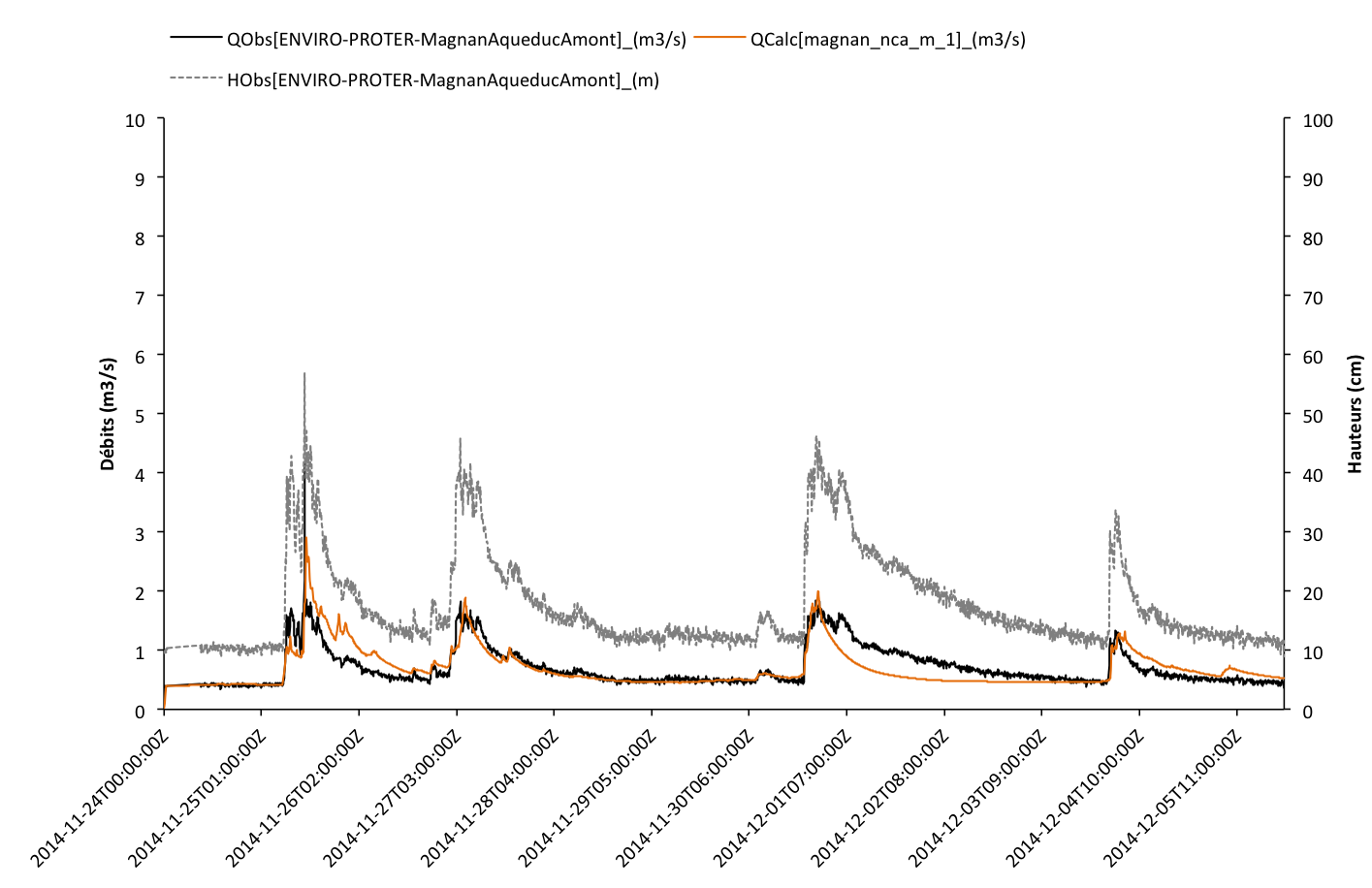
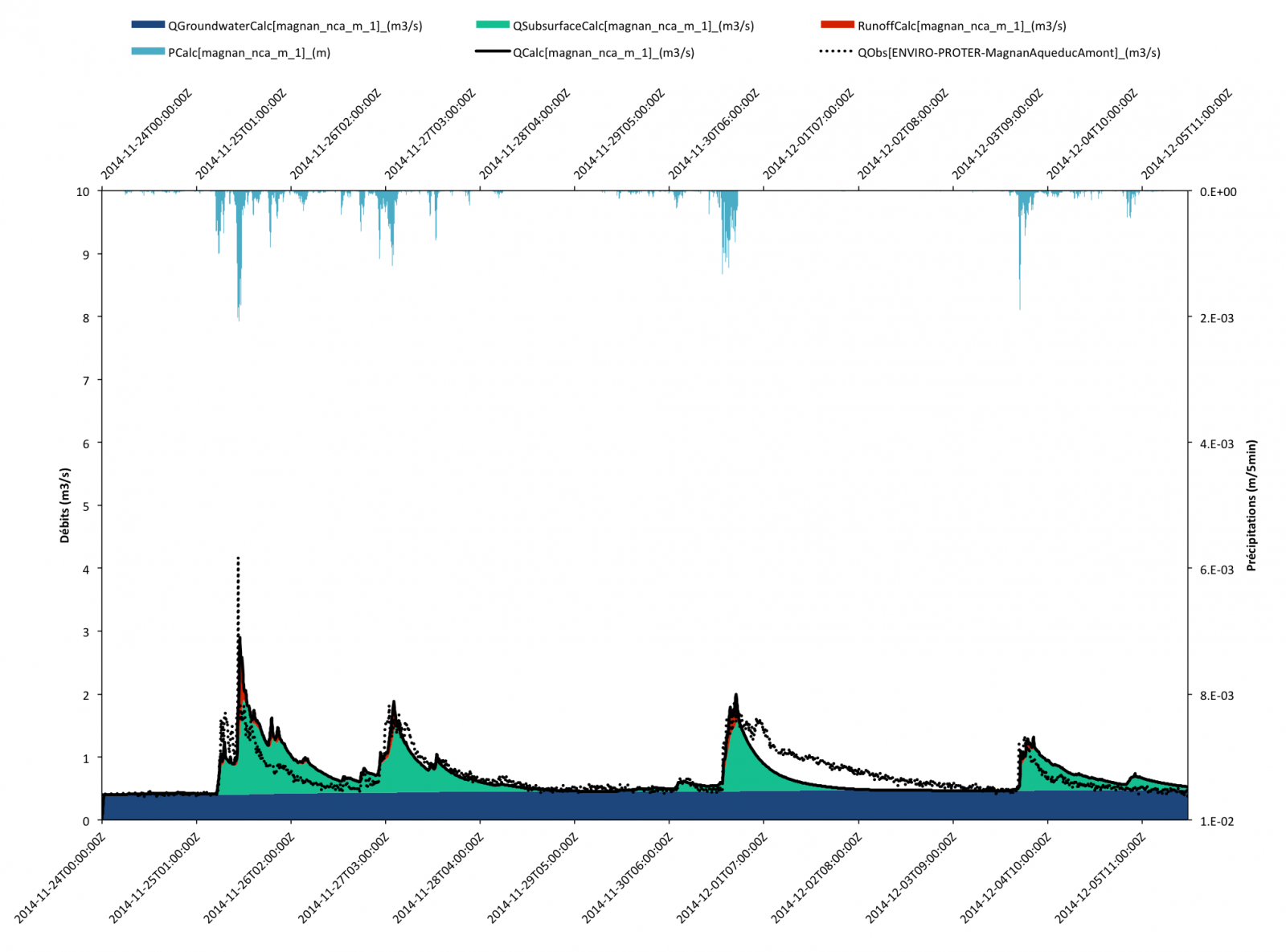
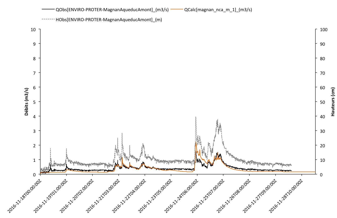
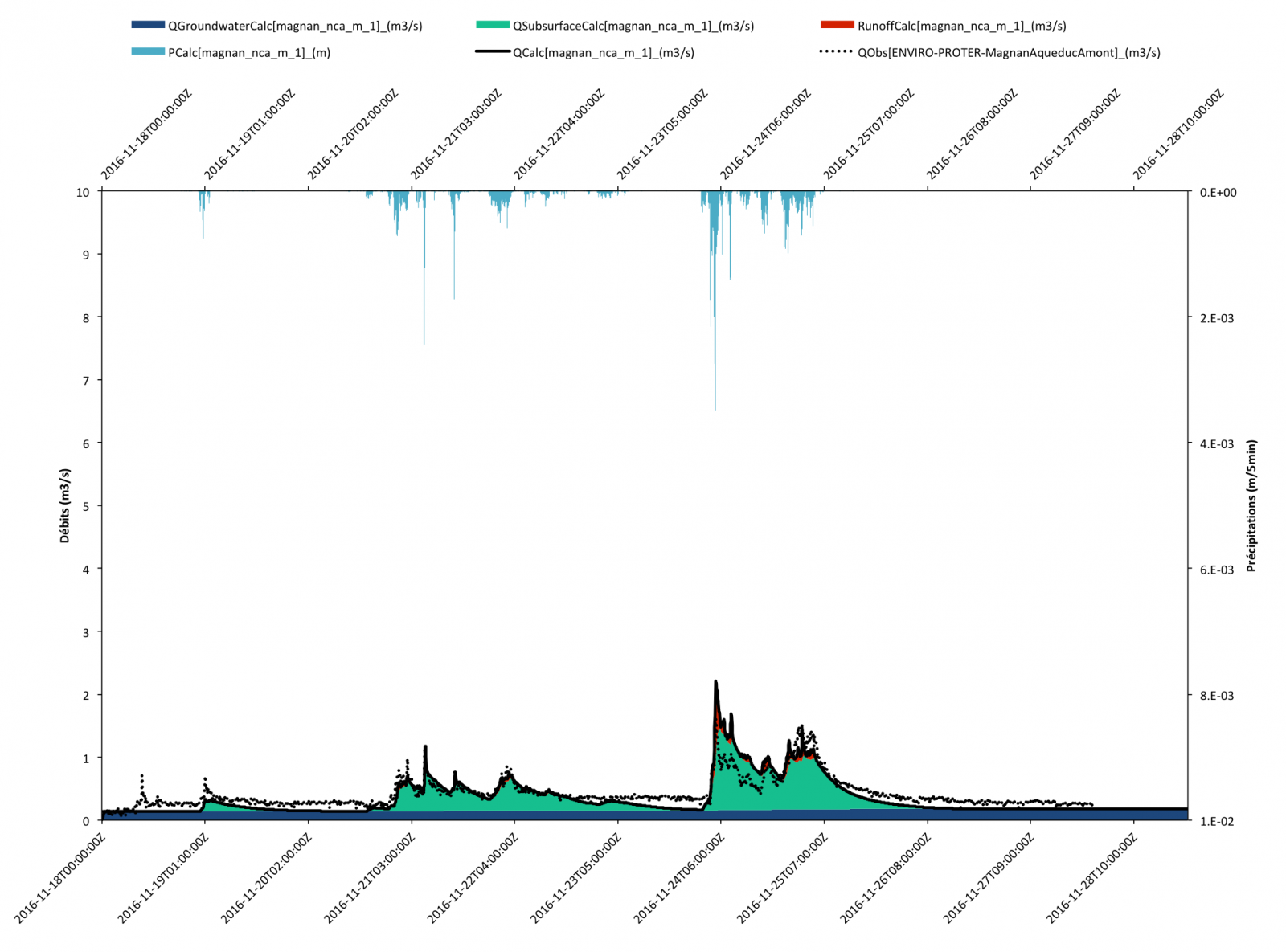
See the operating principle of HydroCore, our “rainfall-runoff” type spatialised hydrological simulation model
TECHNICAL PRINCIPLES
Description of the model
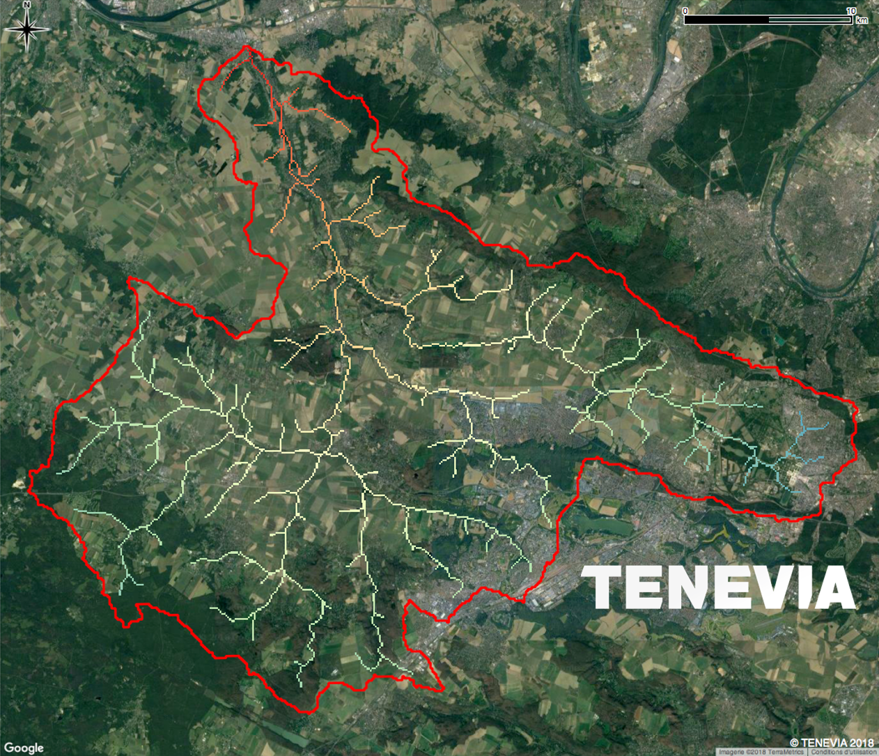
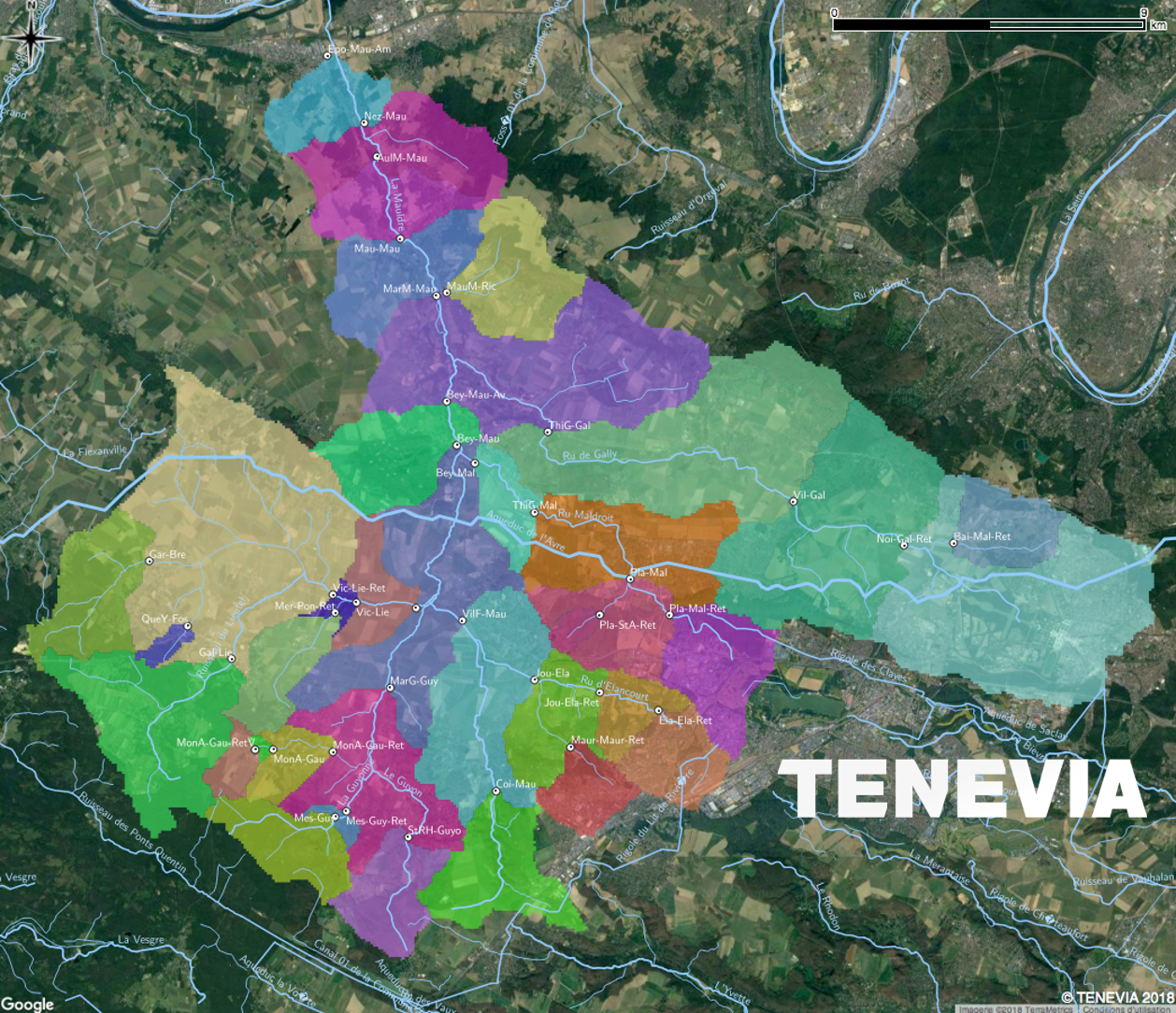
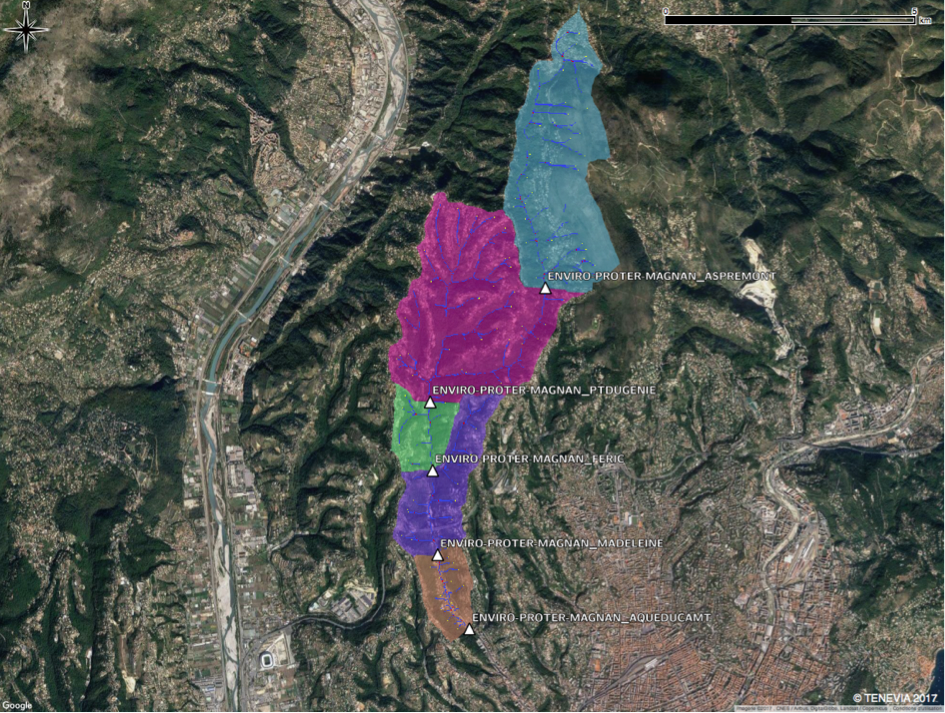
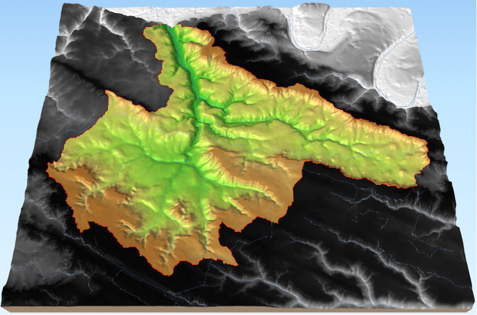
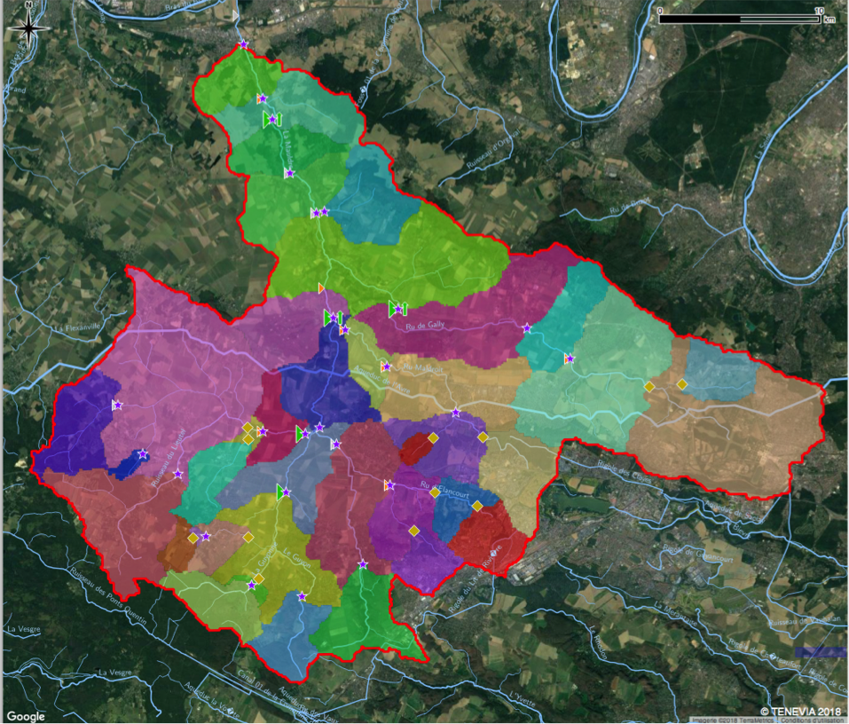
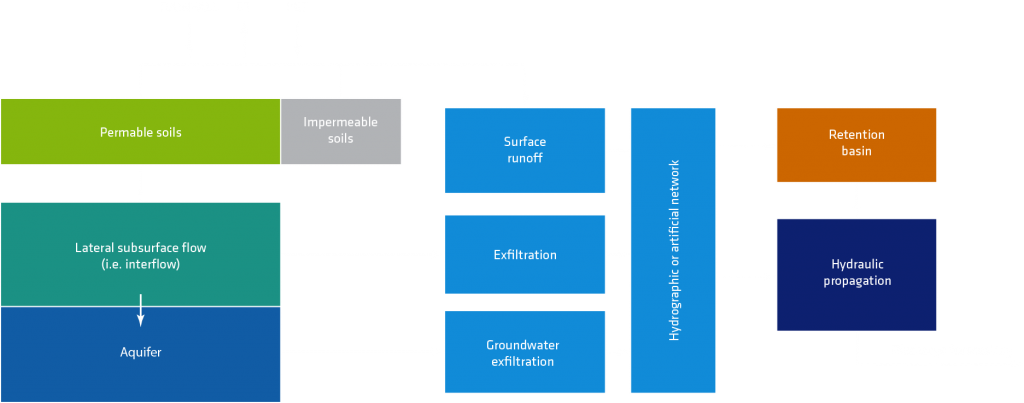
TENEVIA HydroCore® is a digital tool that simulates the transformation of rainfall into runoff on the scale of the catchment area. Based on the physical representation of the catchment area, the HydroCore spatially semi-distributed model divides each catchment area into several spatial entities. This space is divided into sub-catchment areas using hydrographic and topographic criteria.
Representation of the hydrological processes:
HydroCore takes the spatial variability of the runoff processes into account. They are represented using:
- a surface water balance that shows the partitioning between infiltration, evapotranspiration and runoff according to the soil’s water content;
- the dynamics of infiltration-excess and saturation-excess runoff, the lateral subsurface flows (i.e. interflows) and the exfiltration in the hydrographic network;
- hydraulic propagation in the hydrographic network;
- aquifer recharge and discharge;
HydroCore’s continuous operation prevents initialisation problems that are characteristic of event-based models (i.e. specification of initial soil moisture).
Set up and initial calibration
When setting up HydroCore, different elements of information can be integrated, such as the topography (numerical model of the terrain), pedology, geology, land use, etc. Once structured and adapted to local specificities, HydroCore can be calibrated. The calibration stage is a “learning” phase during which the model can complete its adjustment to the characteristics of the forecast site. During this stage, the different parameters governing HydroCore’s operation are set to reduce any disparity with available historical data. This data, which is first investigated, is provided by the client and/or collected by TENEVIA.
Real-time adjustment through data assimilation
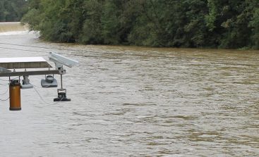
Any calibrated model is only a simplified and imperfect representation of the hydrological and hydraulic reality. During the operational forecast phase, for a number of reasons, differences are usually observed between simulated and observed conditions. Real-time monitoring networks (see our CamFlow sensor) can be used to improve forecasting.
The main sources of errors come from uncertainty regarding the precipitation input and the model parameters/structure.
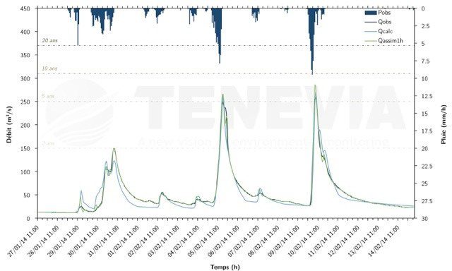
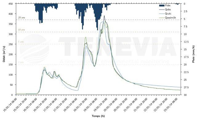
To limit the impact of these uncertainties, HydroCore’s data assimilation module carries out an analysis at a moment (t) of the differences between the simulations and the observations over a period of time (P). This result allows HydroCore to adjust certain of the model’s condition variables at t-P, such as the water saturation condition of the ground. Using this adjusted condition at t-P obtained through optimisation, HydroCore can make a new forecast through to time step t+F, F being the forecast horizon. HydroCore’s assimilation module can also intervene by adjusting certain of the model’s other parameters, such as those governing the hydraulic transfer. Thanks to the measurement network, therefore, HydroCore can correct phase and amplitude errors in real time (e.g. time to peak and flood peak).
HydroCore does not simply correct errors by post-processing the simulated flows (therefore with no impact on the following time step) but implements a real strategy that will correct its trajectory over time. Strategies are implemented to discard outliers and ensure the model’s stability. A regularisation process is integrated to avoid problems of over-adjustment and instability.

Quantifying uncertainties
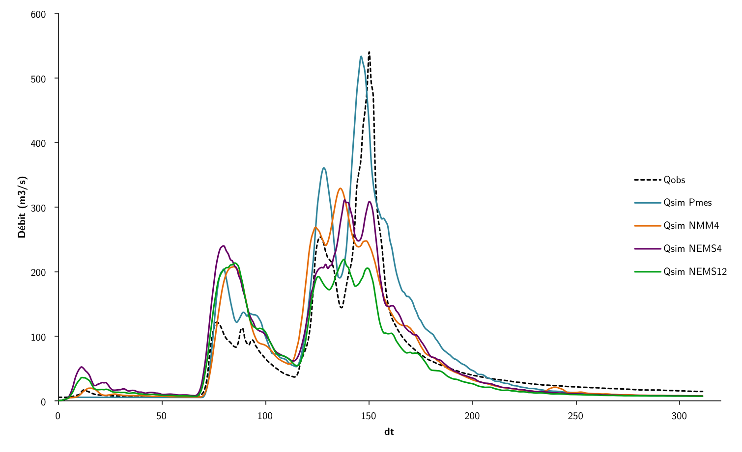
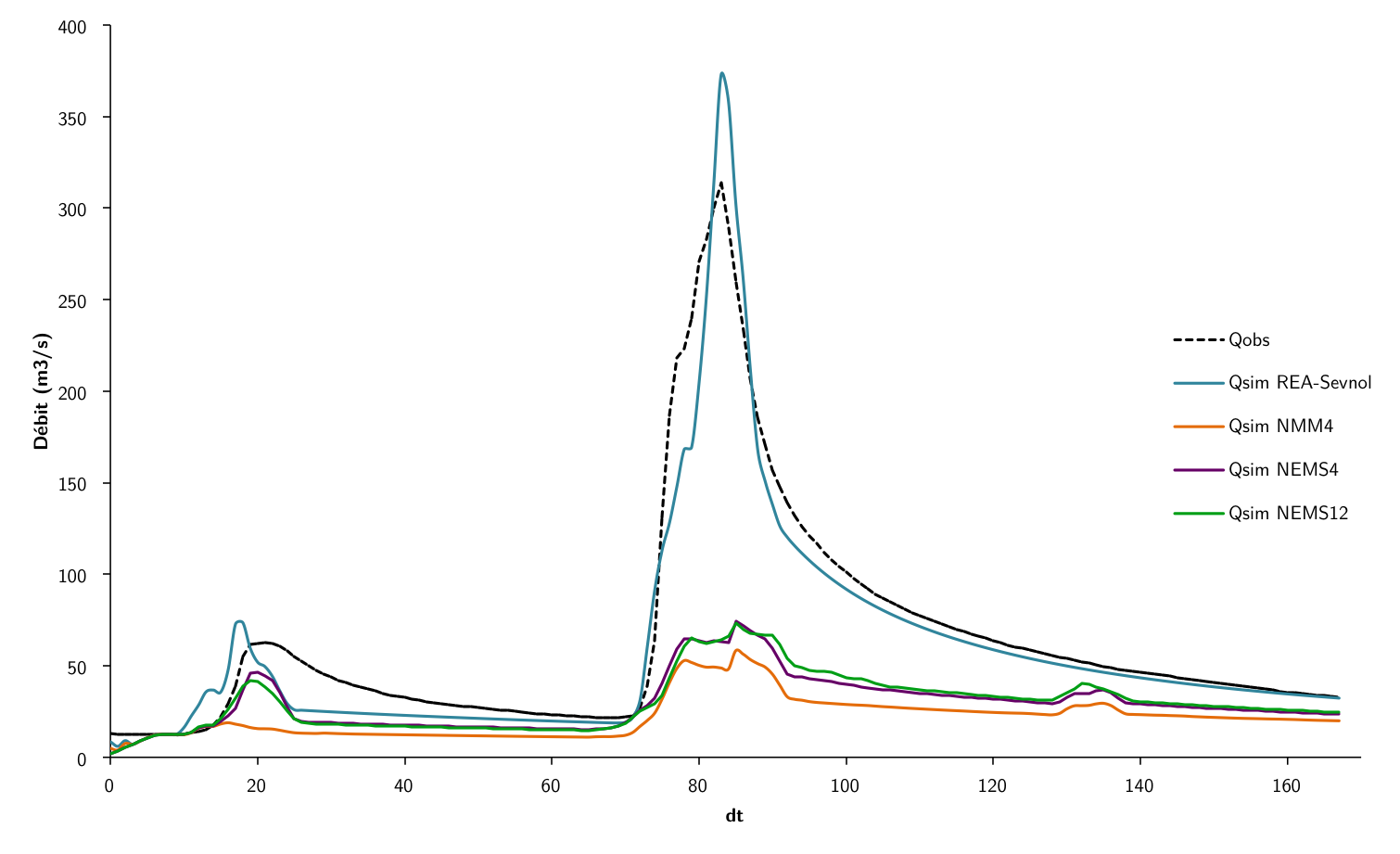
The main causes of uncertainties on flow forecast are due to errors in forecasting precipitation and in HydroCore’s calibrated parameters. To quantify the forecast uncertainties, different weather evolution scenarios are disseminated in the simulator. HydroCore produces a hydrological forecast for each of these scenarios and for different combinations of parameters. The uncertainties of the overall forecast generated in this way can be quantified.
Operation and service levels
HydroCore is deployed on an application server (cloud computing). It centralises all the data required for the model’s real time operation (e.g. weather forecasts and assimilated data). HydroCore produces hydrological forecasts for multiple points of interest chosen by the user and called Virtual Stations.
The HydroCore simulator offers three levels of service.
- Essential: Flow forecasts using measurements and/or precipitation forecasts.
- Advanced: Flow forecasts with hydrometric data assimilation to correct any deviations from the model.
- Complete: Flow forecasts with data assimilation and ensemble forecasting to quantify uncertainties
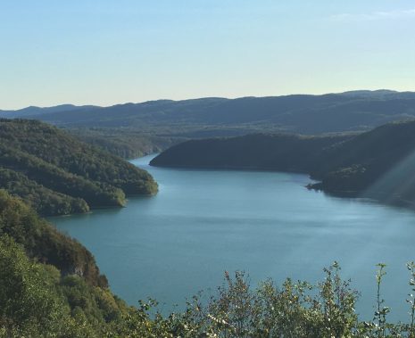
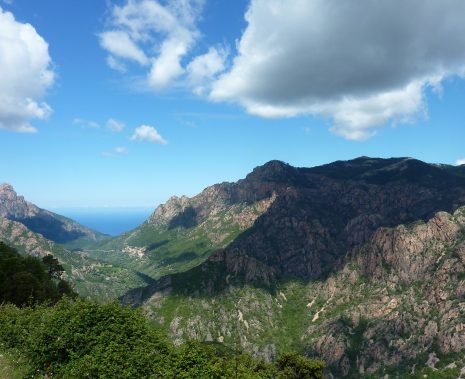
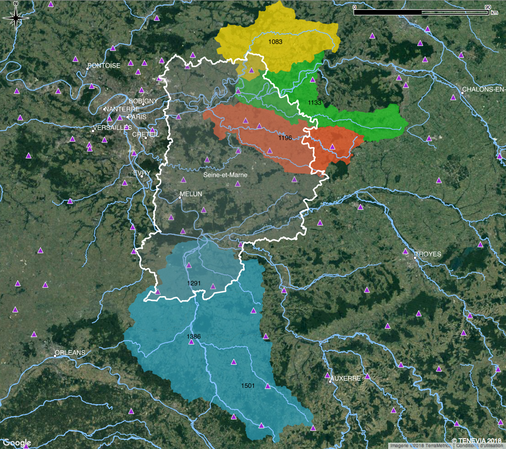
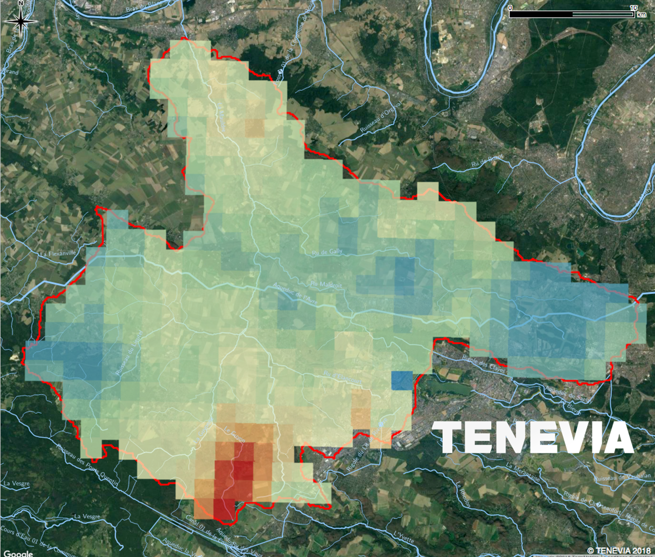
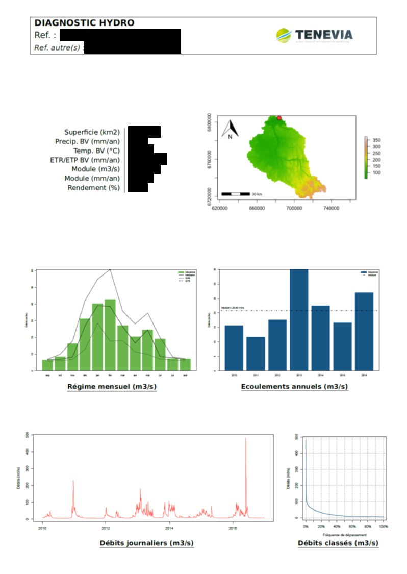
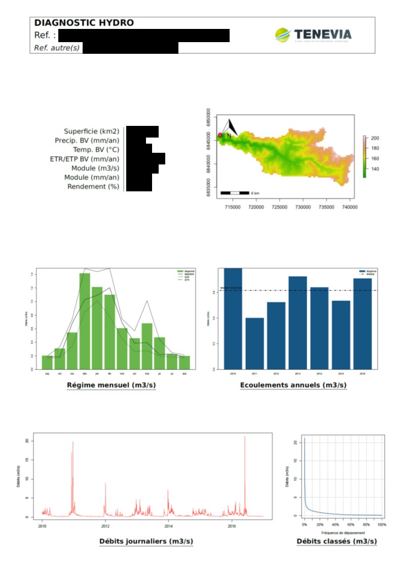
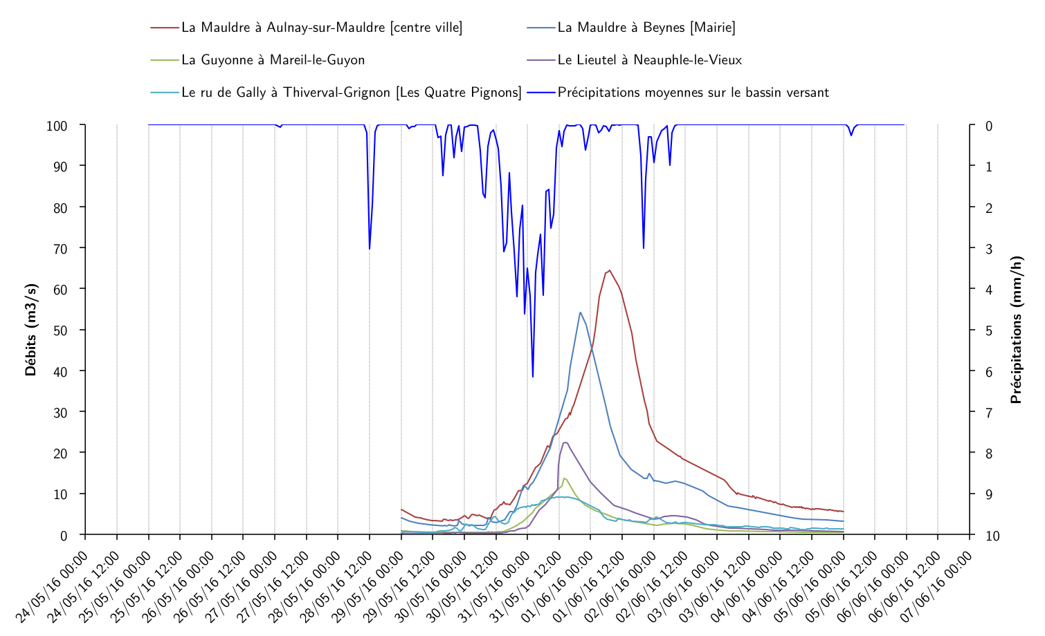
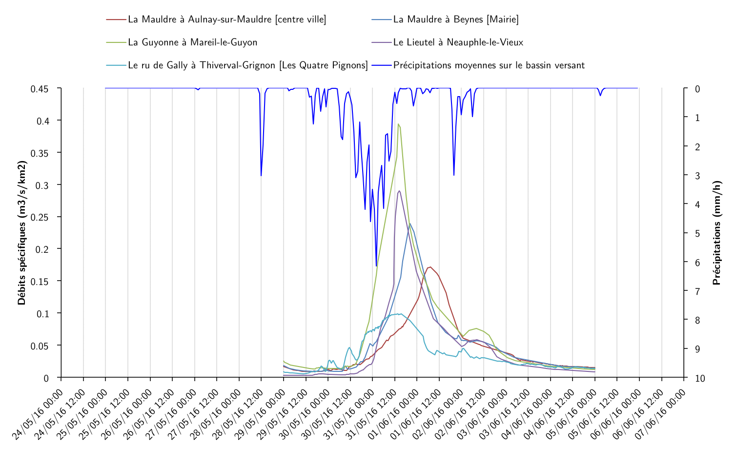
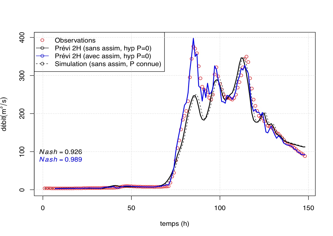
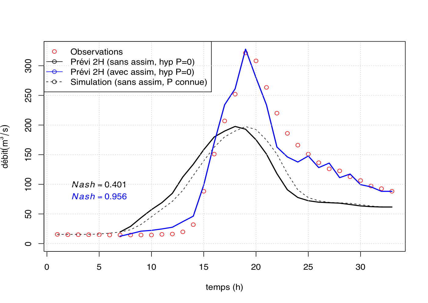
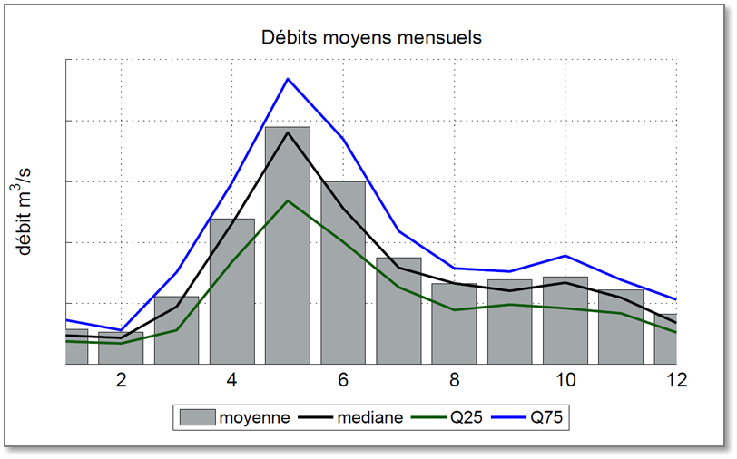
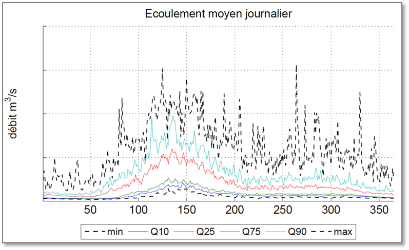
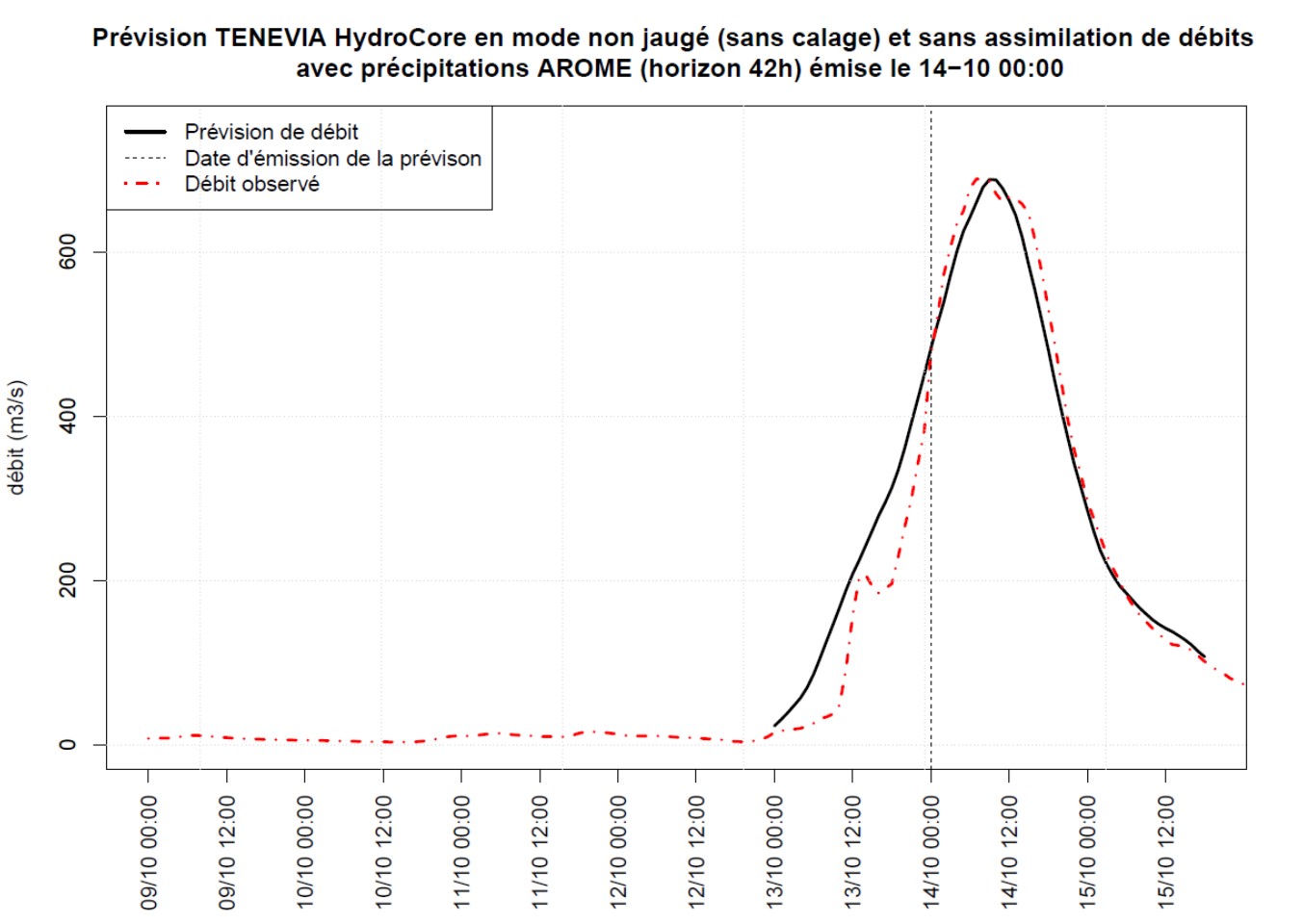
EXAMPLES OF HYDROCORE SIMULATIONS
FAQ & FURTHER INFORMATION
What data do I have to transmit to use HydroCore?
What forecast lead time can be envisaged?
With measured precipitation, HydroCore’s lead time is equal to the flow transfer time (catchment response time). It therefore depends directly on the size and characteristics of the catchment area that governs the flow transfer time.
To extend this lead time, HydroCore uses weather forecasts. The hydrological forecast horizon is therefore heavily dependent on the weather forecast source(s) used. The advection of weather radar images allows operation in “now casting” mode with a short-term forecast horizon of 1-2 hours. Using weather models (AROME, WRF, NEMS, ARPEGE, GFS…) allows HydroCore to generate forecasts going from 42hrs to over 7 days. The notion of forecast uncertainty calculated by HydroCore is essential here for the most precise use of the hydrometeorological information.
What applications is HydroCore used for?
TENEVIA HydroCore® can be implemented for flood and low water forecasting, pre-determining extreme flows, drafting studies of anthropic impacts on hydrology (e.g. construction of hydraulic schemes like dams, changing land use, etc.), carrying out studies on the impact of climate change on hydrology, flow simulation to fill gaps in data and reconstituting historic flow series or assessing a region’s hydropower potential.
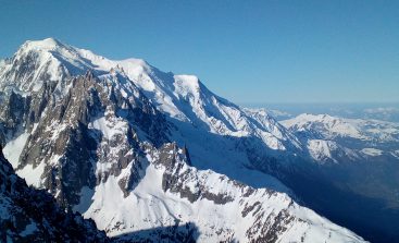
Does HydroCore work on snow-covered basins?
HydroCore focuses on rainfall-runoff hydrology; however, basins with a snow and/or glacial component can be used with the TENEVIA SnowCore® simulator. it represents the evolution of the water content in the snowpack and any glaciers. used in combination with hydrocore, the estimate of the snow/ice melt improves flood forecasts and dam management in mountainous areas.

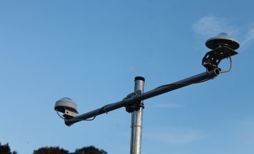
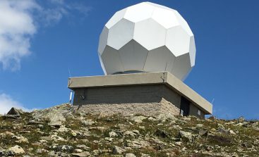
Weather stations, rain gauges, radar nappes, high-resolution forecasts (…)
See a summary of TENEVIA’s meteorological solutions available on a subscription or rental basis and manufactured by our partners –weather stations suppliers and weather data producers.
WEATHER OBSERVATIONS
Weather station
Weather Radar
According to radar visibility
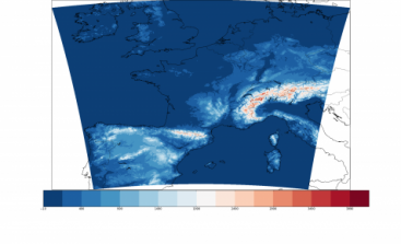
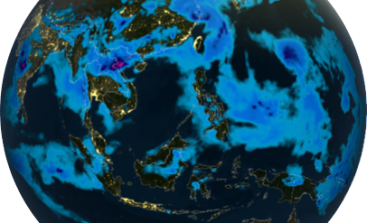
WEATHER FORECASTS
NOWCASTS
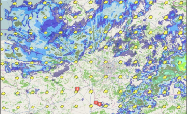
RADAR
HIGH-RESOLUTION
Global
(...)