CamFlow is TENEVIA’s sensor for surface velocity and discharge calculation.
OVERVIEW OF CAMFLOW
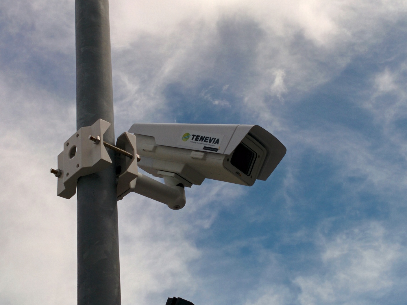
A smart camera that is not in contact with the water, the CamFlow sensor can be used for measurements in rivers, canals and sanitation systems. TENEVIA’s CamFlow® uses a fixed camera to measure surface velocity and calculate the flow of a free-surface flow. The depth measurement used for the flow calculation is obtained using image analysis (see CamLevel) or another sensor installed on site (radar, pressure sensor, etc.).
Connected to an adapted transmission system, CamFlow measures different hydrometric variables in real time.
ADVANTAGES OF CamFlow
Non-intrusive sensor
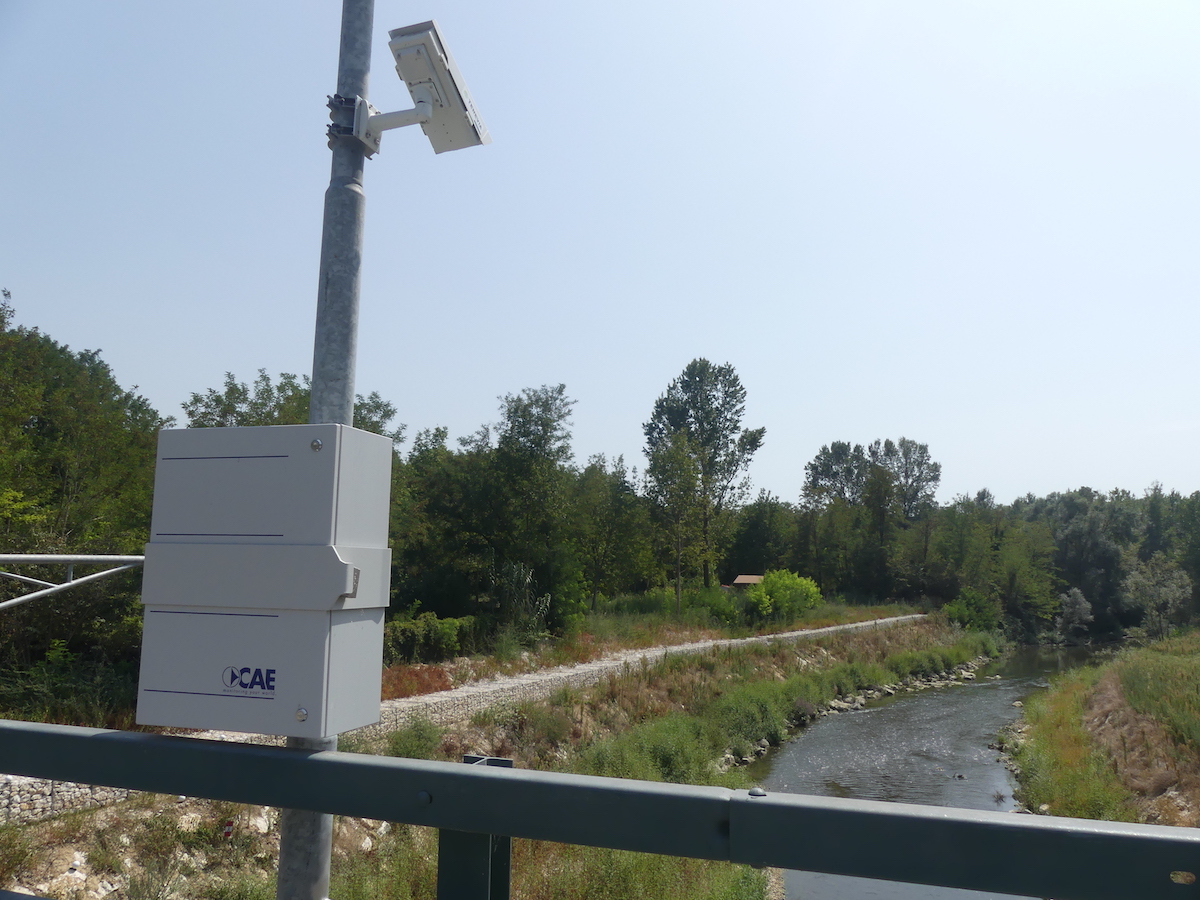
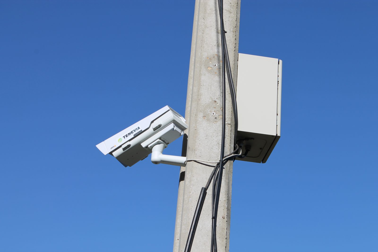
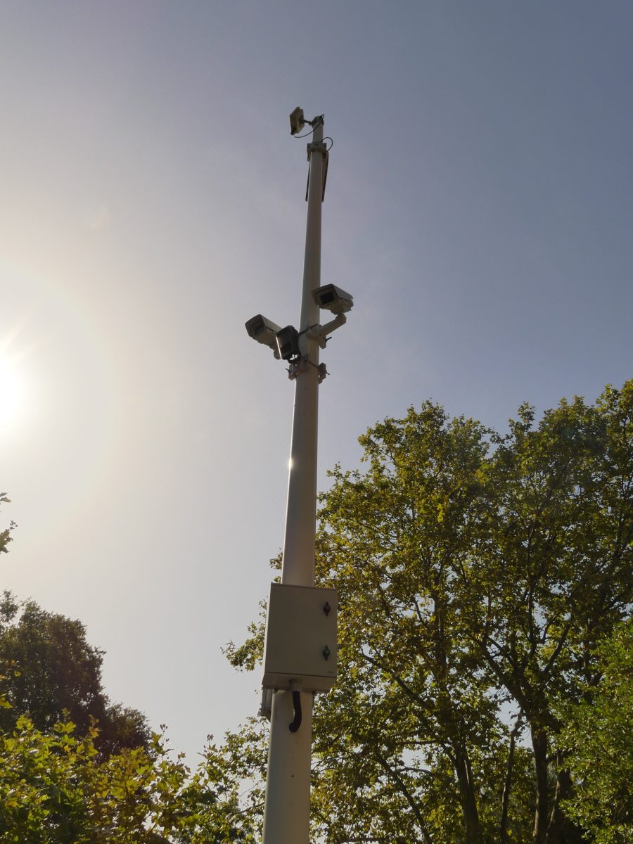
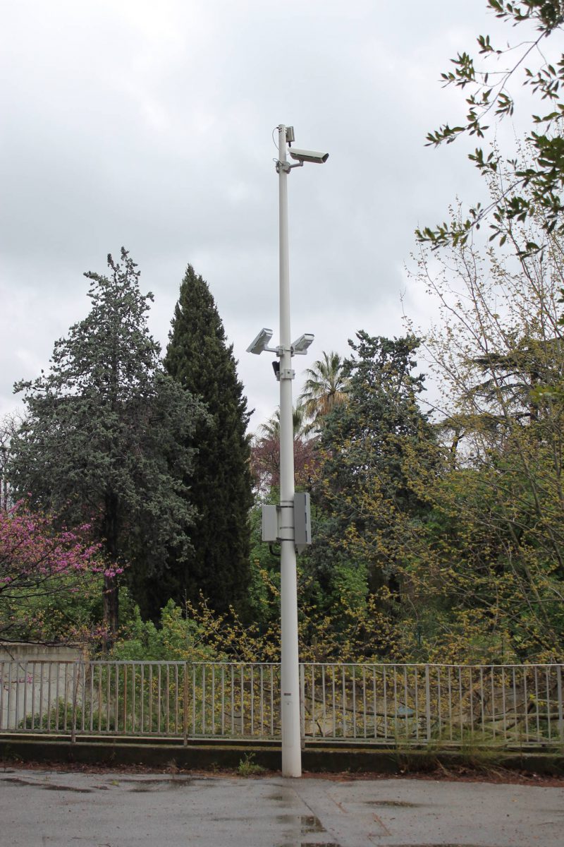
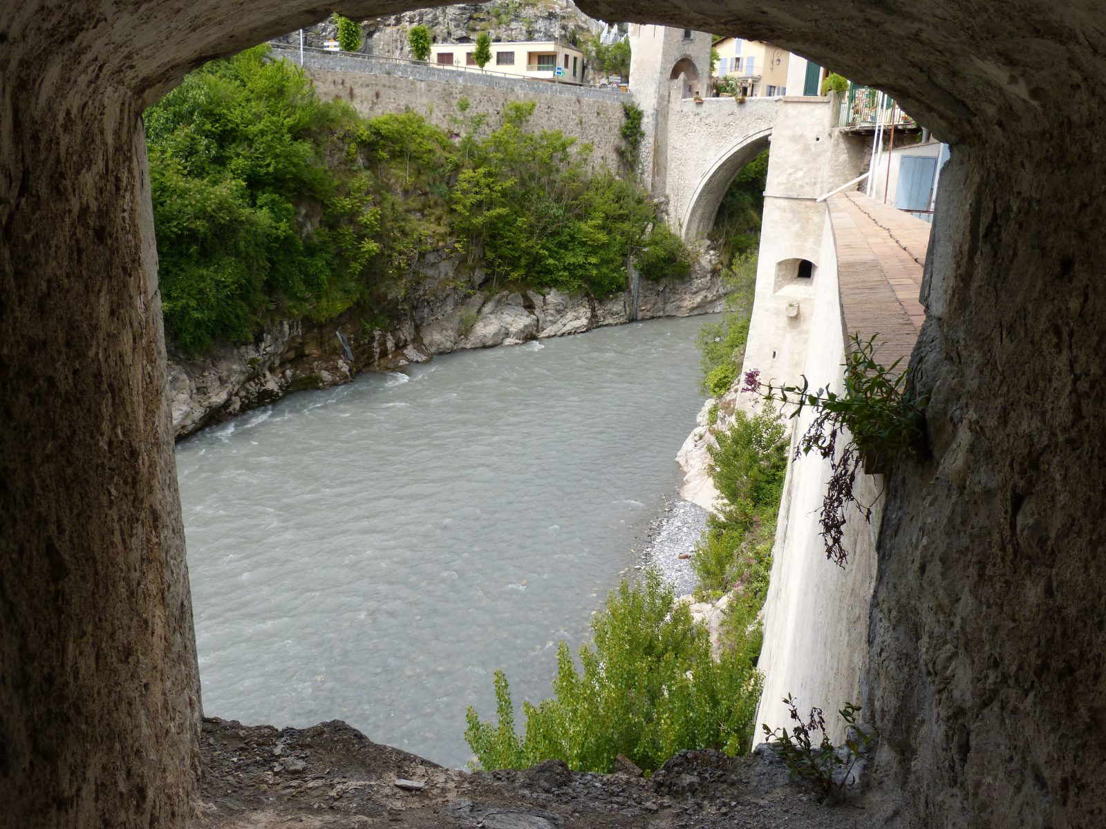
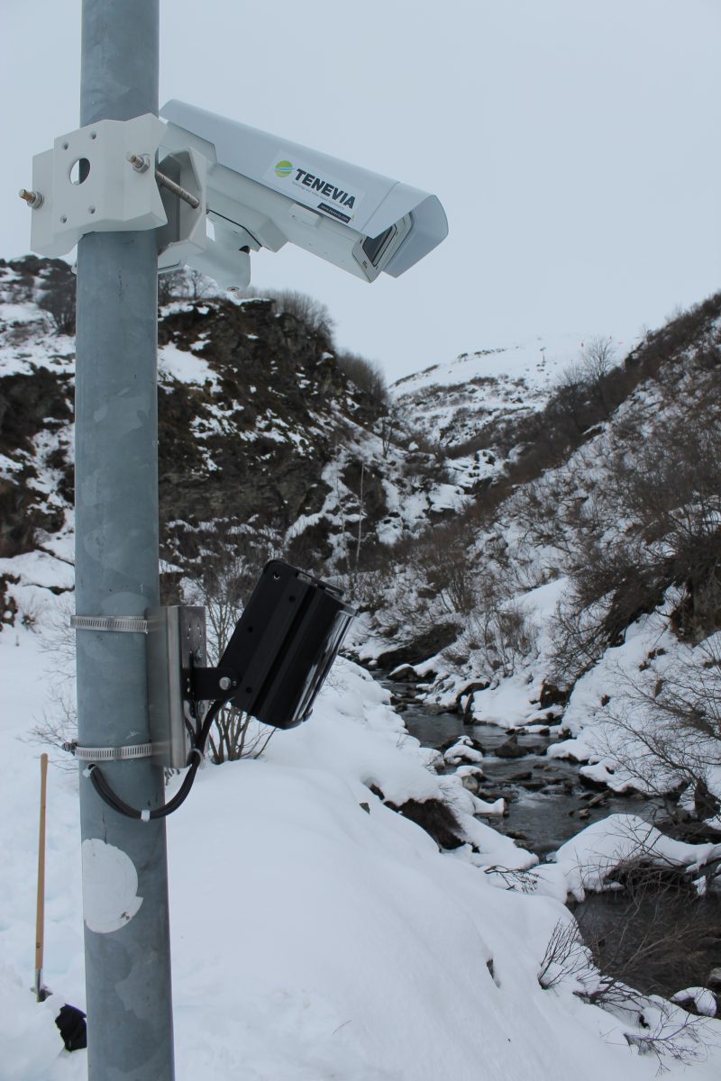
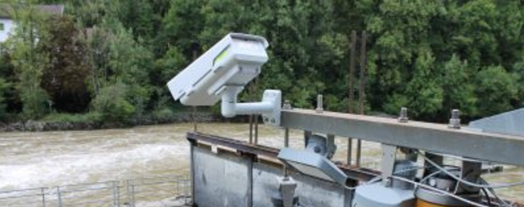
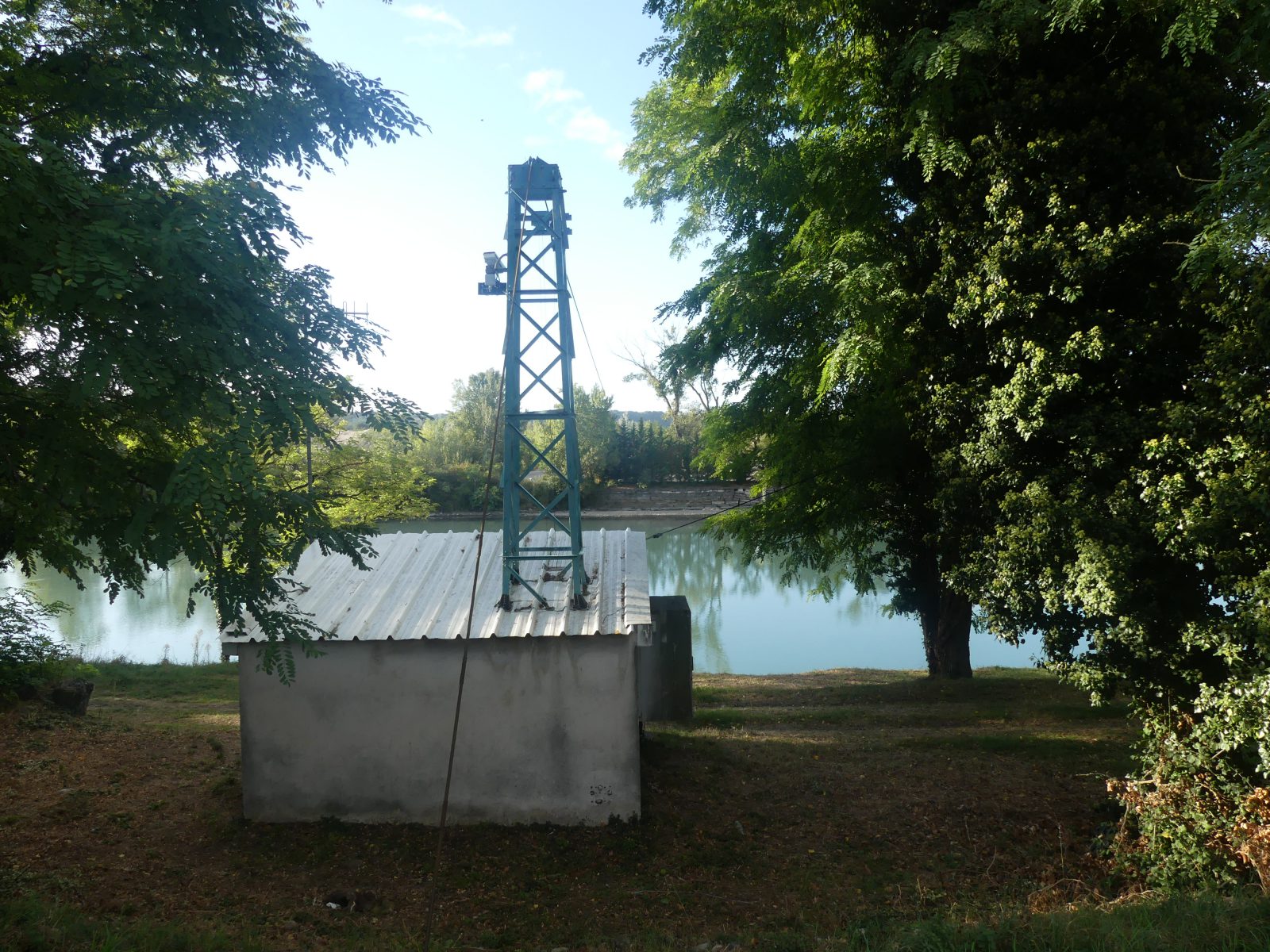
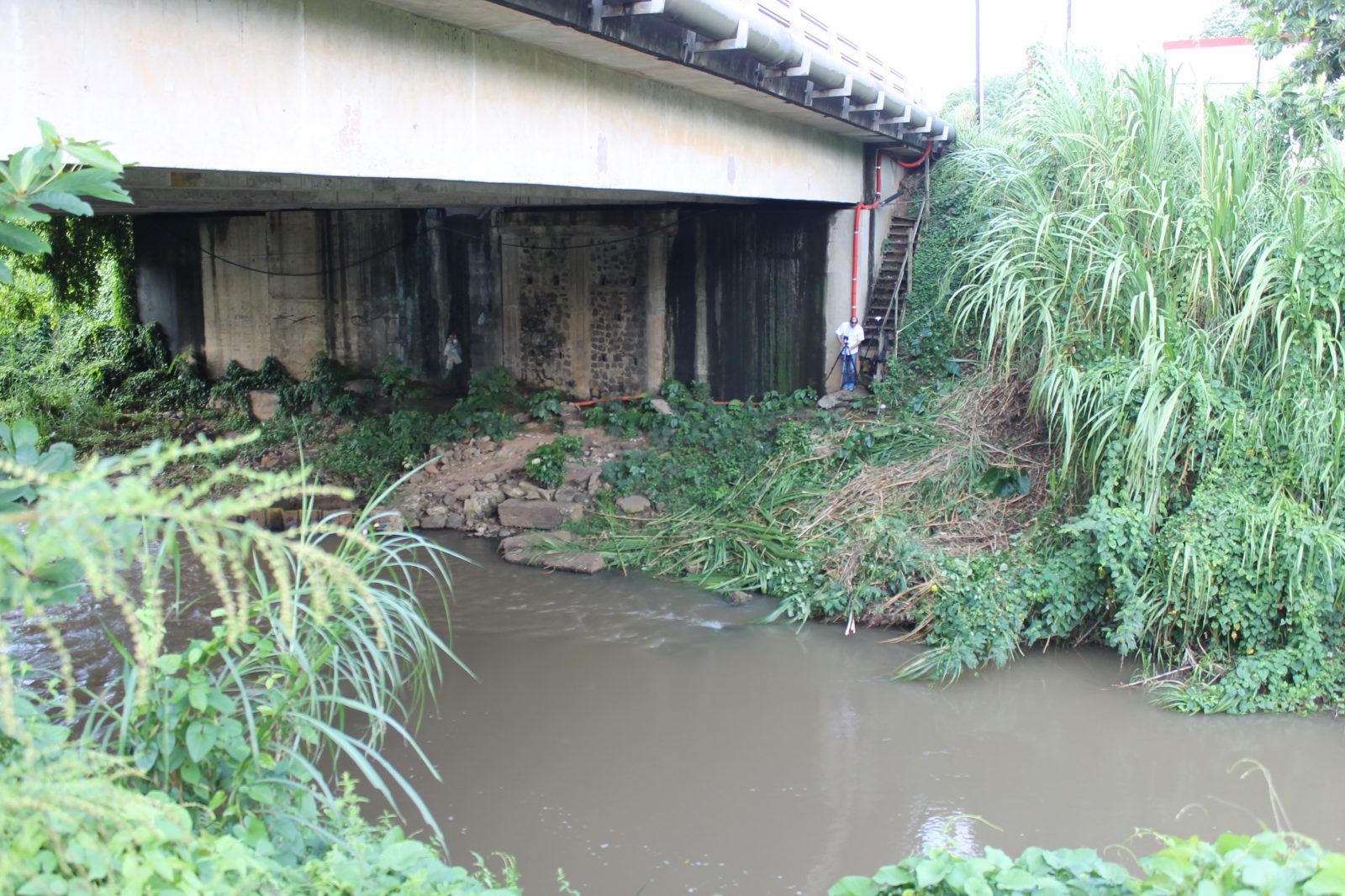
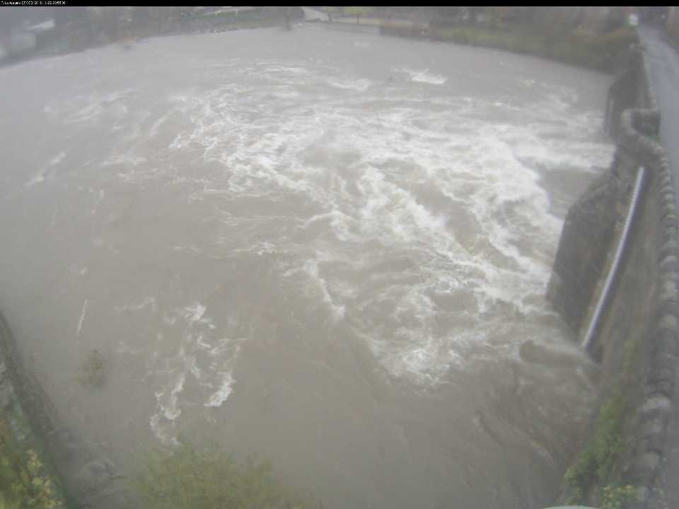
A contactless tool, CamFlow is installed away from the river. It is not submerged and therefore the system is protected from floating debris. The sensor’s adaptability on site means it can be installed from a bank or bridge. There are many accessories and supports for the CamFlow camera in the video-surveillance industry, making it easier to fix to a pylon, a wall, a bridge pier or any other support that does not risk being submerged.
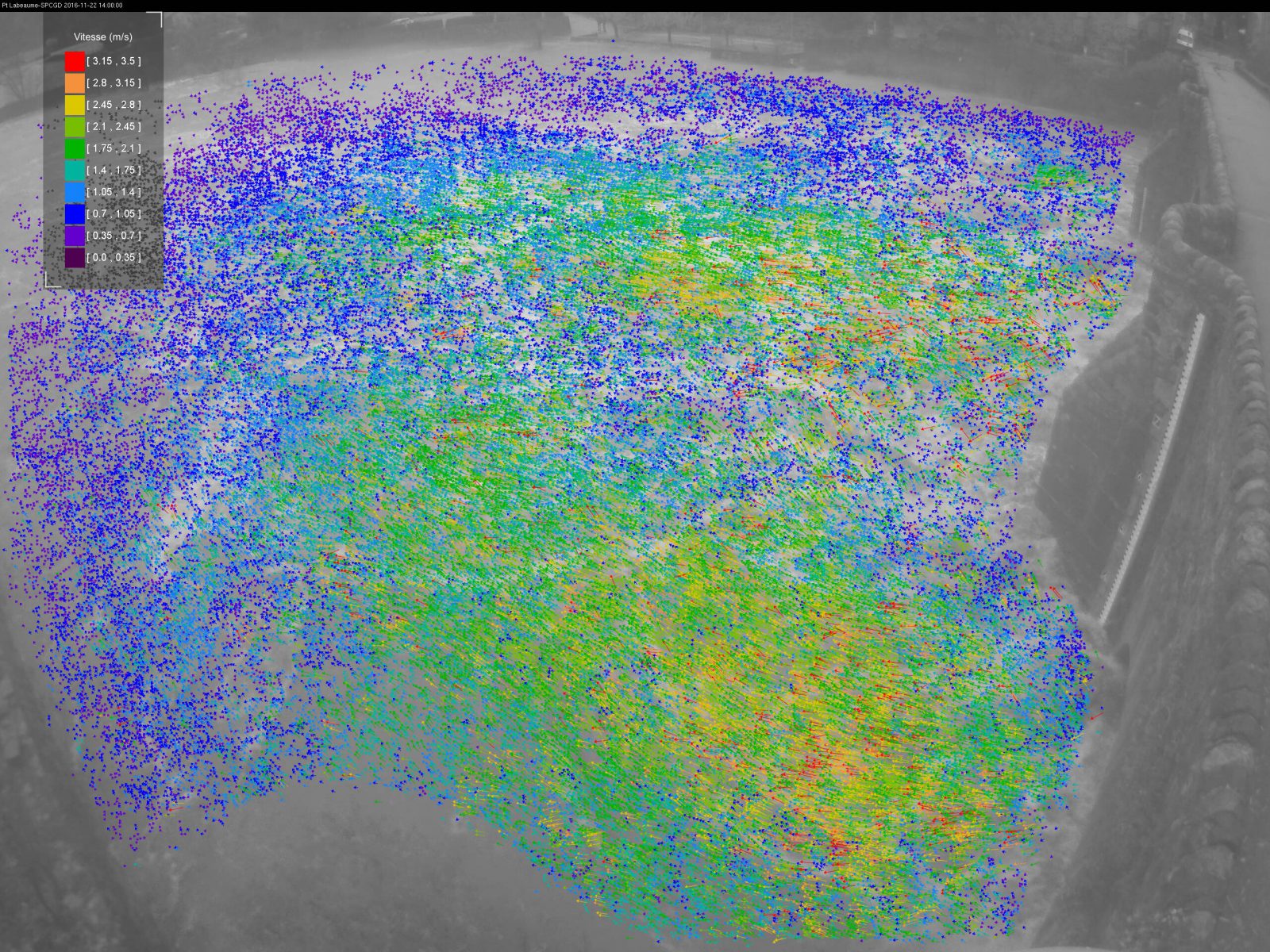
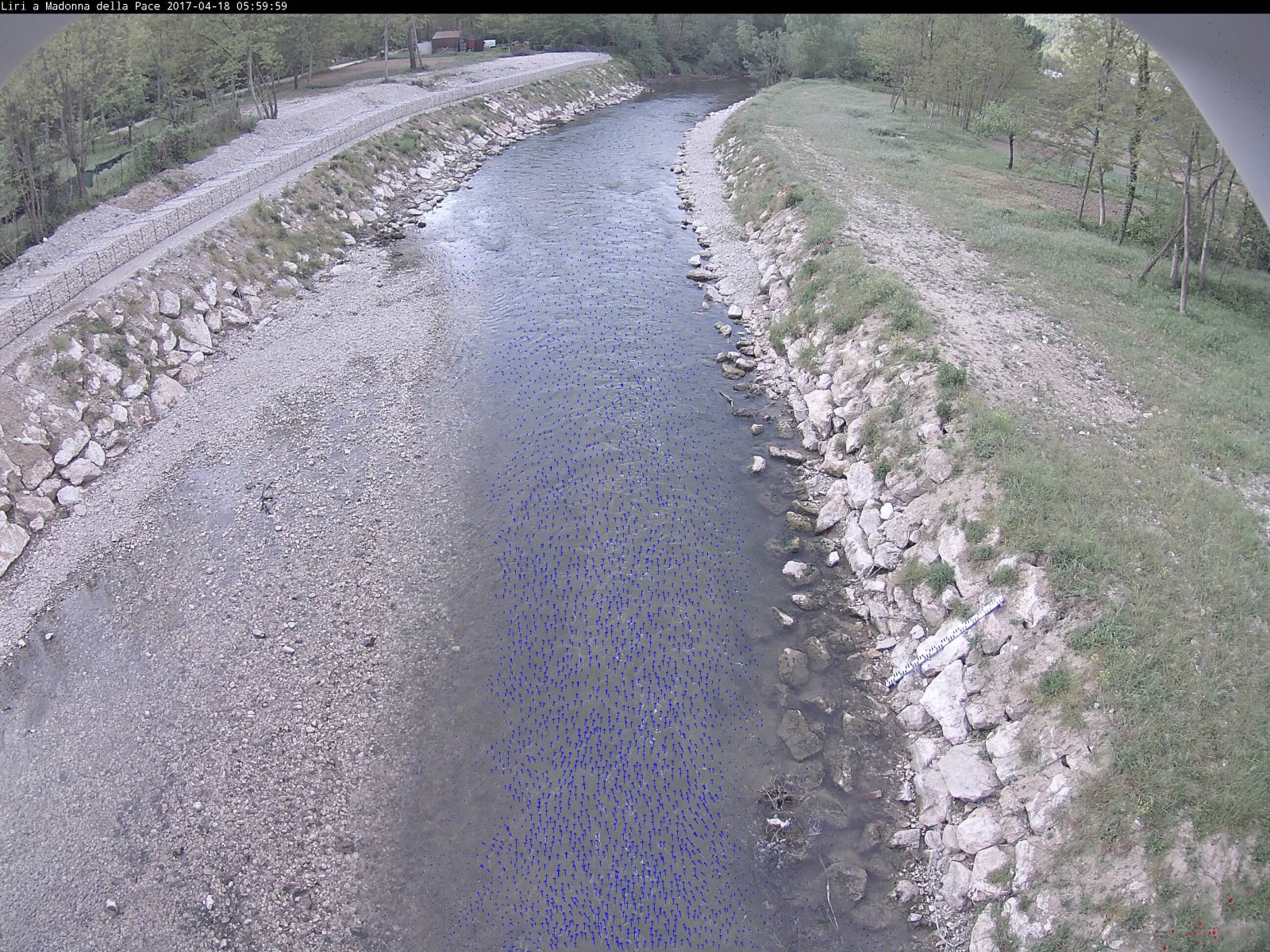
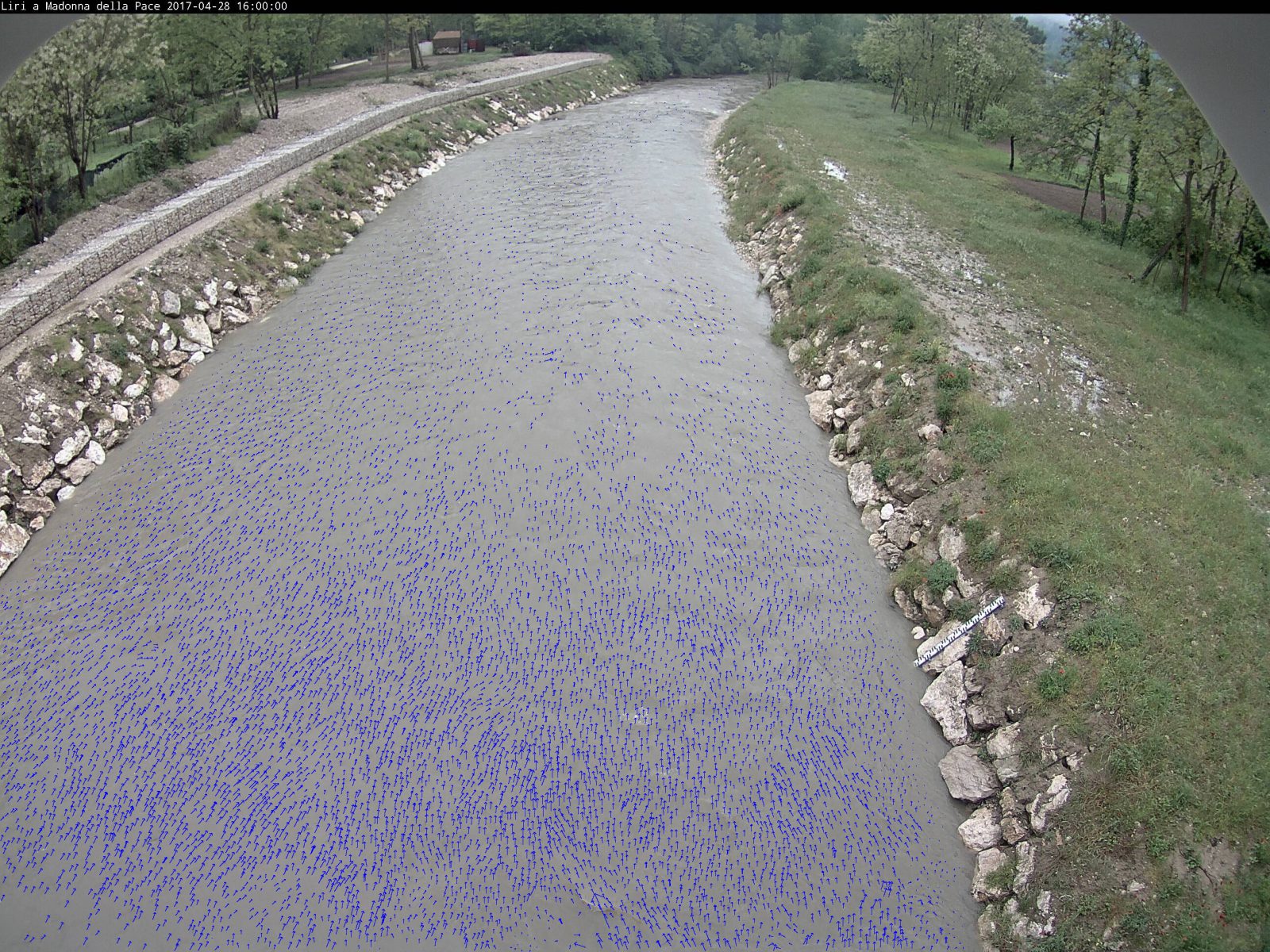
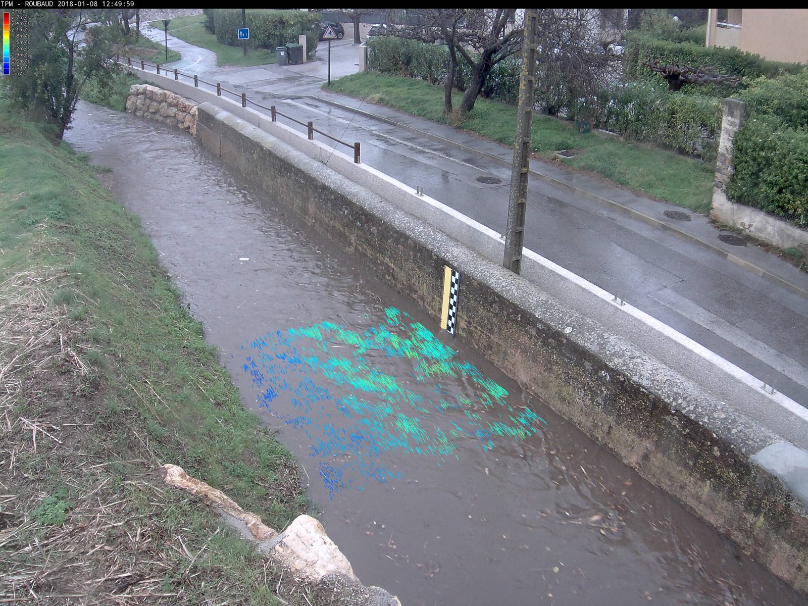
Spatial measurements of surface velocities
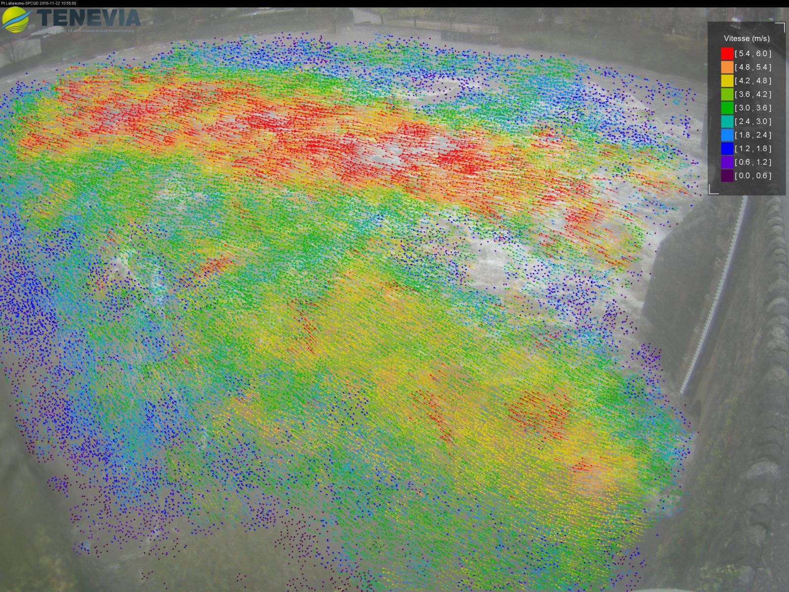
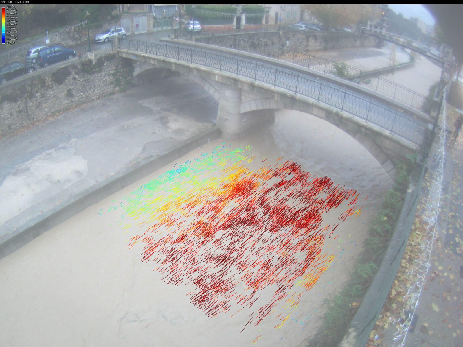
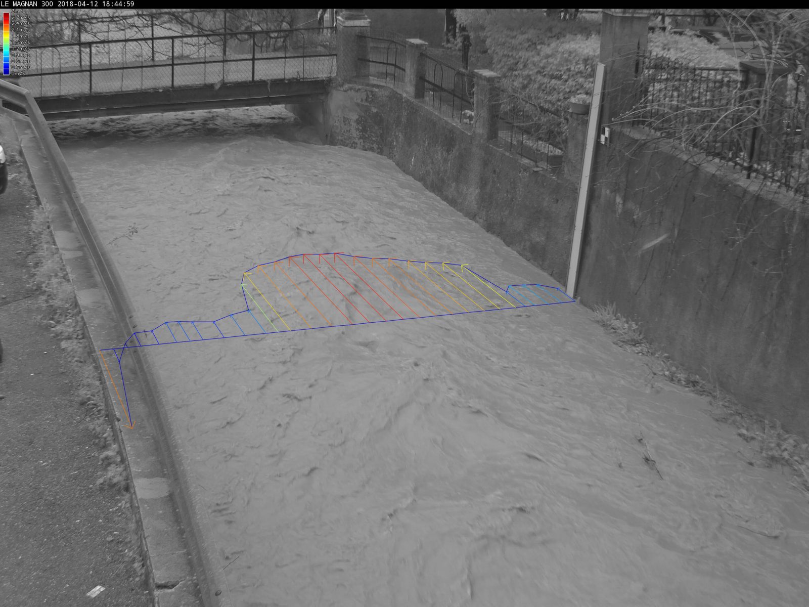
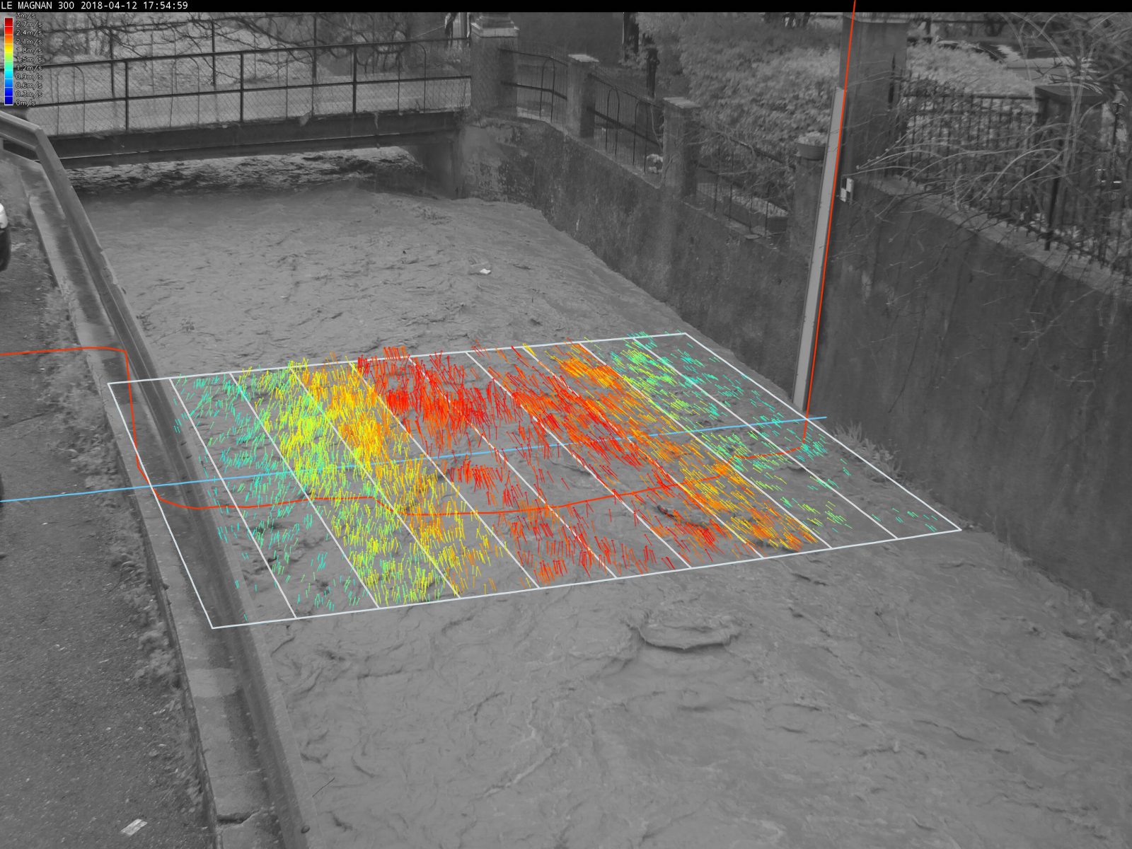
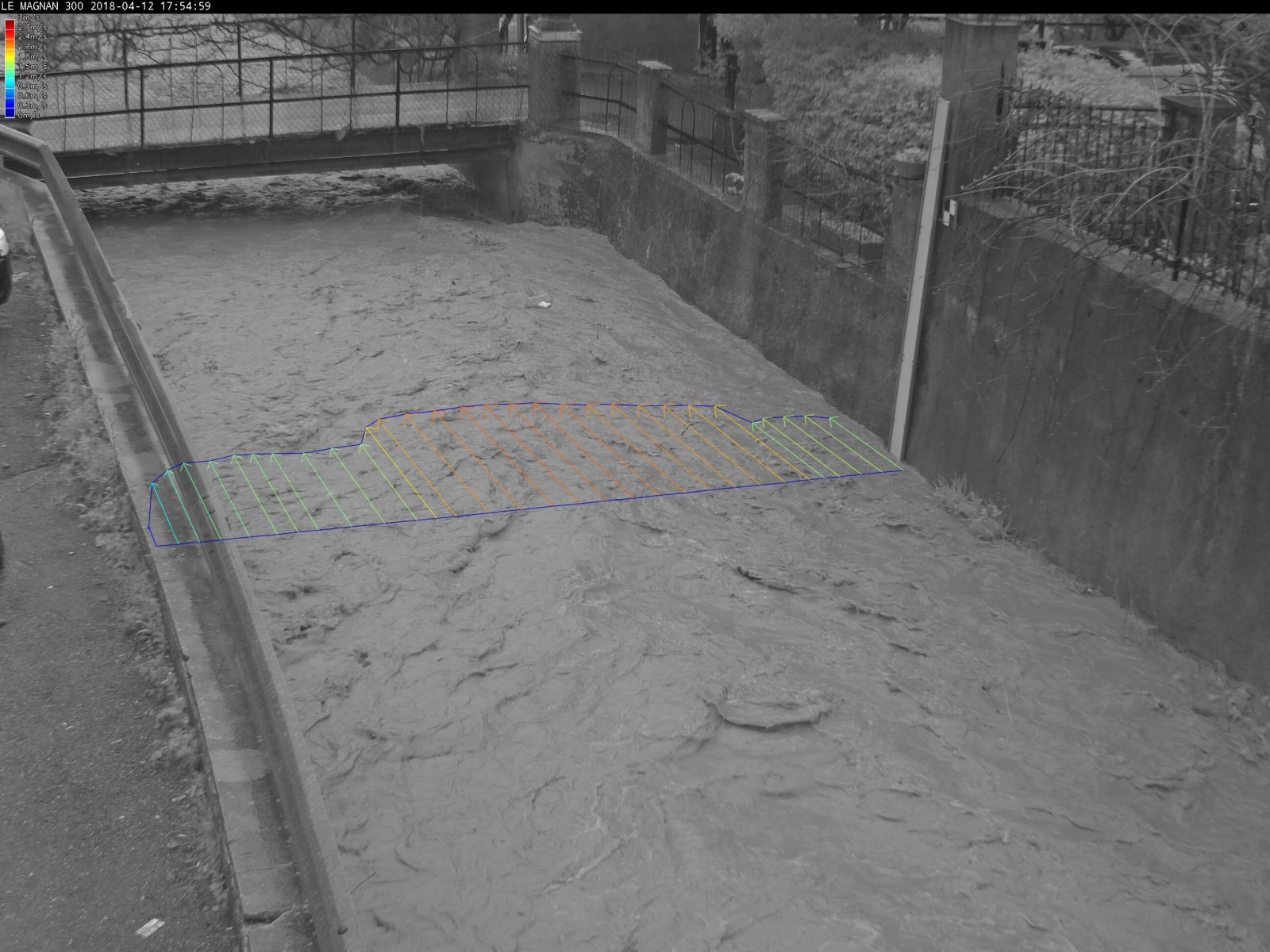
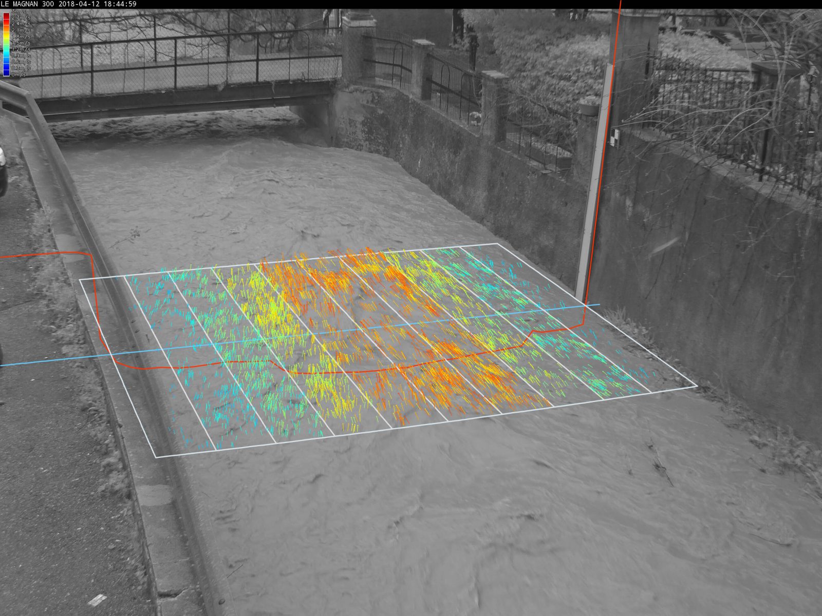
Based on the measurement of movements by analysing image sequences, CamFlow takes spatial surface velocity measurements. CamFlow shows the entire streamwise surface velocity profile.
Calculating discharge without calibration
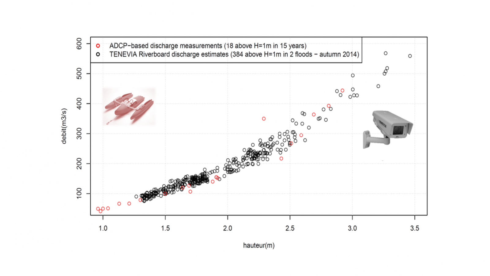
Calculating discharge does not necessarily require calibration using earlier flow measurements (e.g. ADCP gauging). It is actually based on measuring the streamwise surface velocity profile. This information is much richer than a local measurement (more complex relation with average velocity). Given the accuracy and robustness of the velocity measurements, very good results can be obtained with standard hydraulic assumptions (e.g. velocity coefficient fixed to average value). If earlier measurements are available, they can be used to refine the standard hypotheses in order to account for very specific site conditions.
Removing doubt and remote visual check
The CamFlow sensor has the advantage of operating through images. These images make it easier to appreciate a hydrological situation. They also offer a better understanding of a section’s hydraulic behaviour and make it possible to communicate on the risk of flooding, for example. Users can therefore easily confirm the pertinence of the data produced.
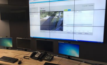
Functions enriched by our web services
TENEVIA helps you to use measurements and images through its TENEVIA OS supervision service. Based on high-availability servers hosted in France, this service allows the advantages of a surveillance system to be fully exploited:
- image and measurement storage;
- camera operation supervision;
- access to an advanced e-mail and text alert module;
- real time consultation and access to data history;
- visualisation of the measurement results keyed in the images (augmented reality).
To find out more go to Web Services on our website.
request

SERVICE LEVELS
| ESSENTIAL | ADVANCED | |
|---|---|---|
| Measures surface velocity | ||
| Calculates discharge |
| ESSENTIAL | |
|---|---|
| Measures surface velocity | |
| Calculates discharge | |
| ADVANCED | |
|---|---|
| Measures surface velocity | |
| Calculates discharge | |
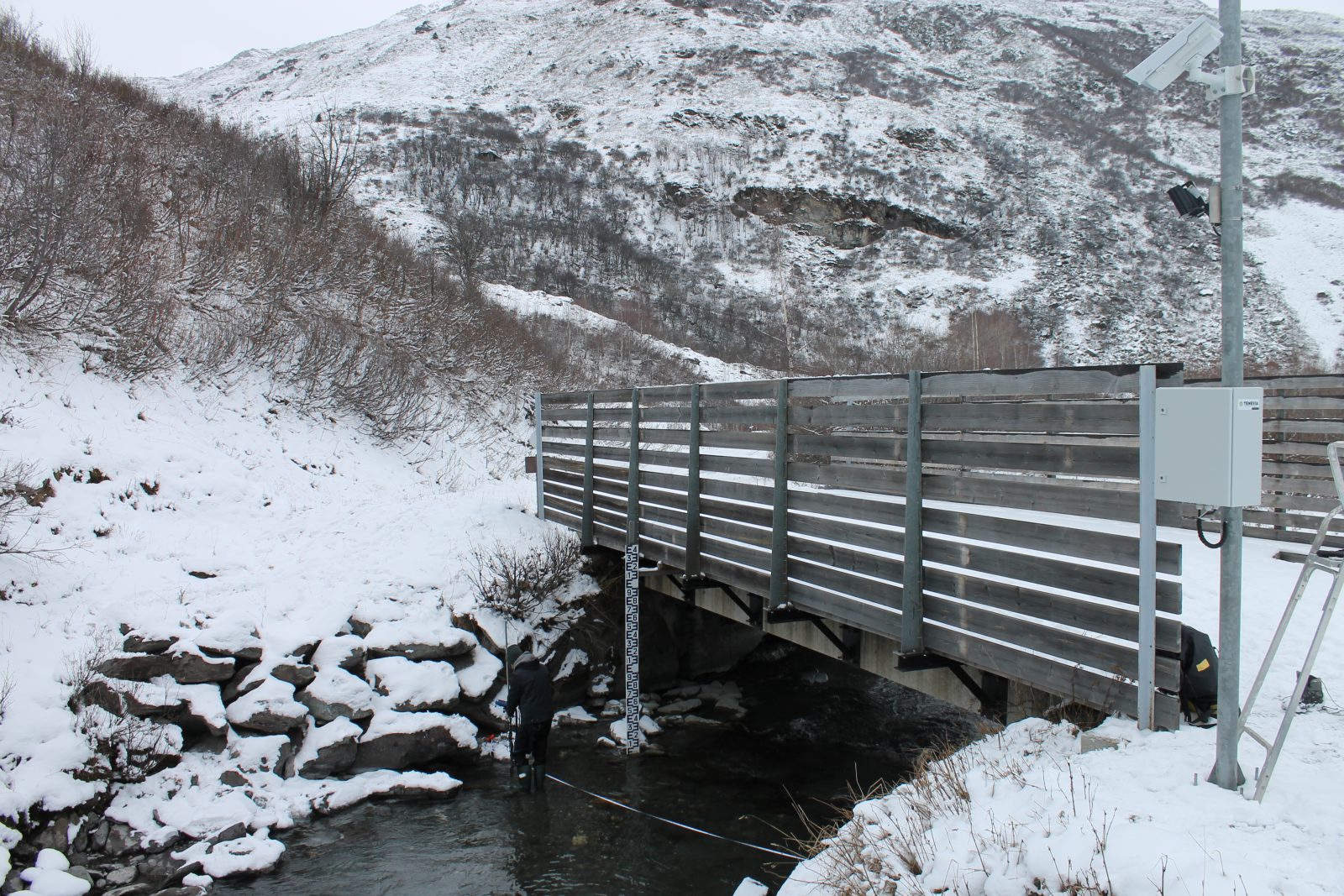
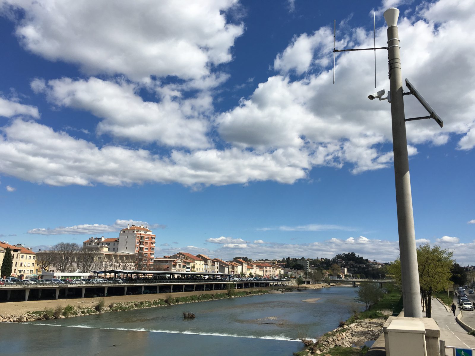
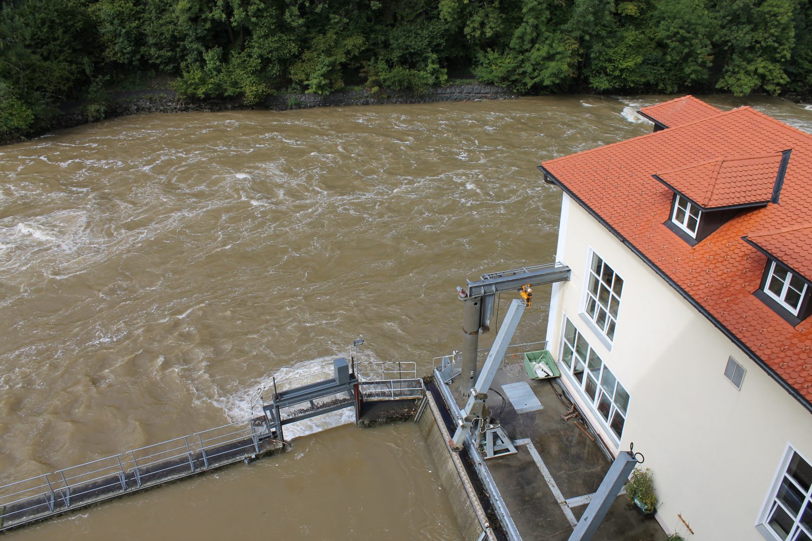
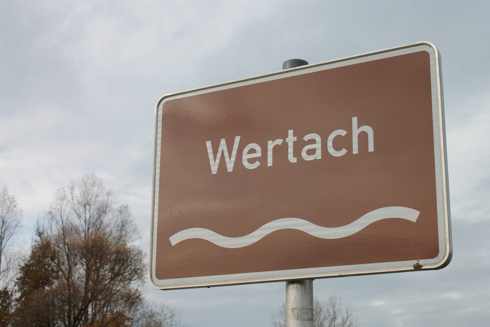
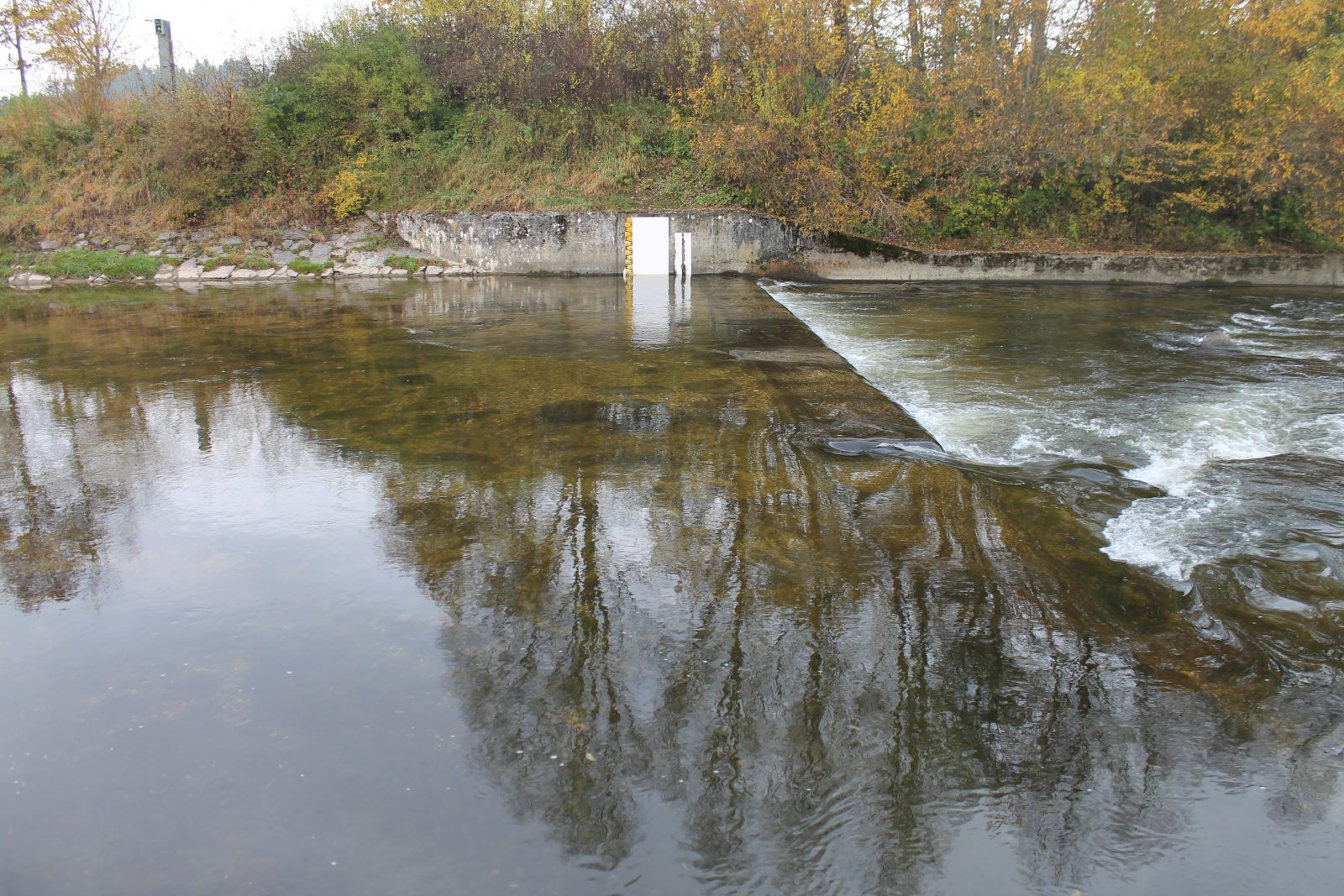
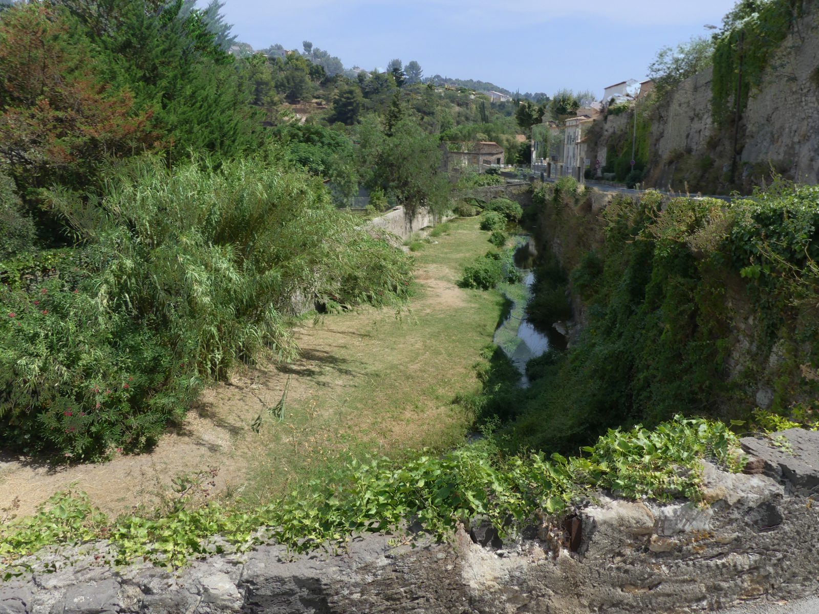
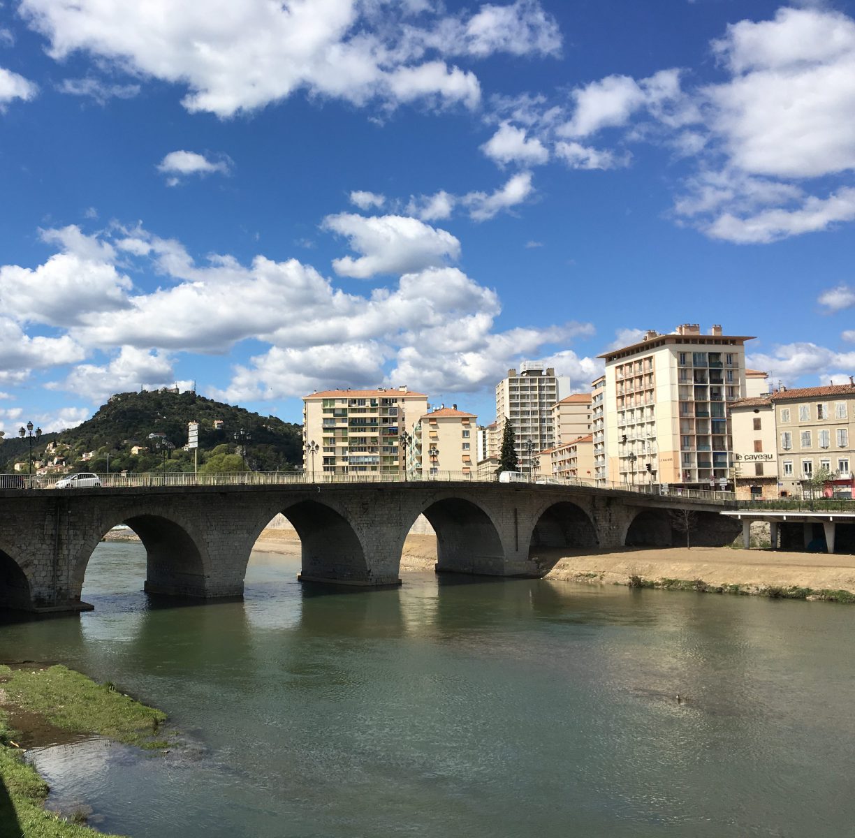
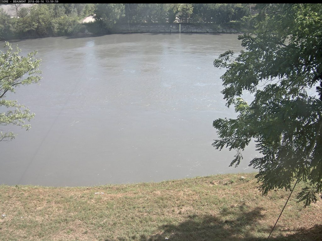
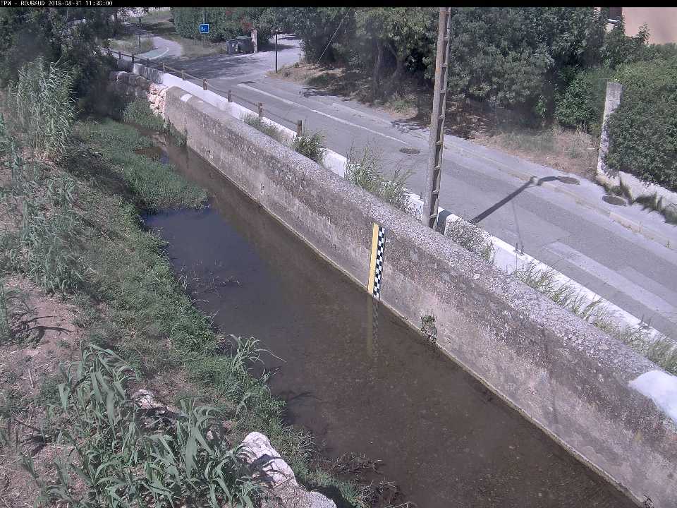
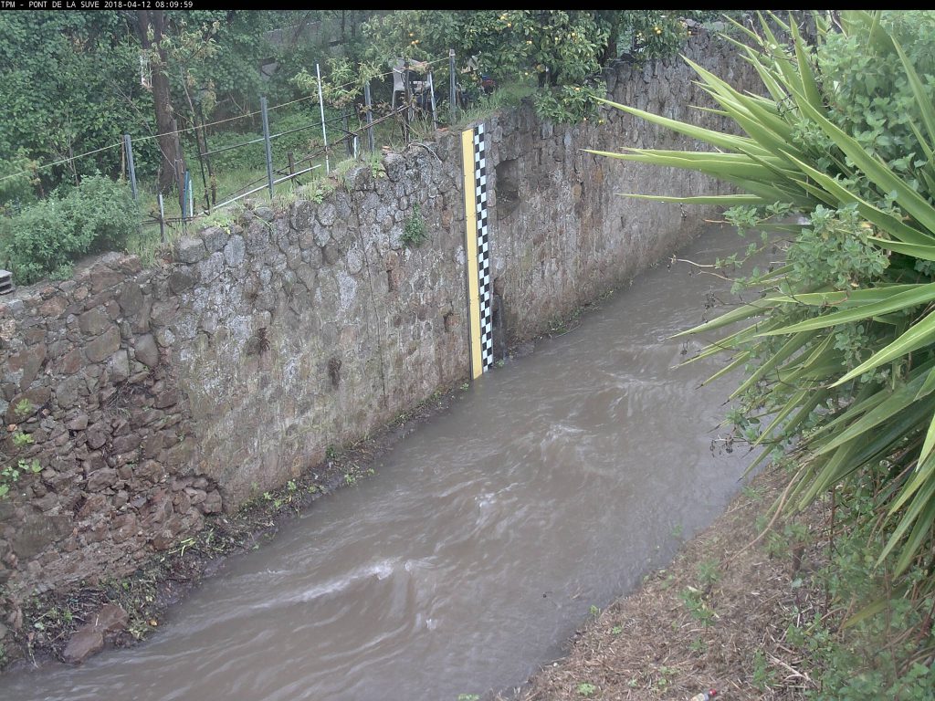
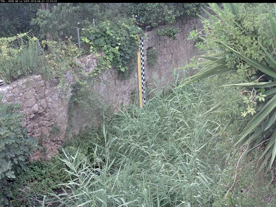
CamFlow in action
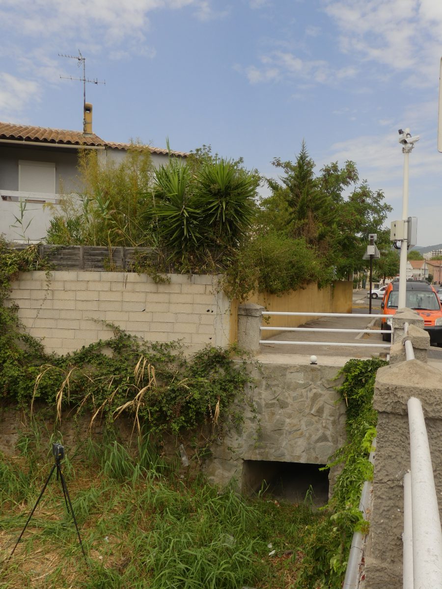
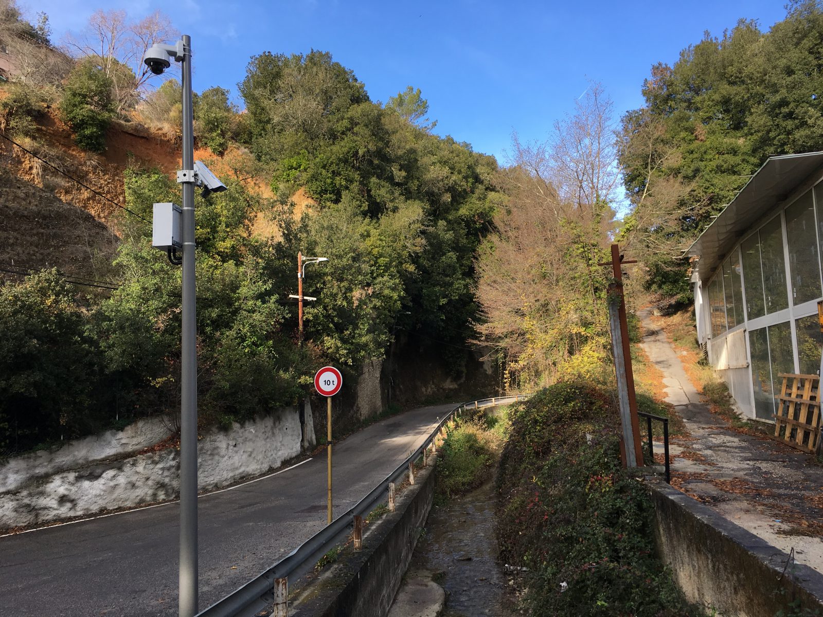
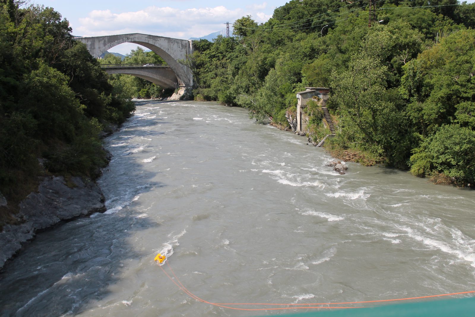
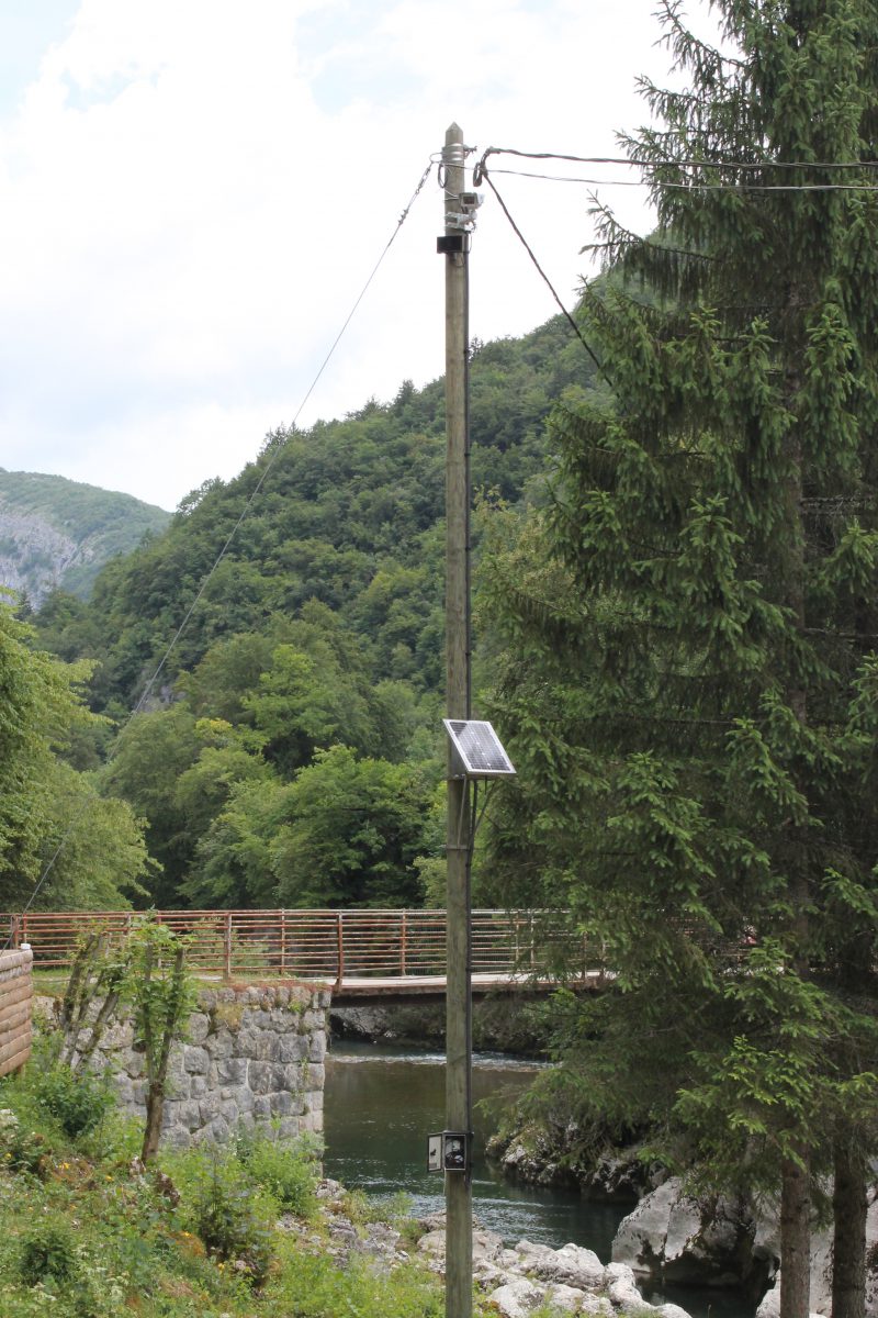
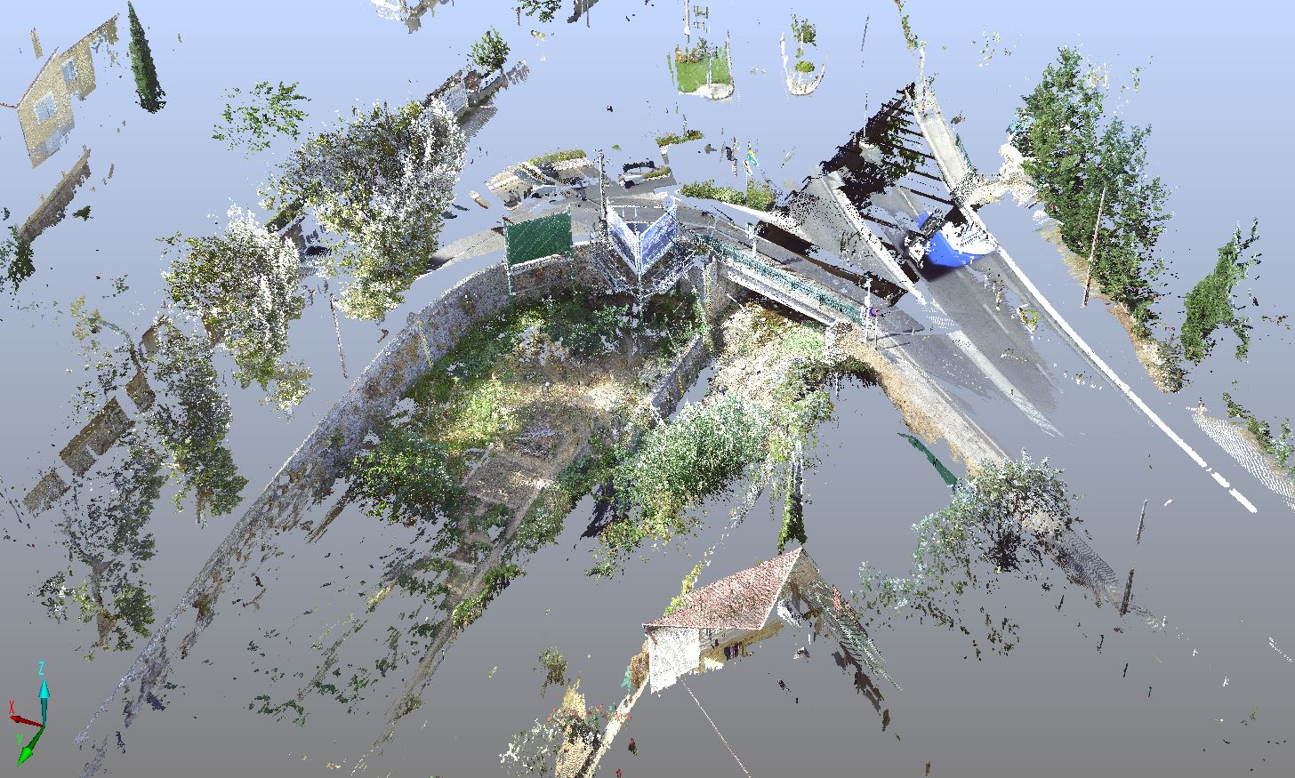
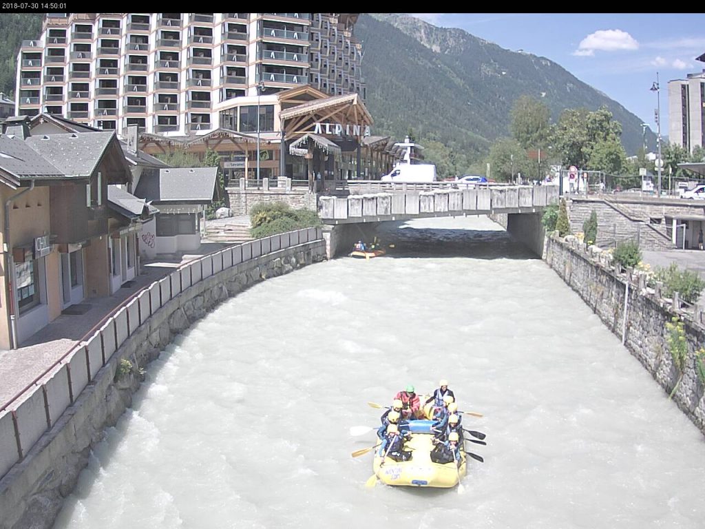
EXAMPLES OF SITES EQUIPPED WITH THE CamFlow SENSOR


ADDITIONAL PRODUCTS
See CamFlow’s operating principle and directions for use in the FAQ section.
TECHNICAL CHARACTERISTICS
Operating principle
The CamFlow sensor’s operation is based on efficient analysis algorithms that detect surface velocity between pairs of images. The lighting must be sufficient to visualise motion on the water surface. Measurements can therefore be taken in the daytime or at night in a sufficiently-lit urban environment. Lighting with an infrared projector is not well adapted to measuring surface velocity.
In order to be able to obtain precise flow measurements, these algorithms are based on detecting surface movements that are visible to the naked eye, such as elements on the water’s surface (branches, bubbles, leaves, etc.) or the movement of waves or water structures. CamFlow therefore implements similar principles to the LSPIV method (Large-scale particle image velocimetry).
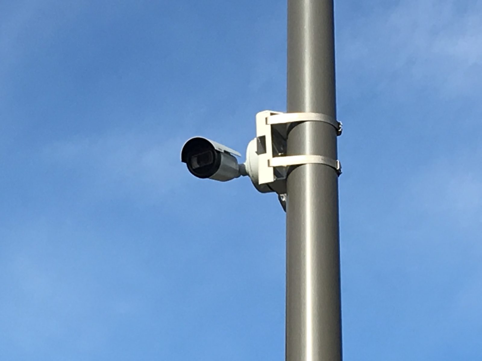
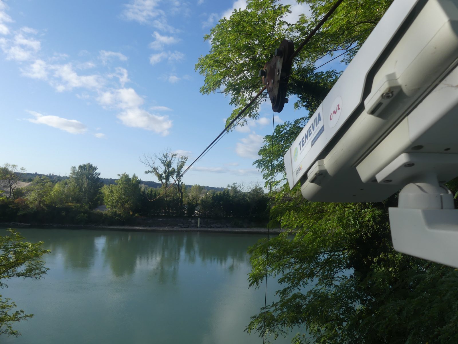
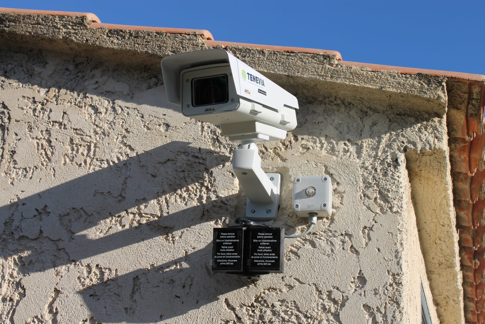
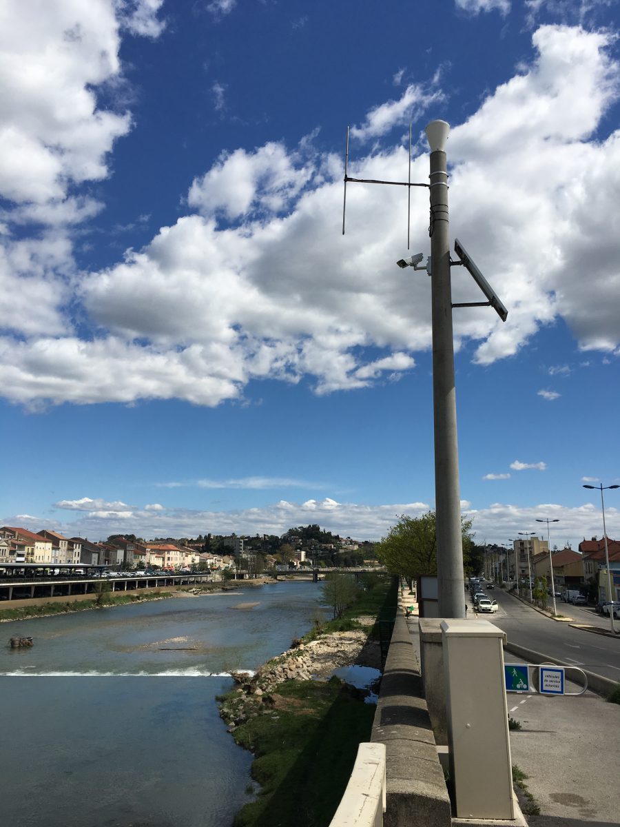
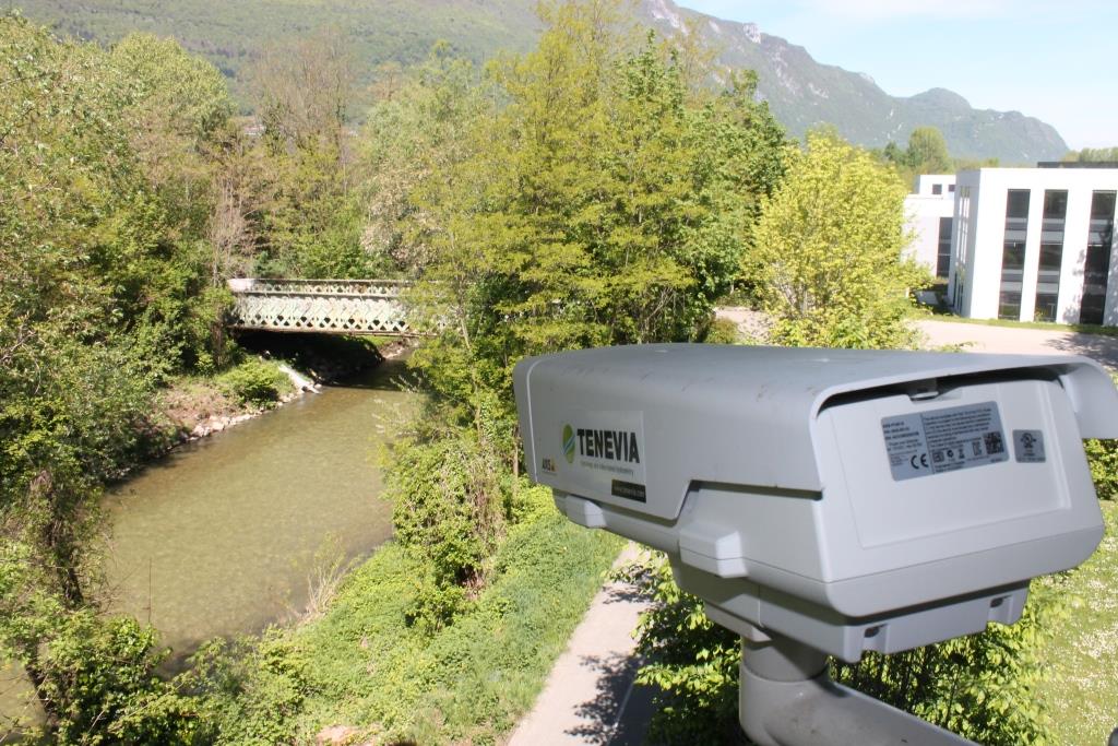
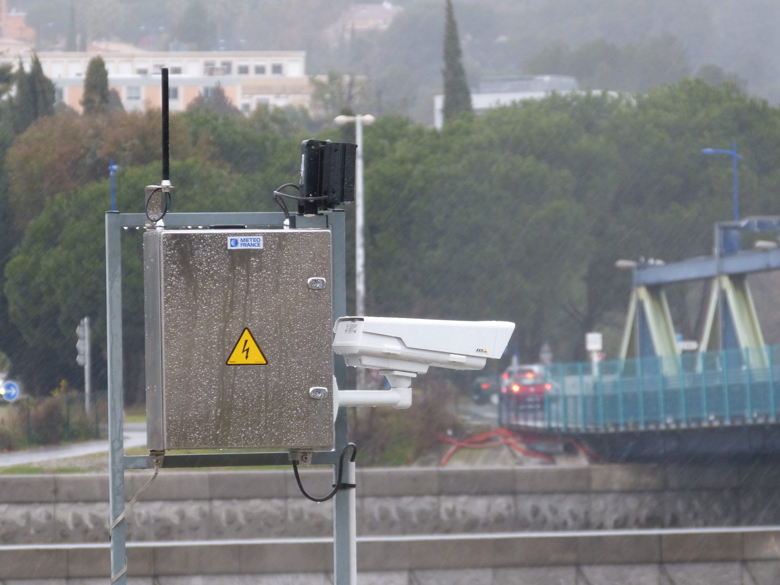
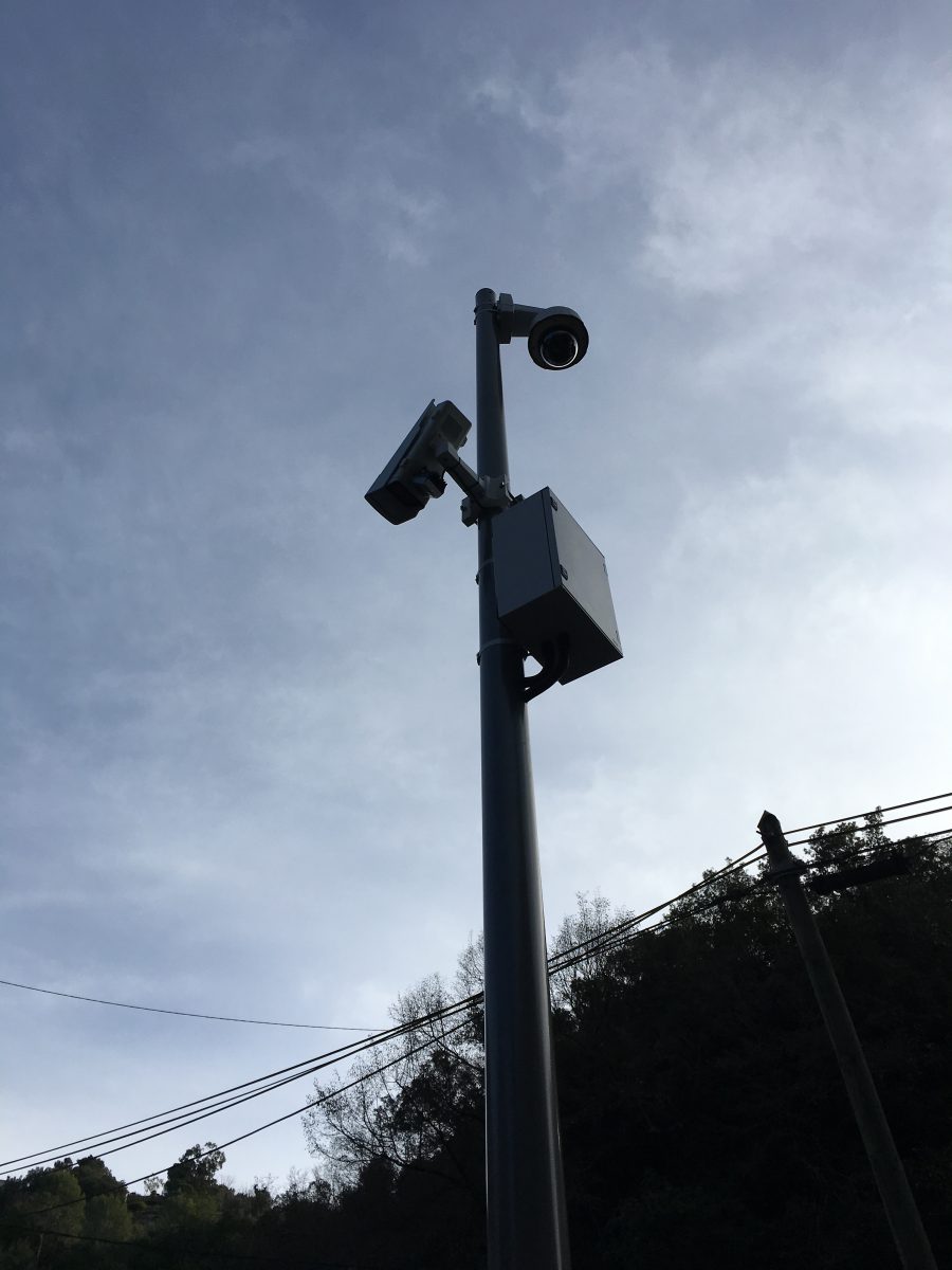
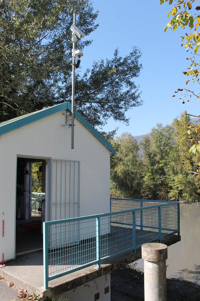
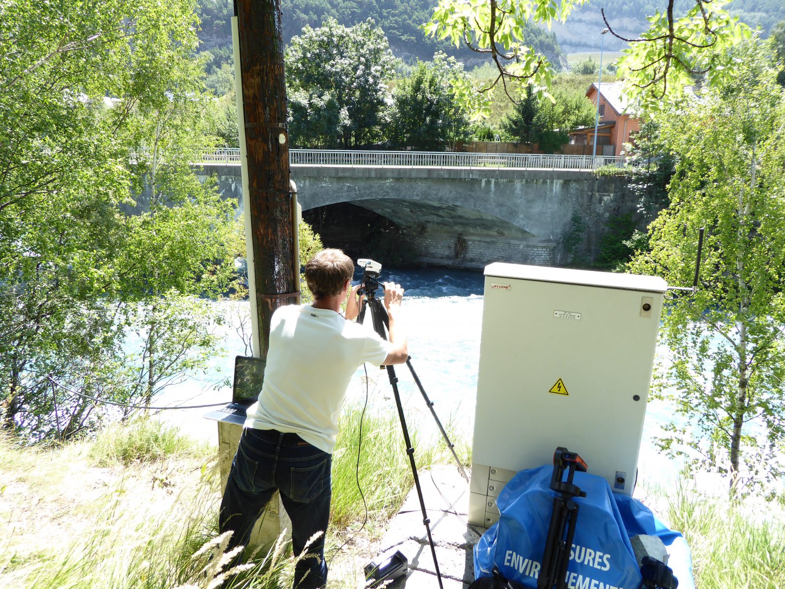
Image-taking device: The sequences of images come from a fixed video-surveillance camera installed close to the measuring site. For information on cameras and image-taking equipment that is compatible with TENEVIA CamFlow®, go to our equipment section.
Water level: Information on water level can be generated by CamFlow on the same basis as CamLevel or using a level measurement from another sensor (radar sensor, pressure sensor, piezometric level probe, ultra-sound, etc). On many sites, CamFlow’s operation does not actually require any data on the reservoir’s altitude (all hydrometric cameras measured with single camera). If the site’s configuration does not allow the CamFlow camera to measure the water level, an external sensor or a second camera dedicated to CamLevel will have to be installed.
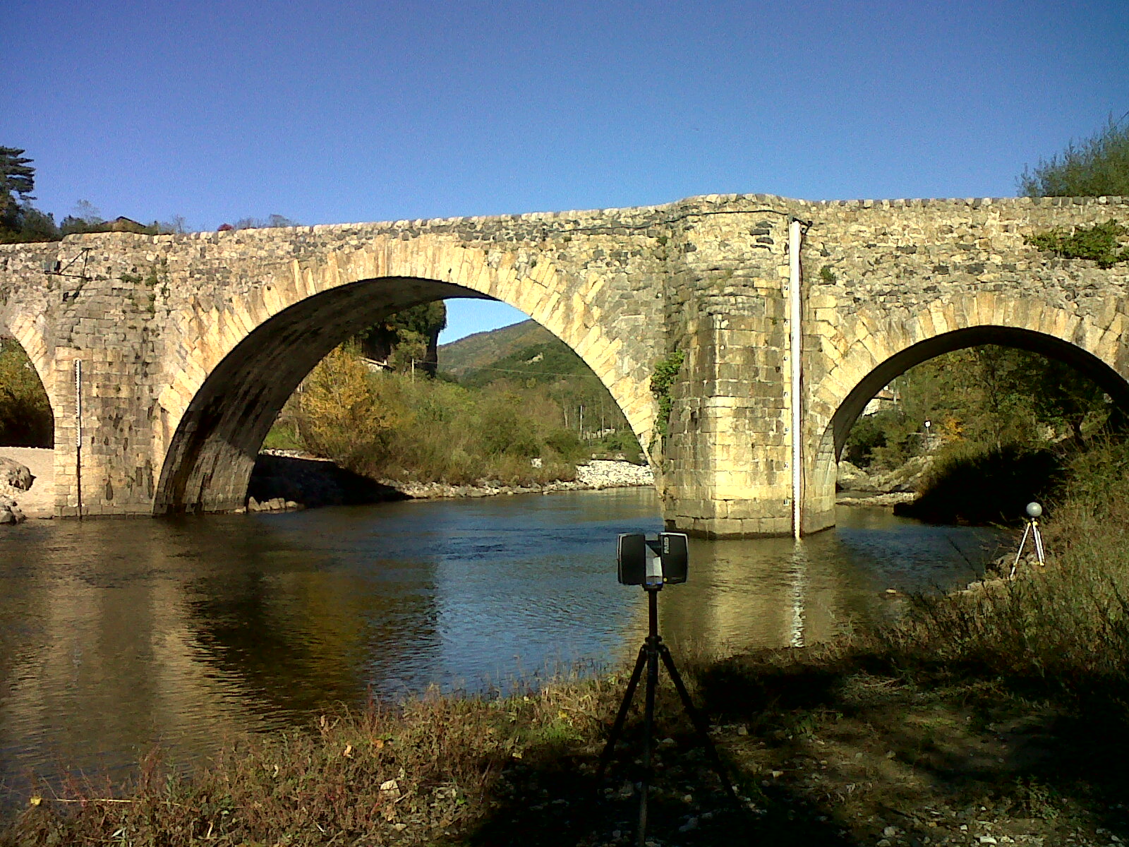
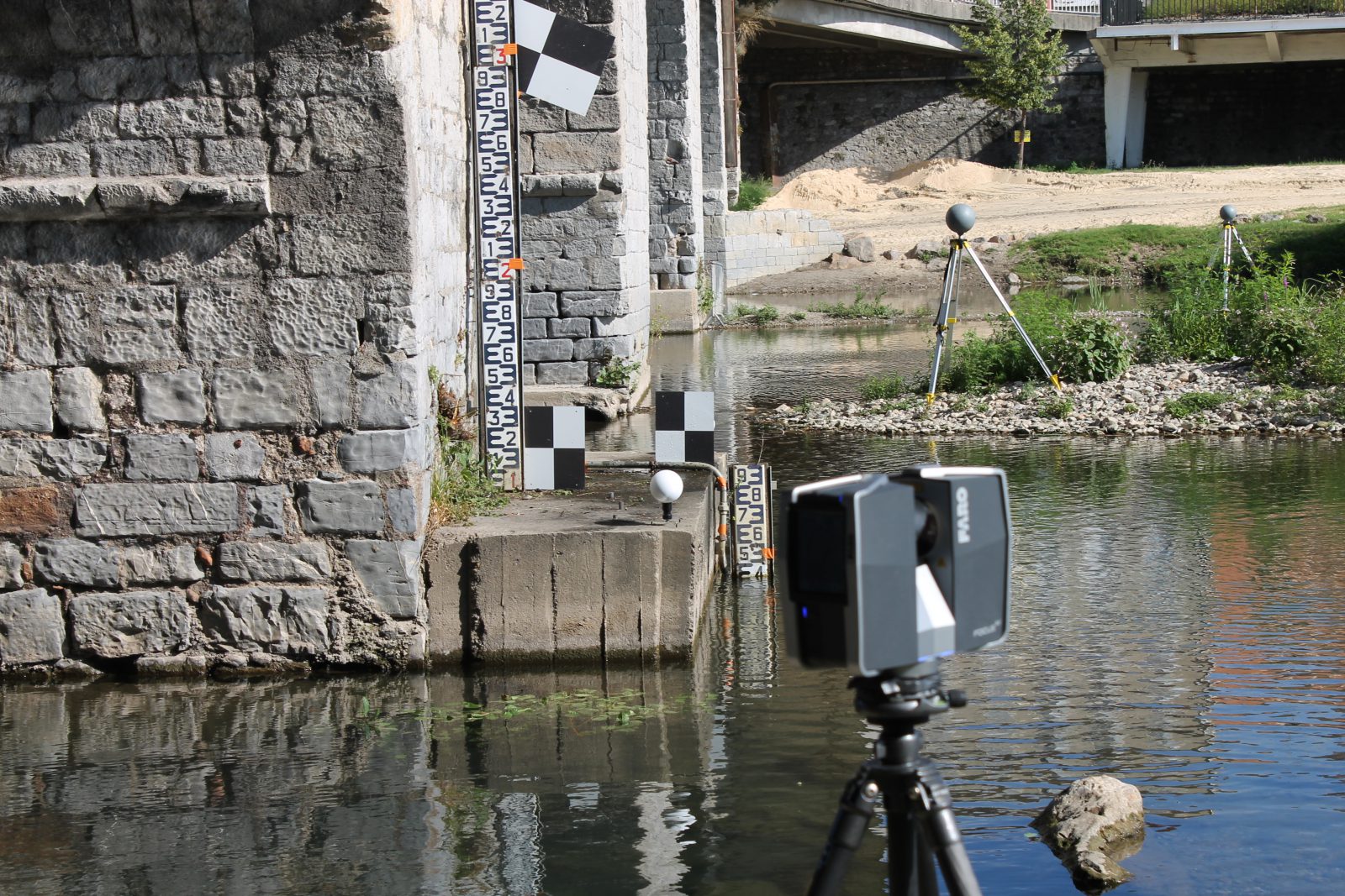
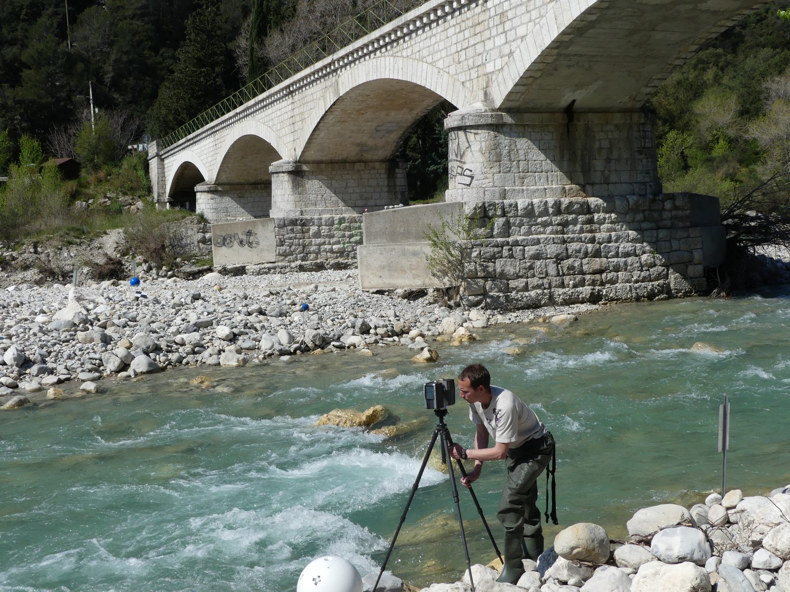
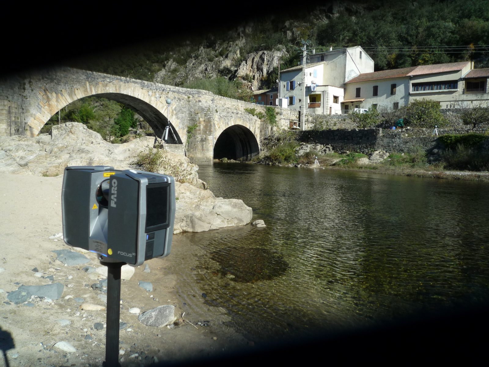
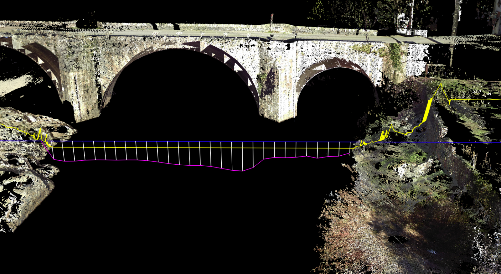
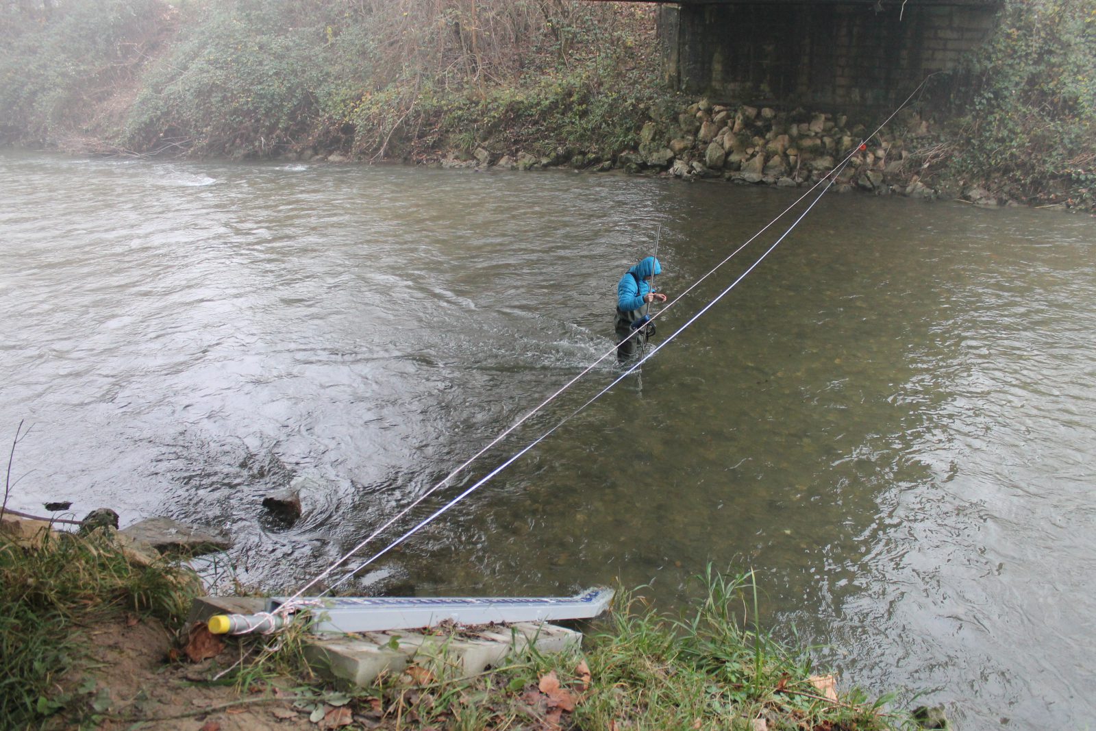
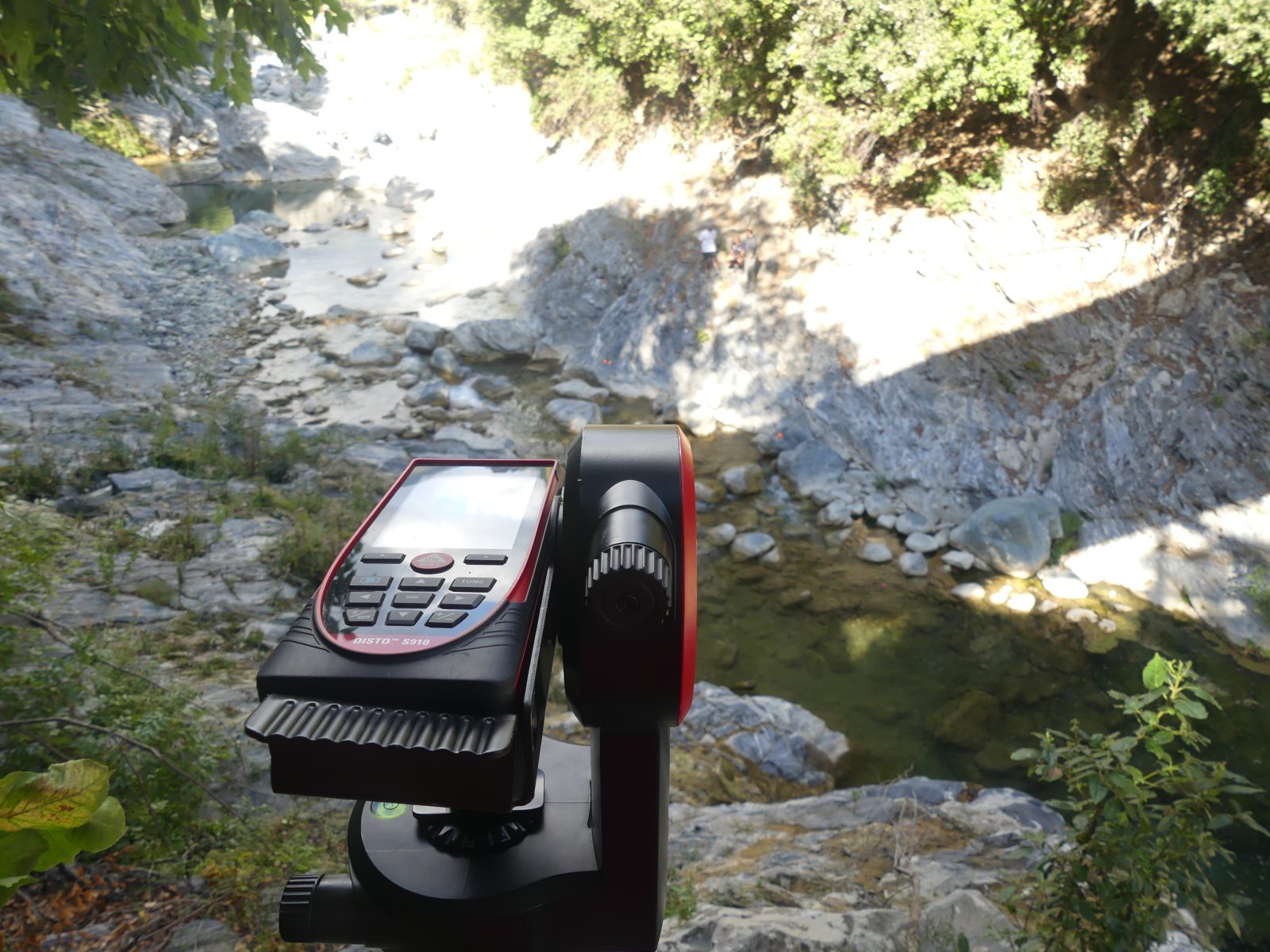
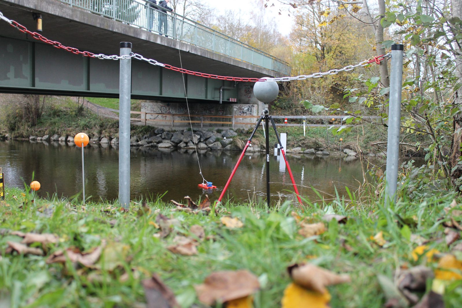
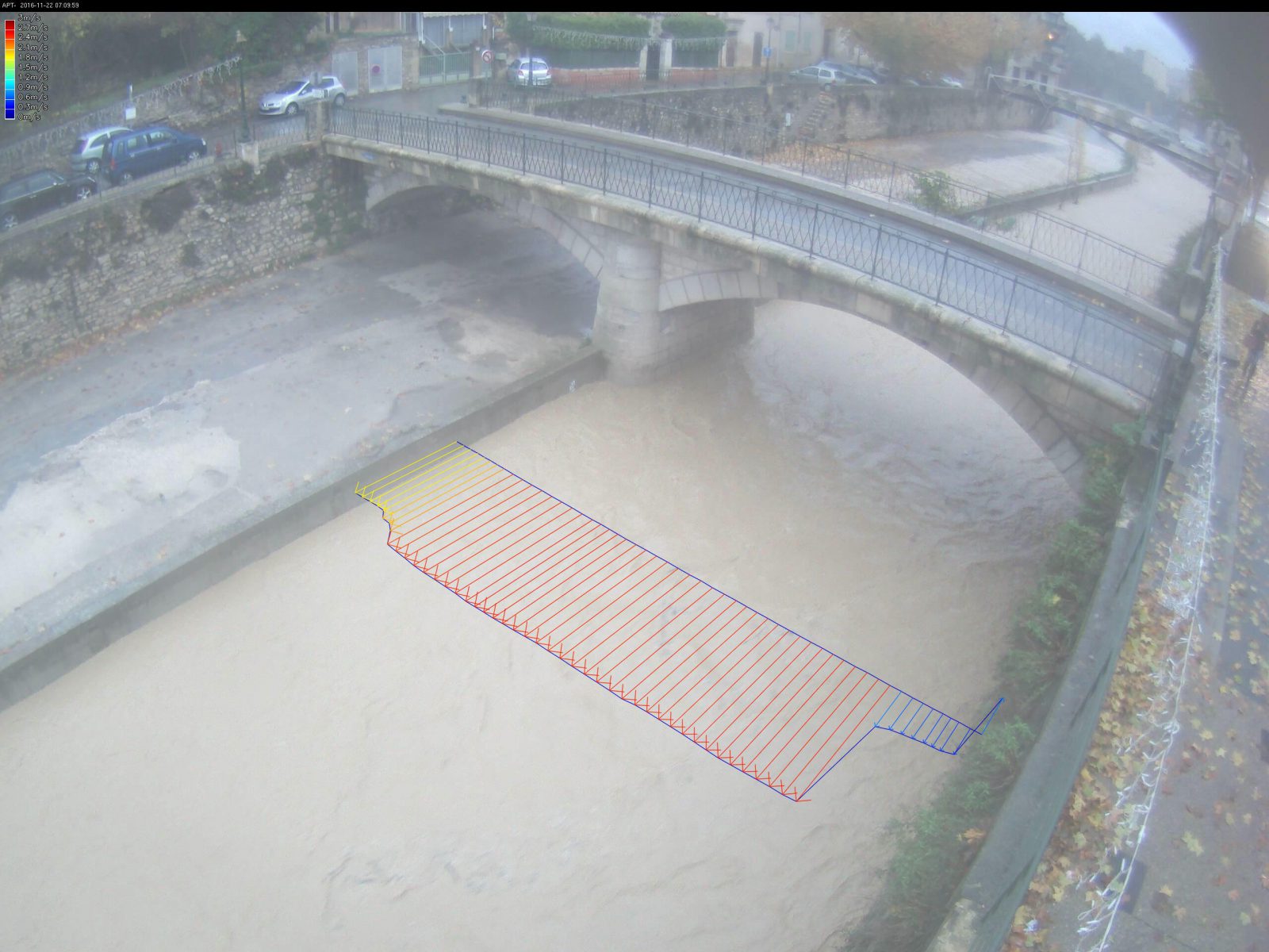
Bathymetry: the flow section’s profile must be measured on site to configure the device.
Discharge calculation
Discharge is calculated using the water level measurement, the bathymetry and the measured surface velocities. This calculation is made in compliance with international standards using the central section method. This method uses a velocity coefficient defining the ratio between the surface velocity measured and the depth-averaged velocity. If additional measurements are available (e.g. ADCP gauging), they can be used to specify these standard hypotheses. More complex and advanced discharge calculation methods can also be used.
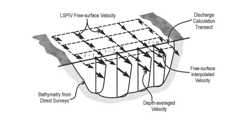
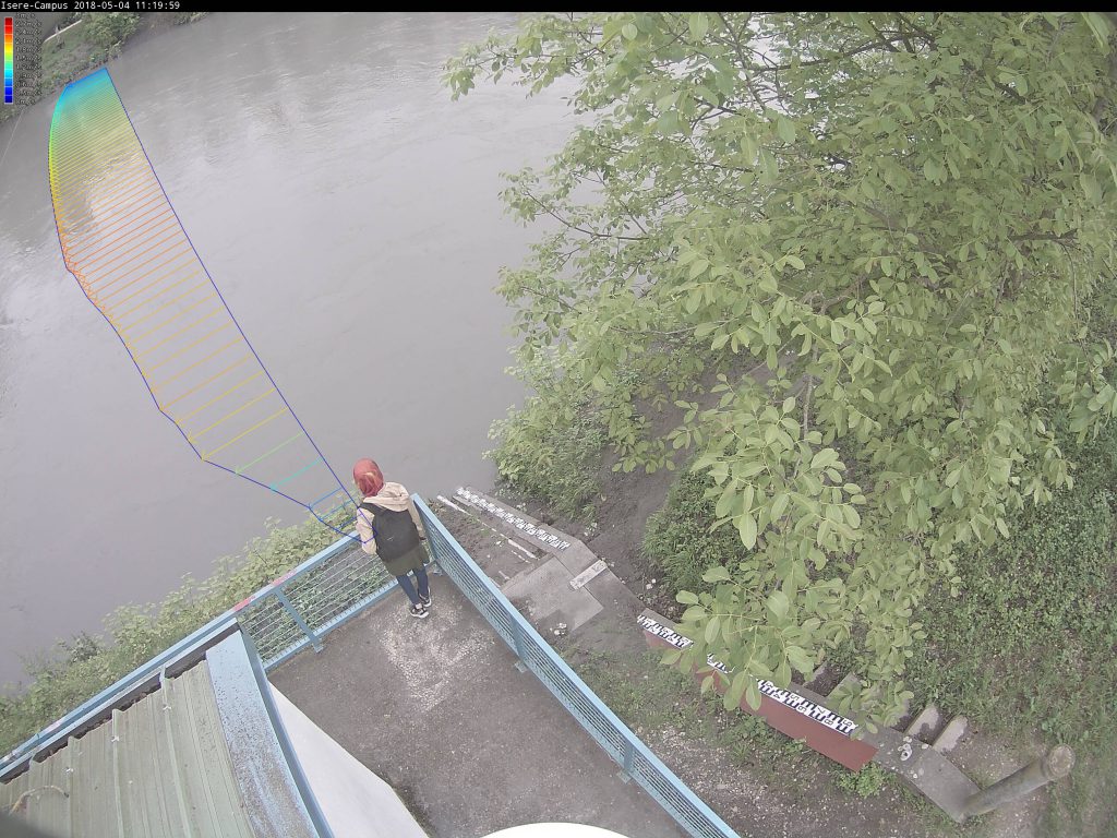
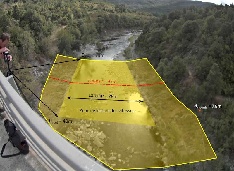
Discharge calculation principle using surface speed measurements (Source: WMO – LSPIV)
Installation and Configuration
The image-taking device is installed like a standard video-surveillance camera. The camera’s location and line of sight must allow good visualisation of the section where the measurements will be taken. Both banks should be visible in the image. The installation must be high enough for the angle between the camera axis and the water’s surface to be greater than 10-15° for the entire measurement range (i.e. also for very high water levels).
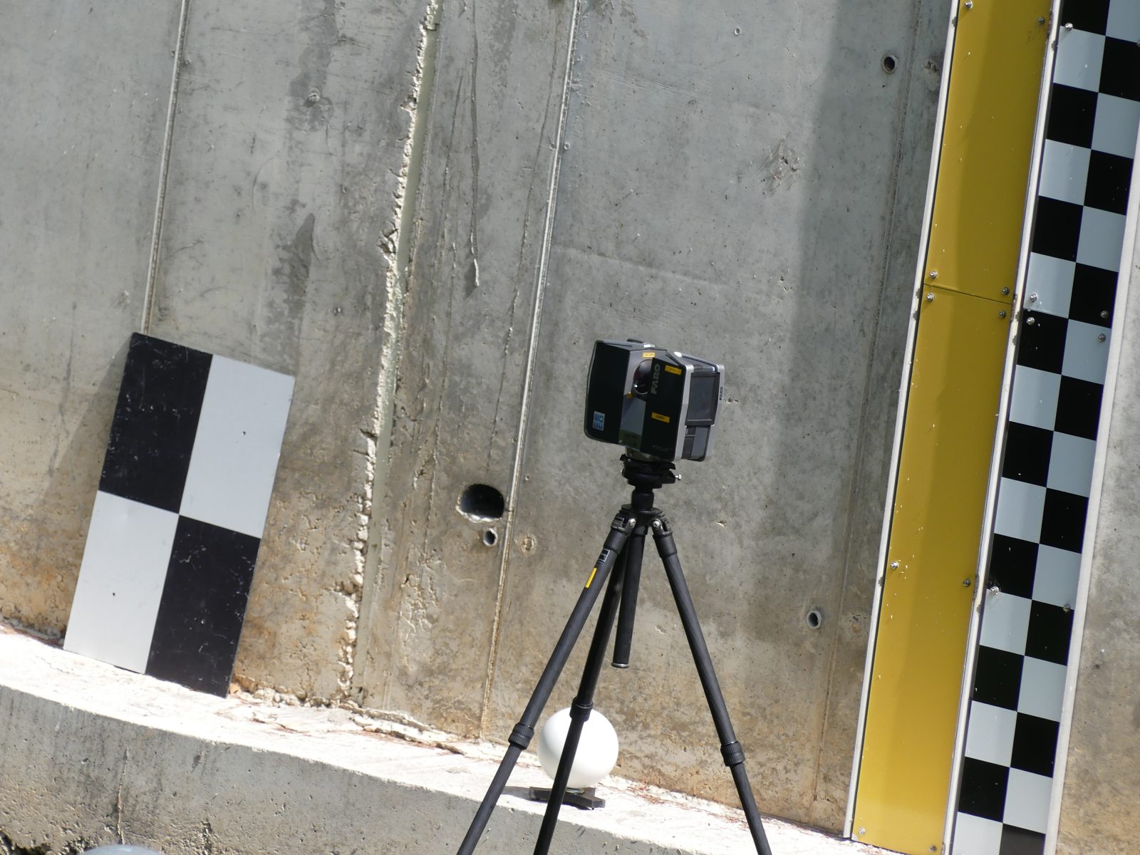
In order to operate, the CamFlow’s image analysis algorithms must be calibrated using topographical and bathymetric data on the site where the image-taking device is installed. The level of information required varies according to the CamFlow service level (Essential or Advanced) the user has opted for. To find out more about calibrating CamFlow, use our installation guide.
⇒ TENEVIA also offers assistance with calibration and topographical surveys.
Service levels
The CamFlow sensor comes with two service levels.
- ESSENTIAL: Measures surface velocity on the visible part of the flow section.
- ADVANCED: Measures surface velocity and calculates discharge (flow meter).
All the CamFlow service levels include the COMPLETE CamLevel OR the integration of an external water level measurement taken by another sensor.
Measurement precision and range
Sensor precision: CamFlow is precise to under 5% for surface velocity and under 10% for discharge. It can vary according to site characteristics. Precision at low water can be corrupted because of a lack of surface movements representative of the flow.
Range of measurement: the CamFlow’s range of operation is not limited by flow conditions. The camera device must simply be adapted to the site. The Axis cameras have the advantage that the image-taking characteristics can be adjusted (resolution, number of frames per second). Nevertheless, CamFlow’s operation depends on the measurement range of the water level.
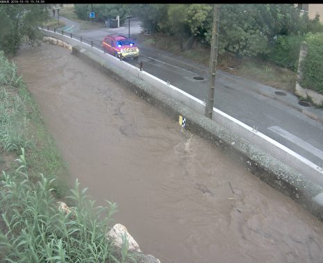
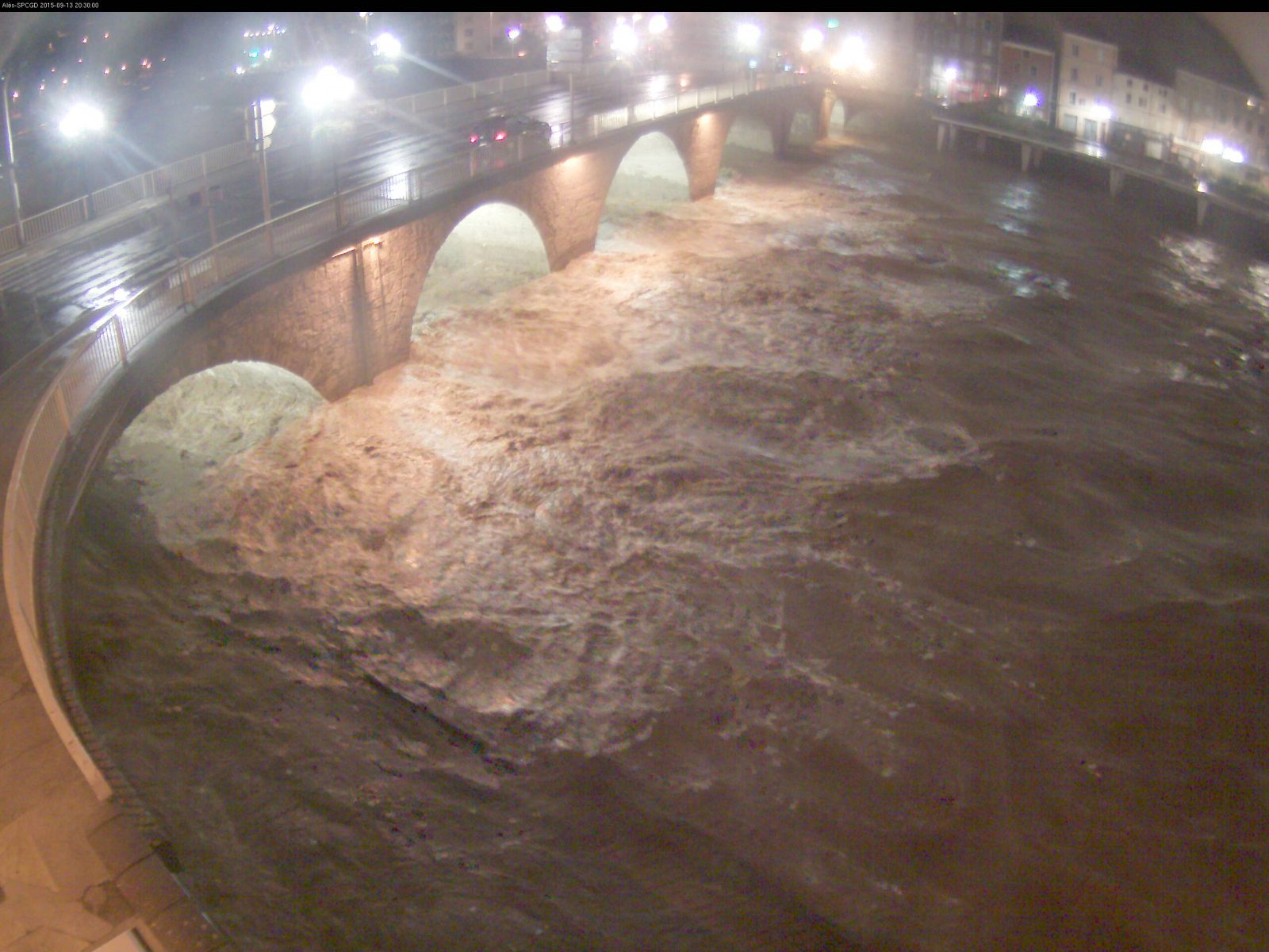
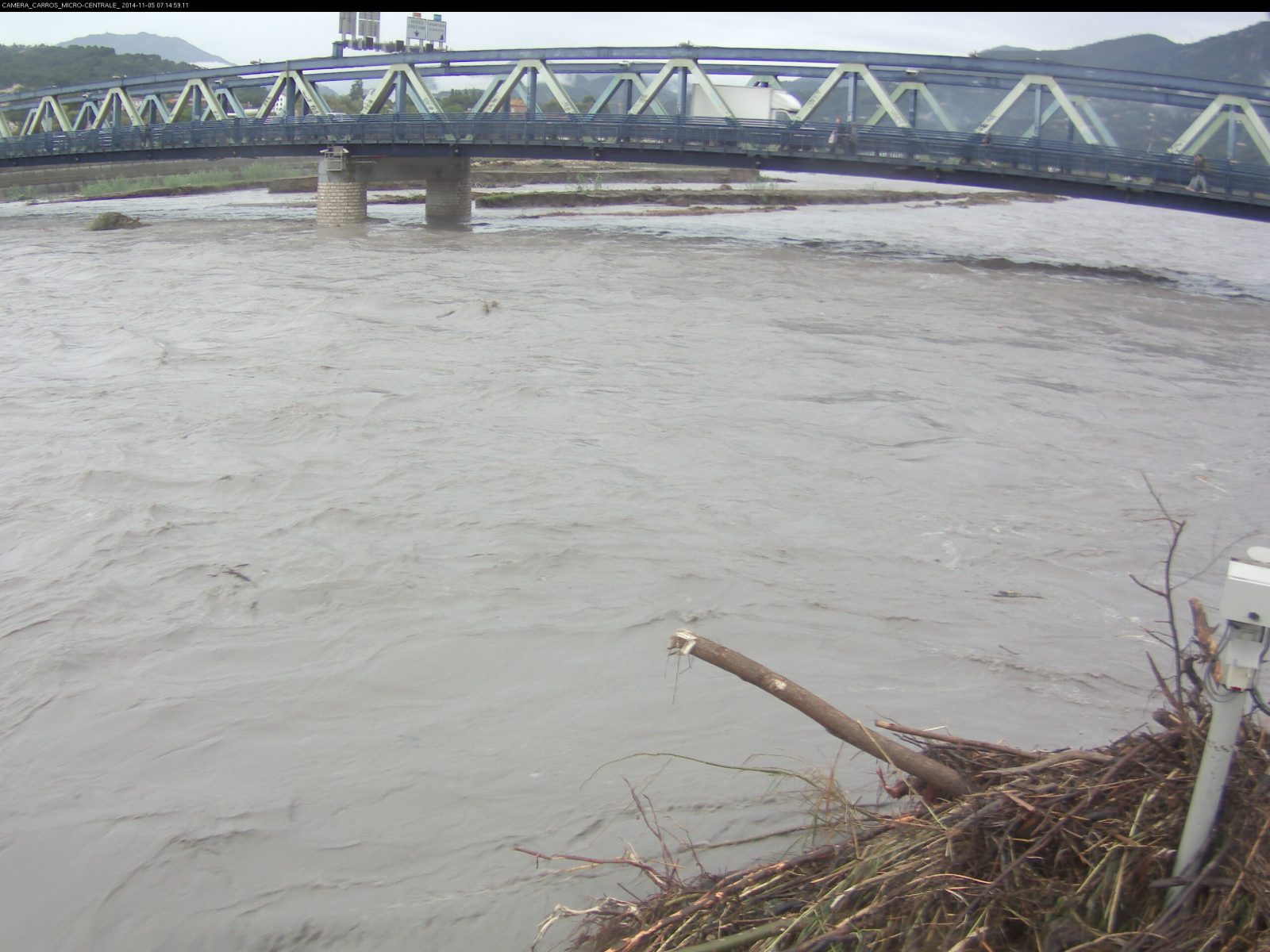
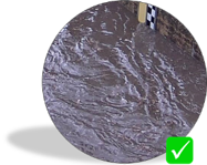
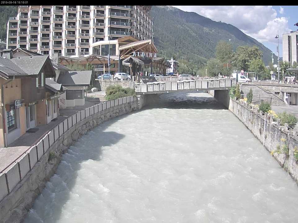
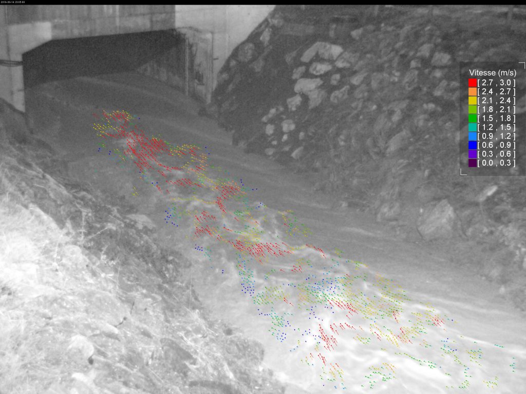
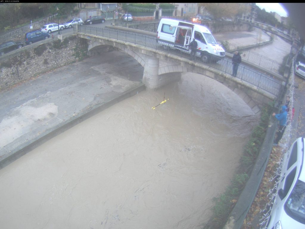
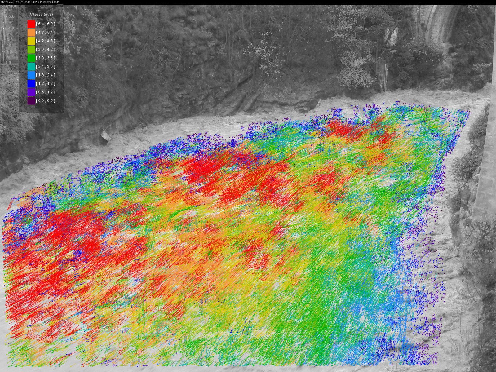
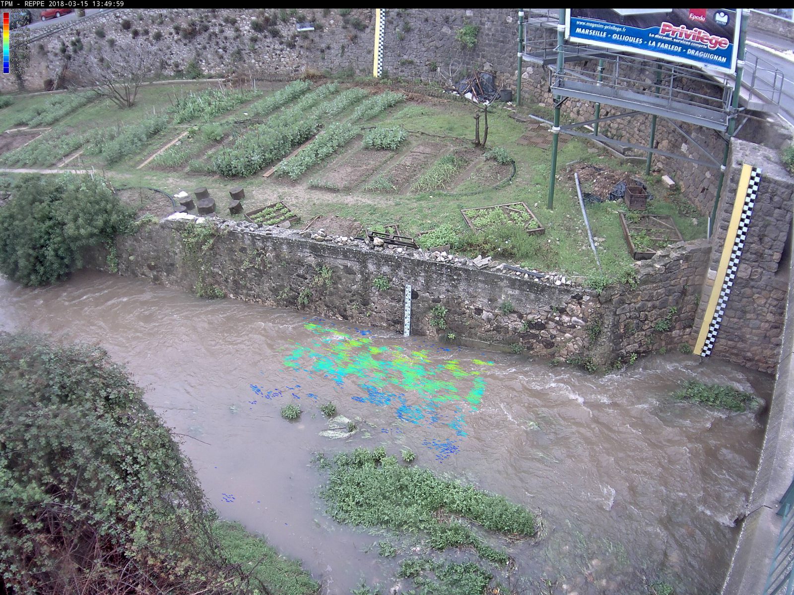
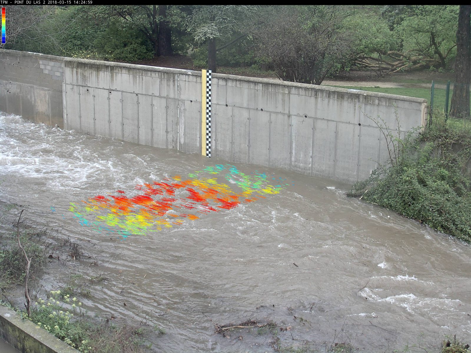
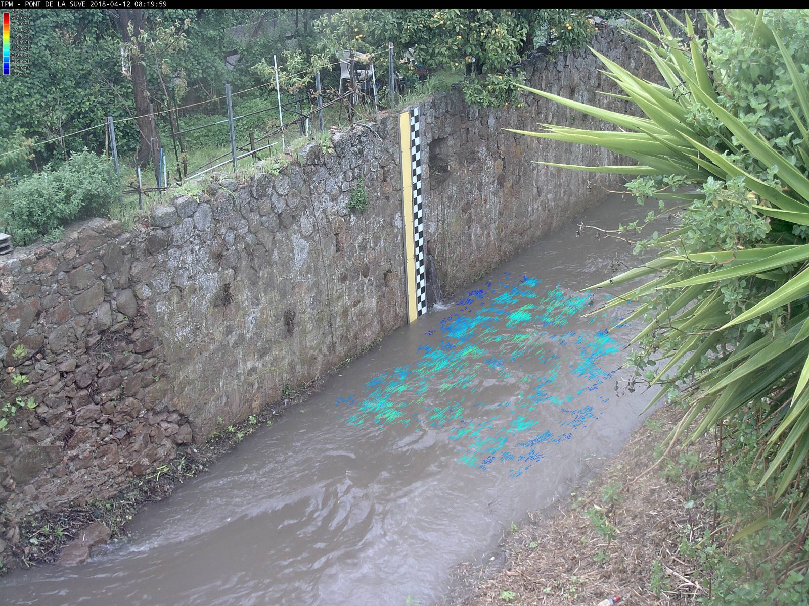
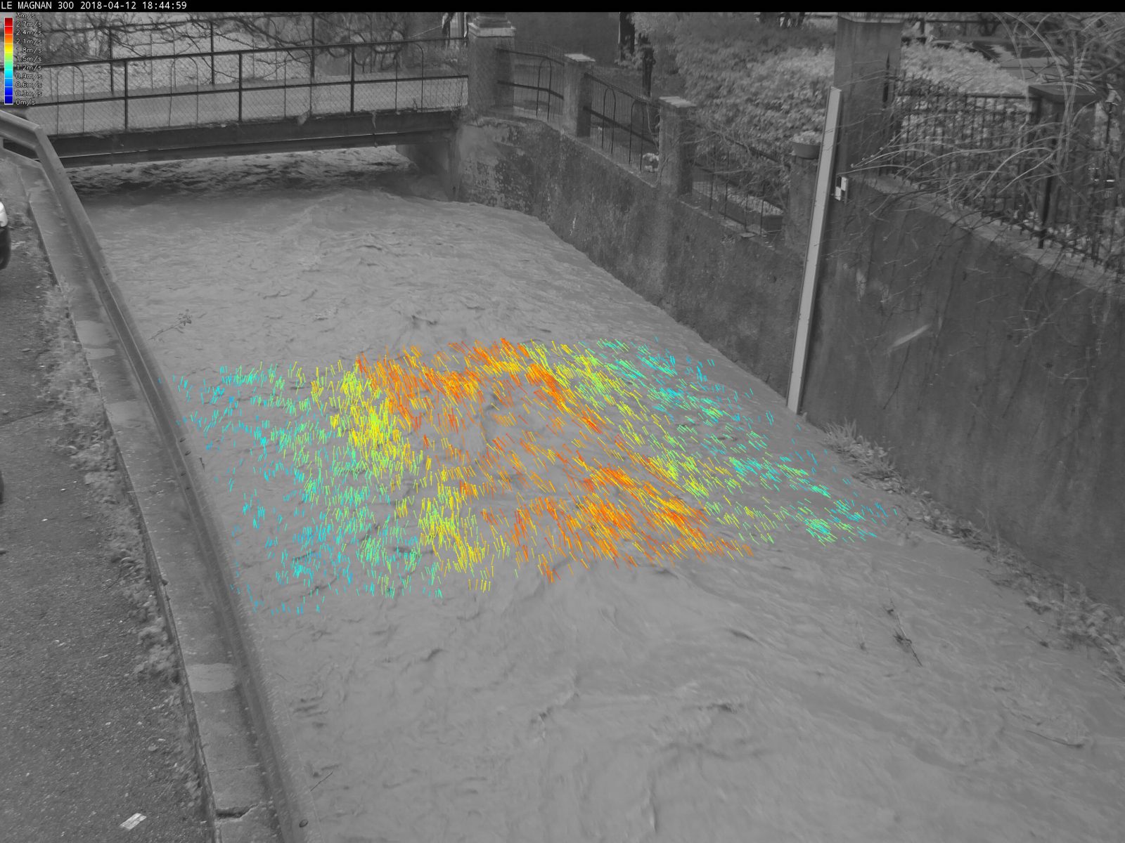
Night speed mesurements on urban river of south of France
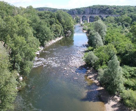
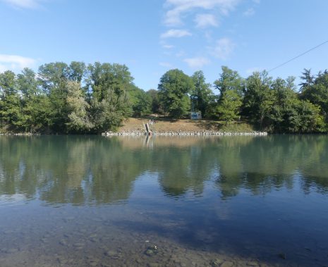
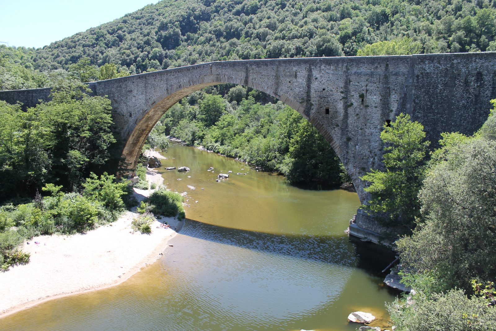
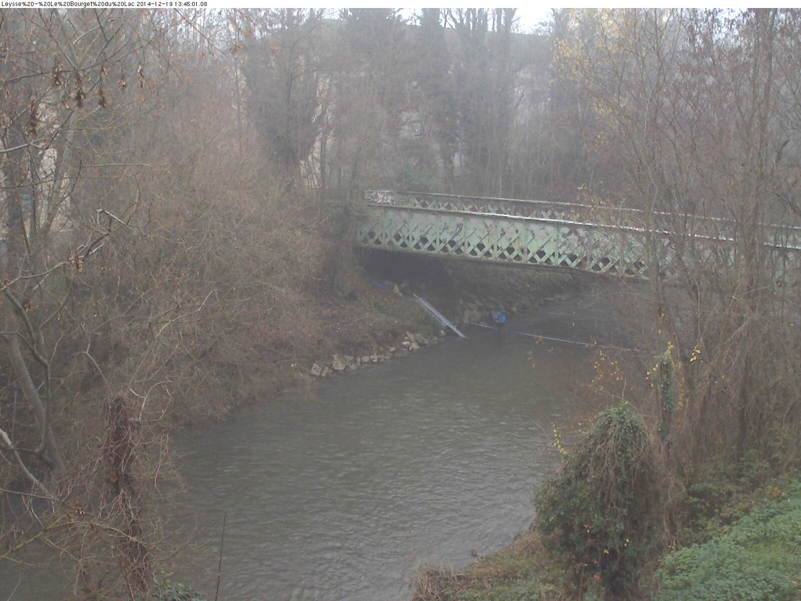
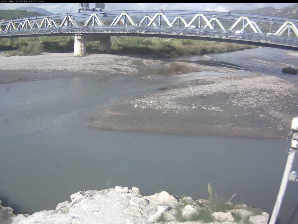
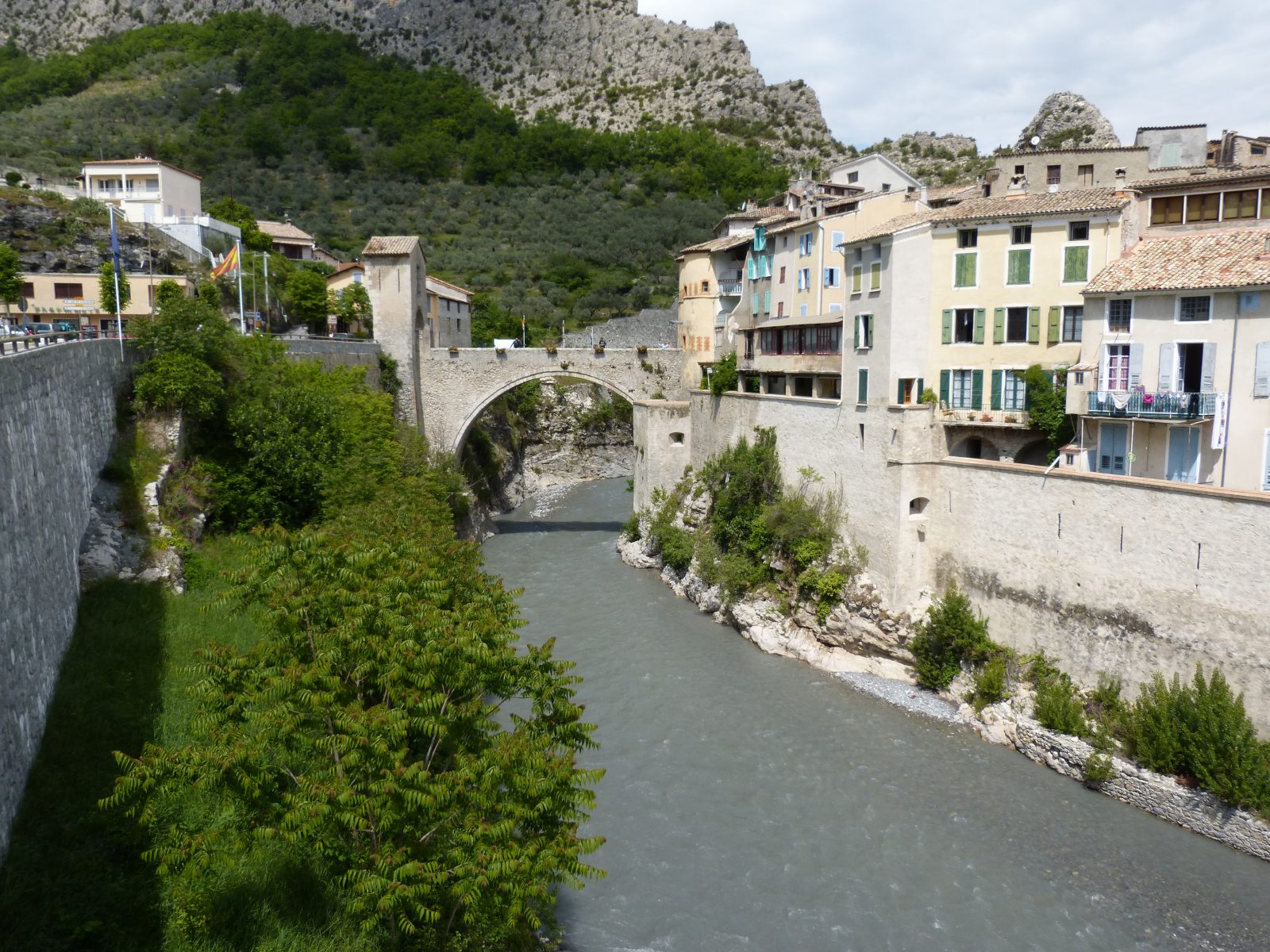
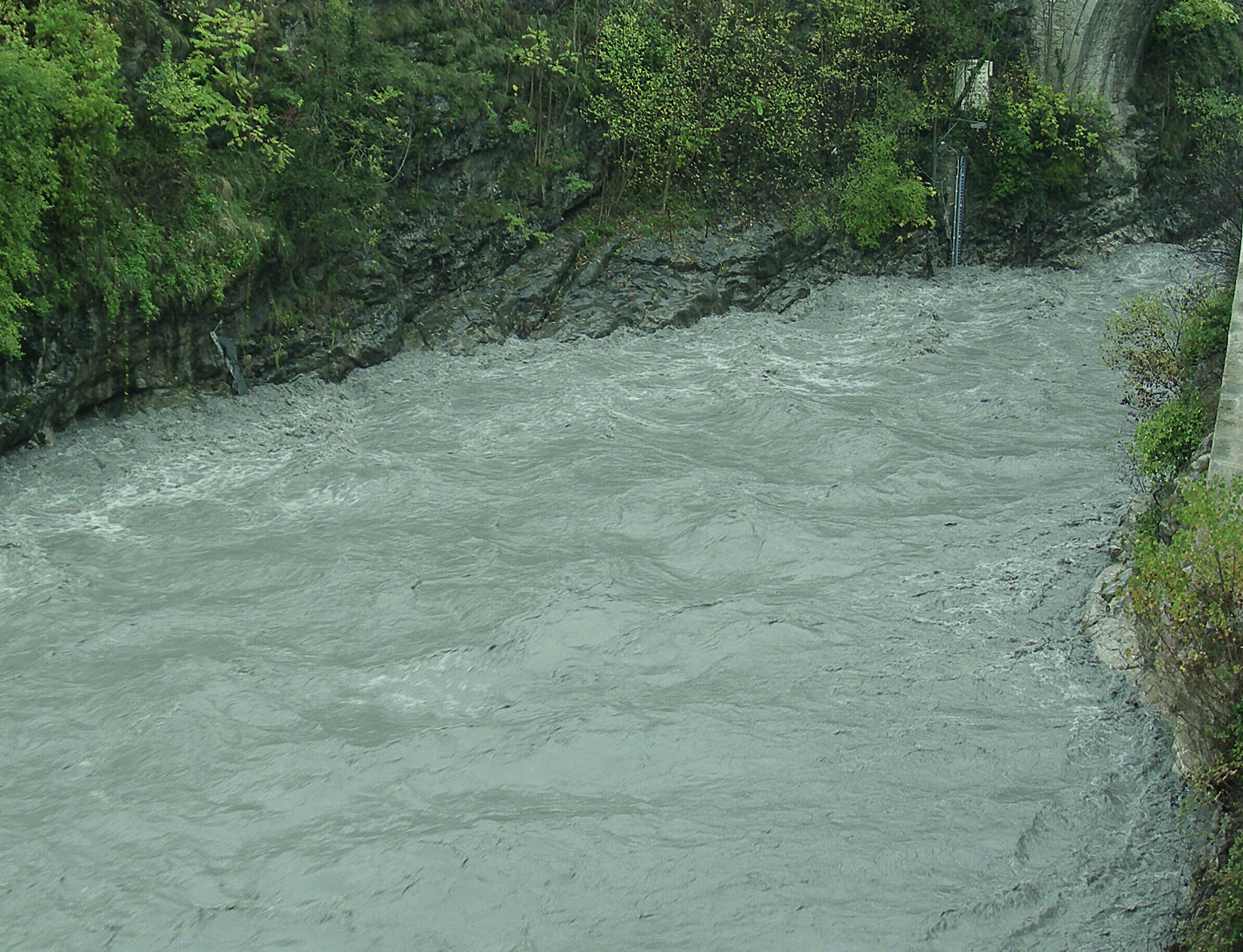
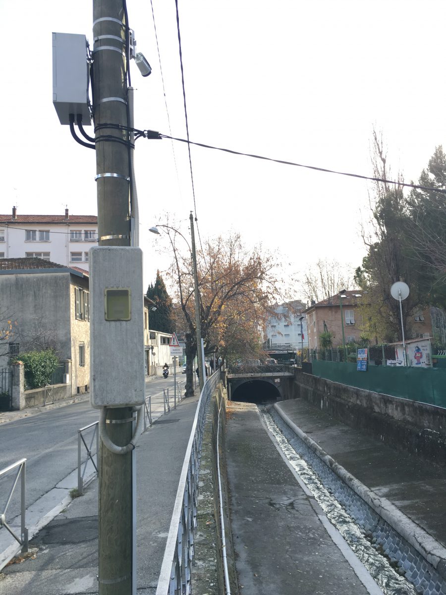
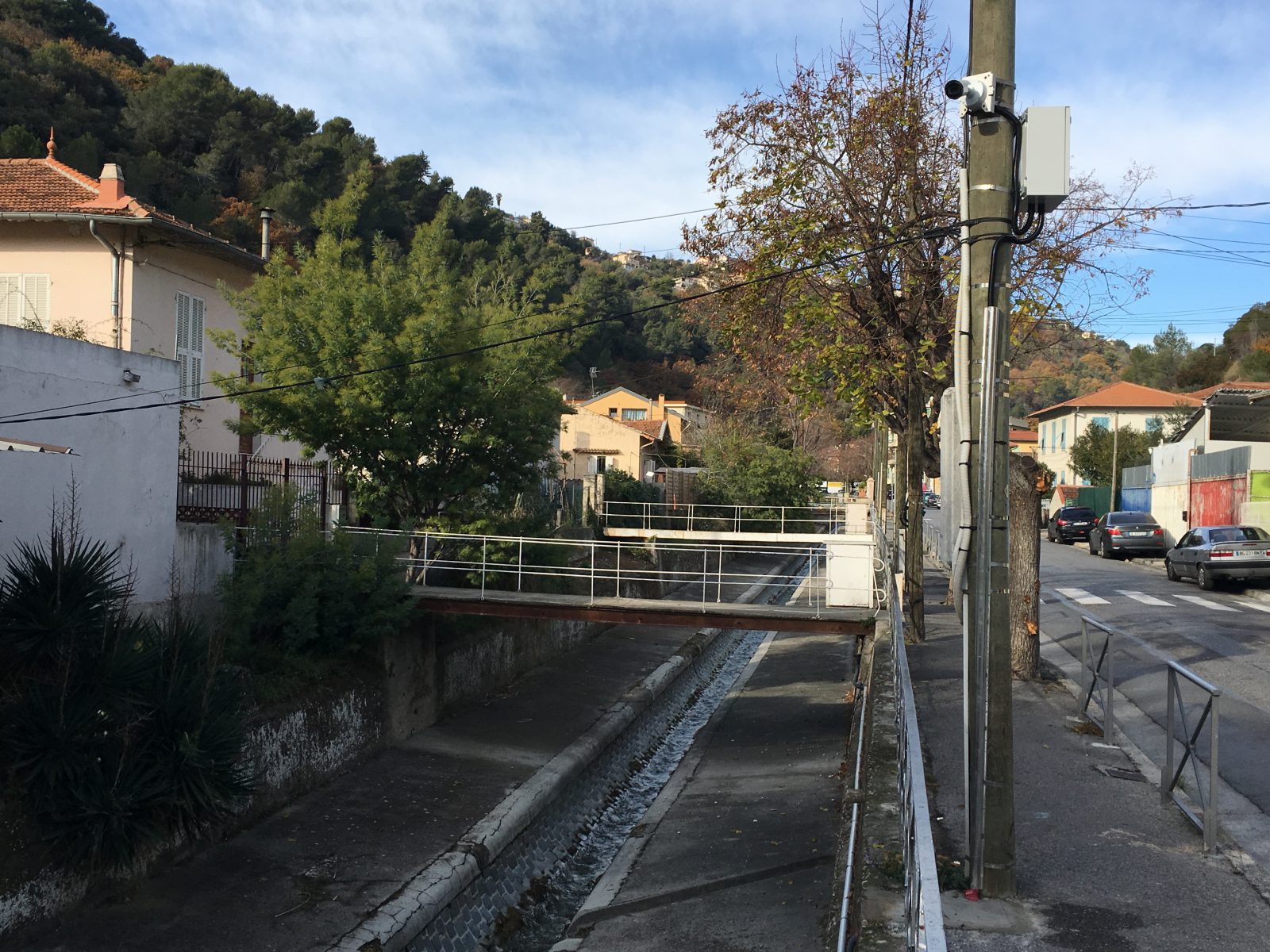
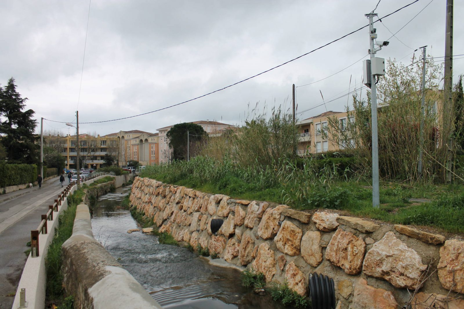
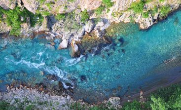
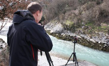
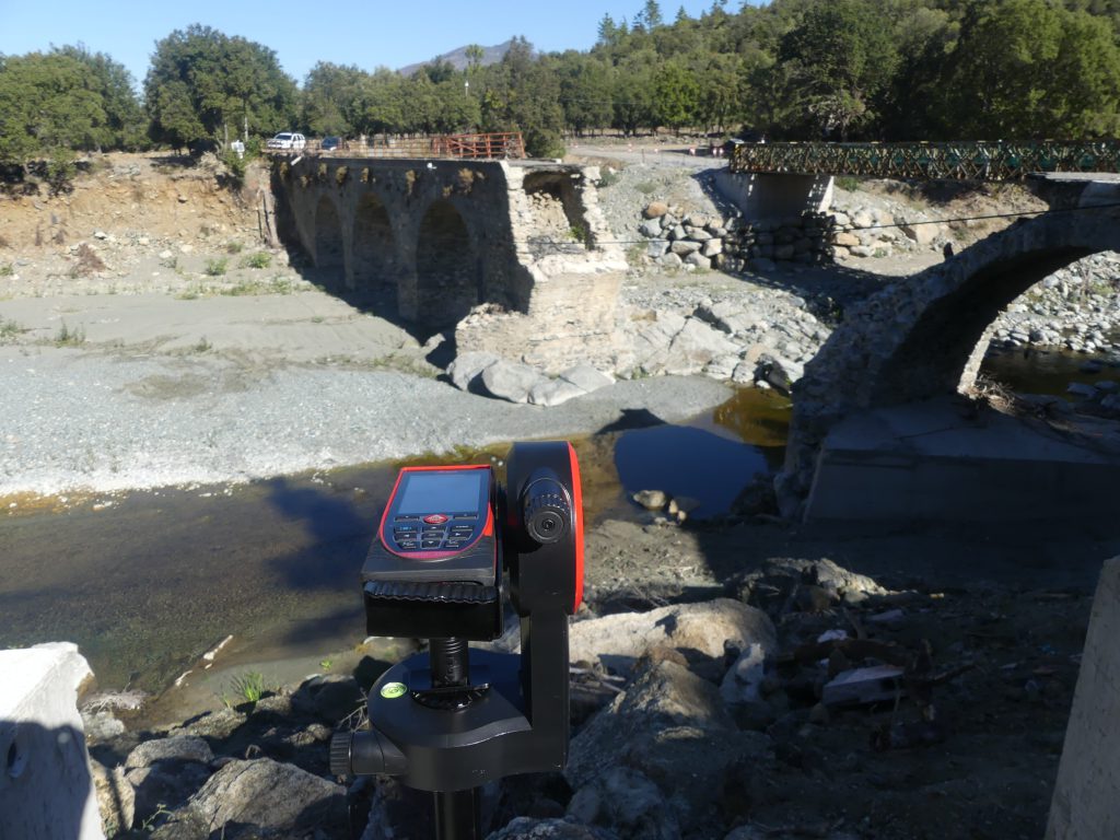
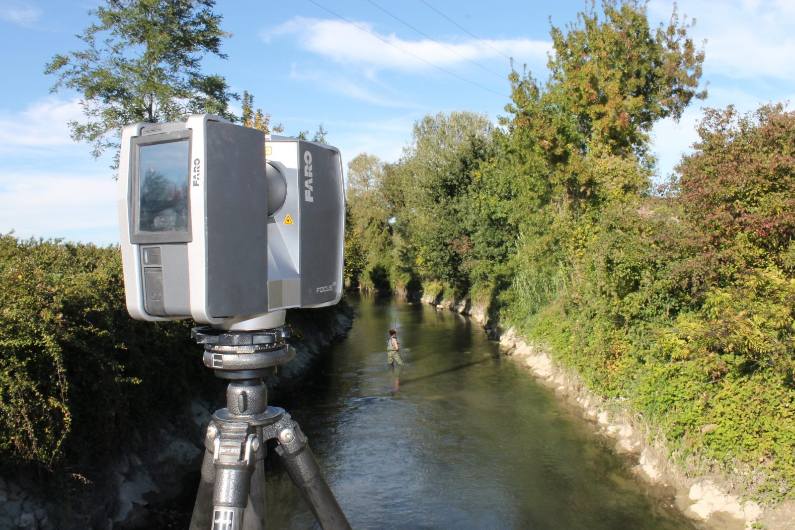
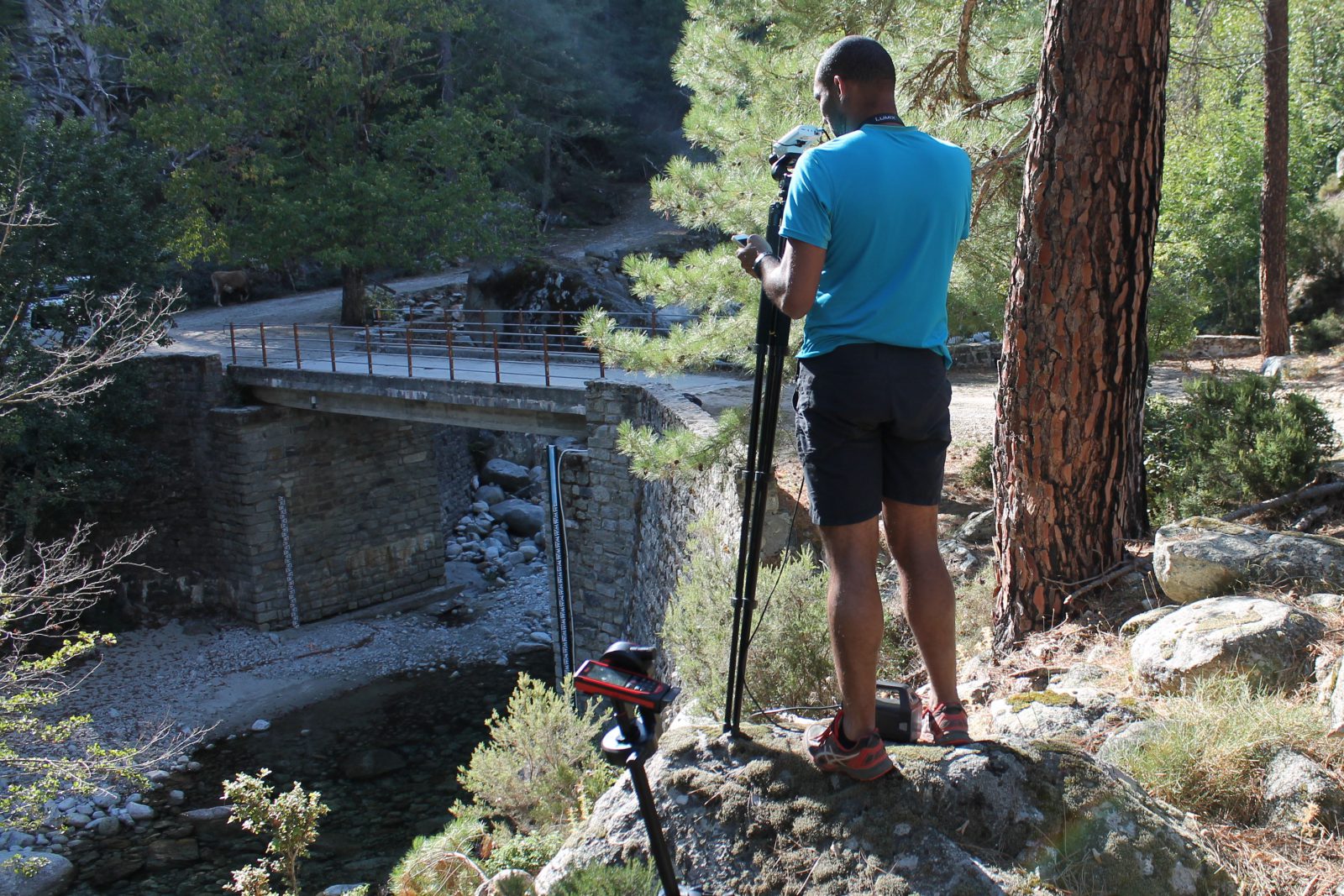
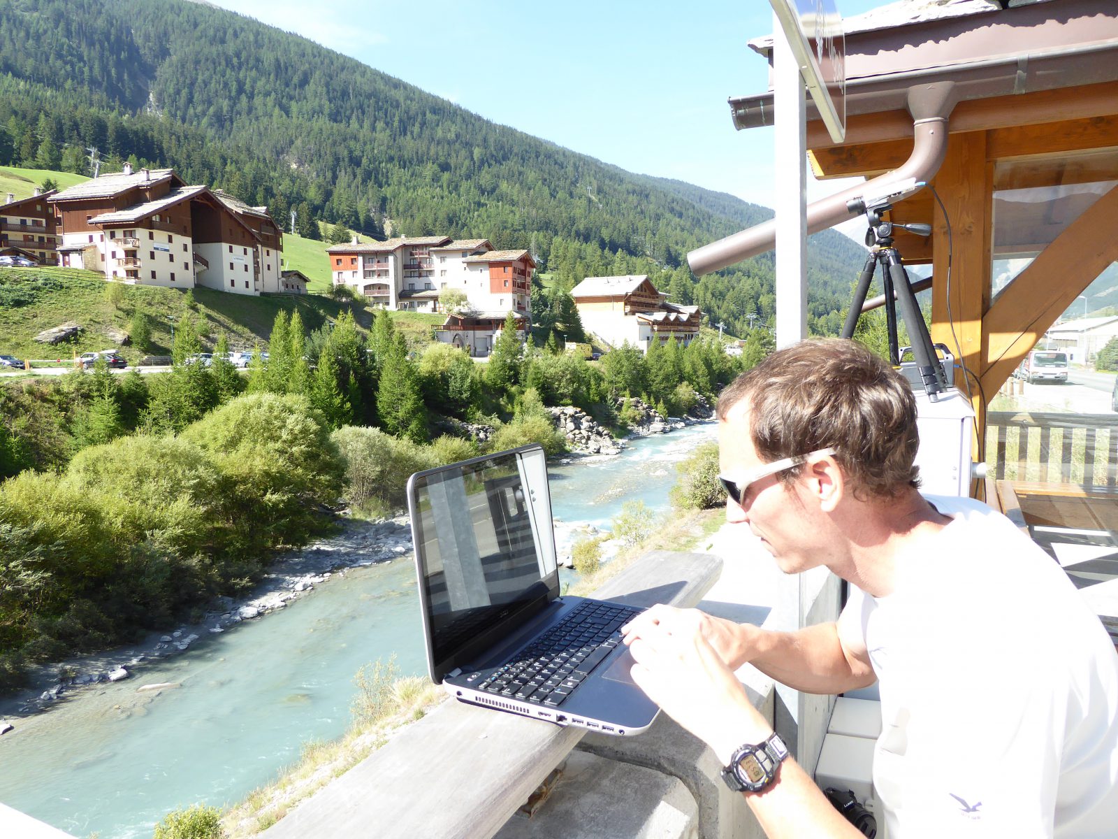
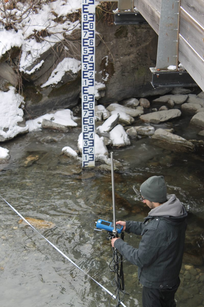
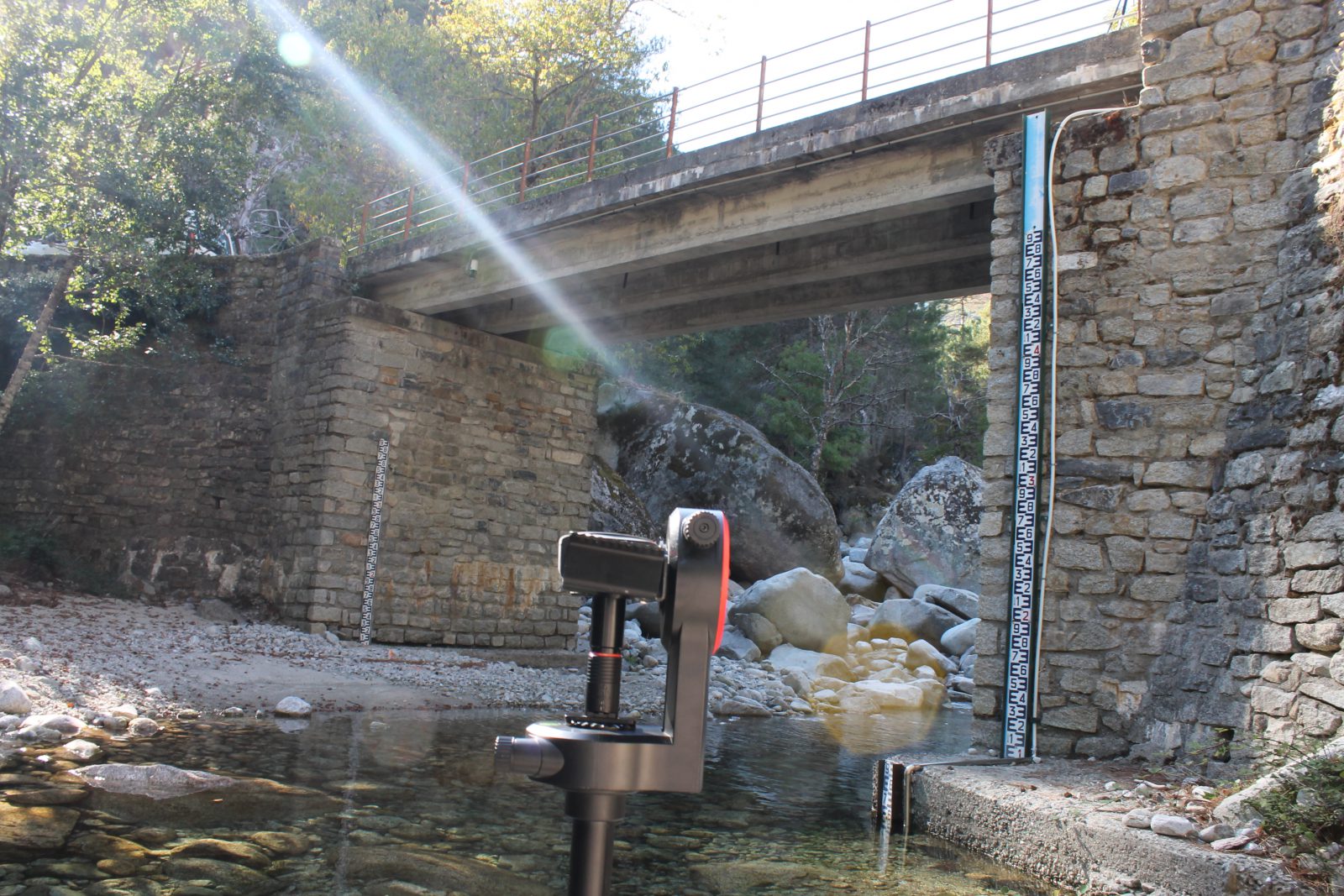
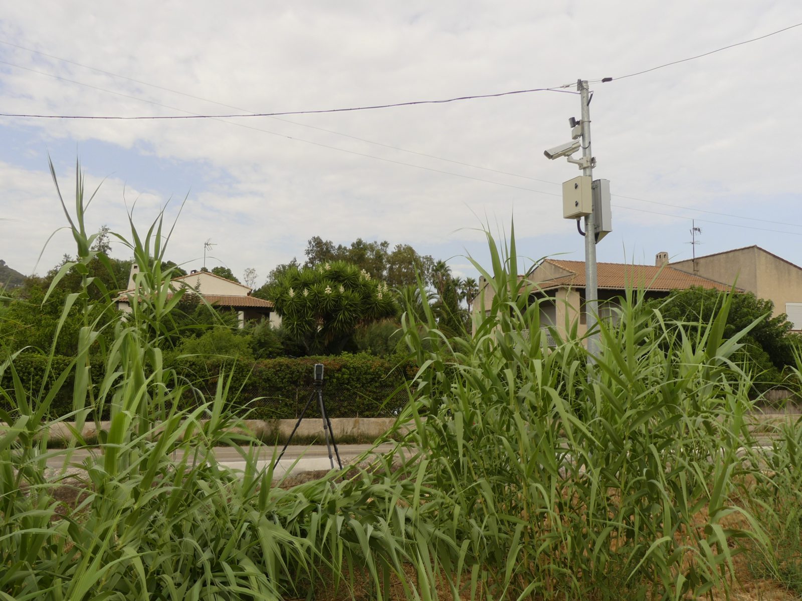
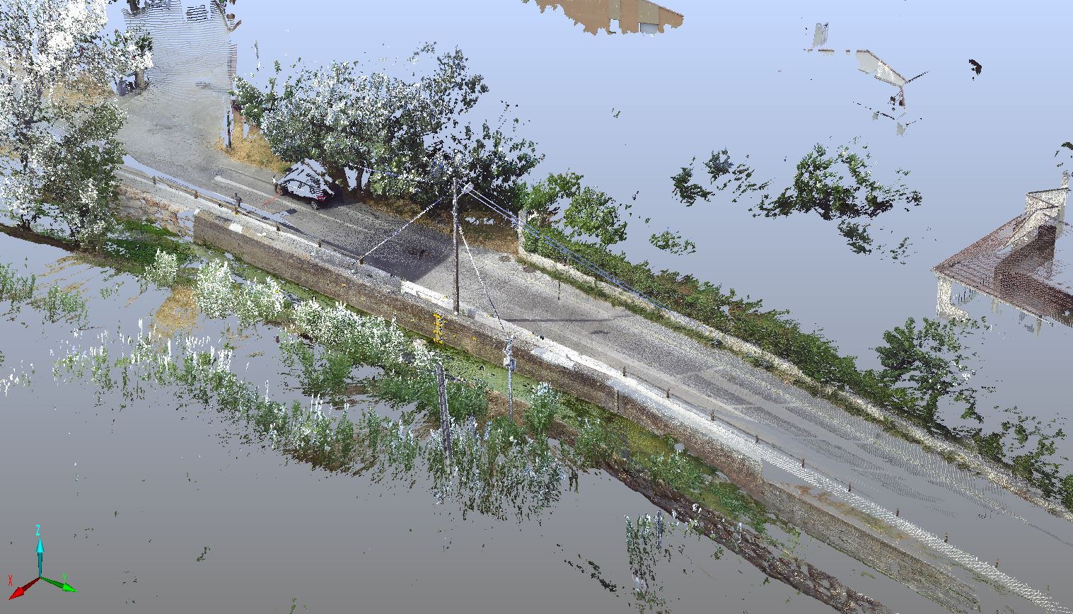
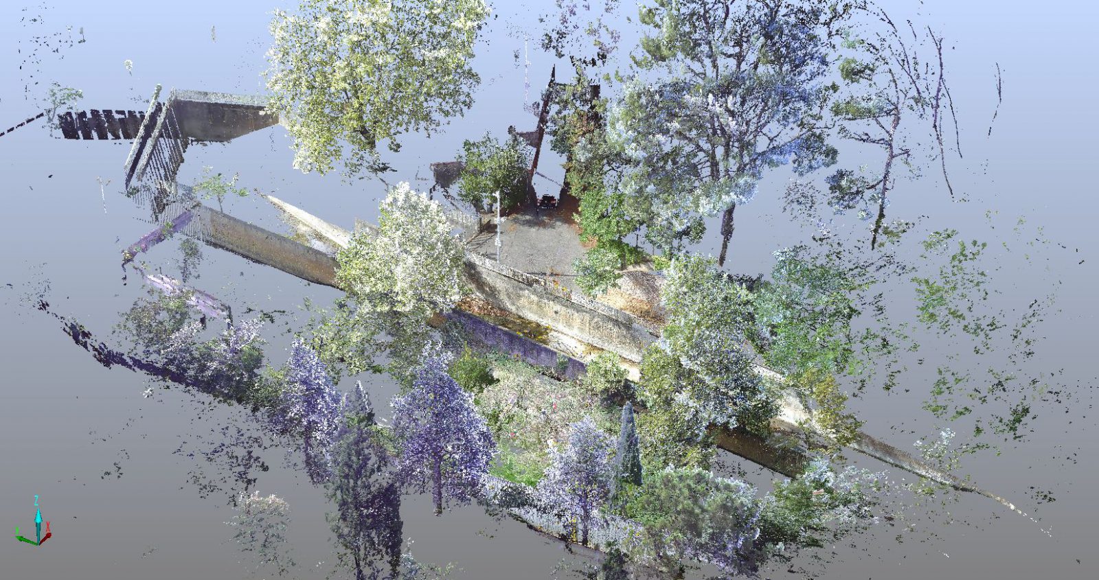
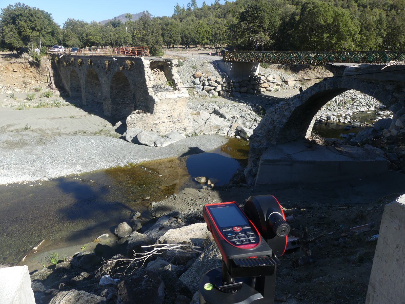
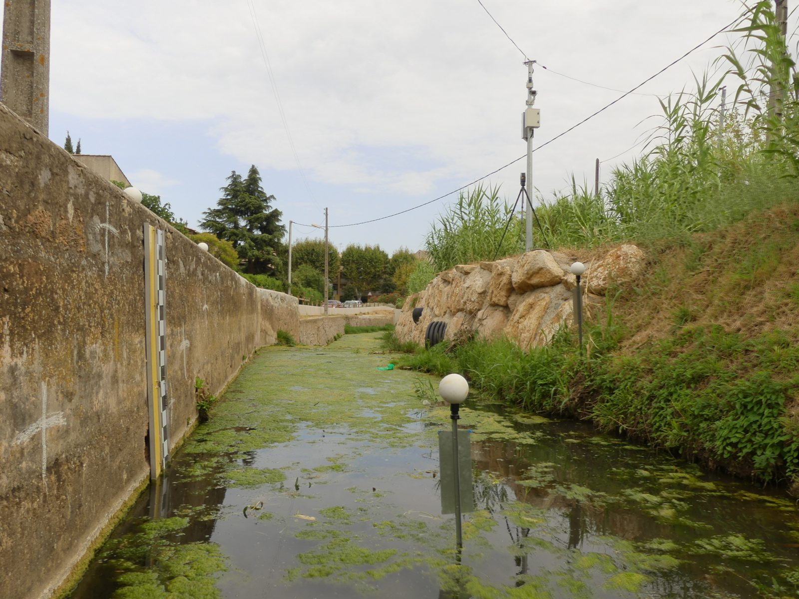
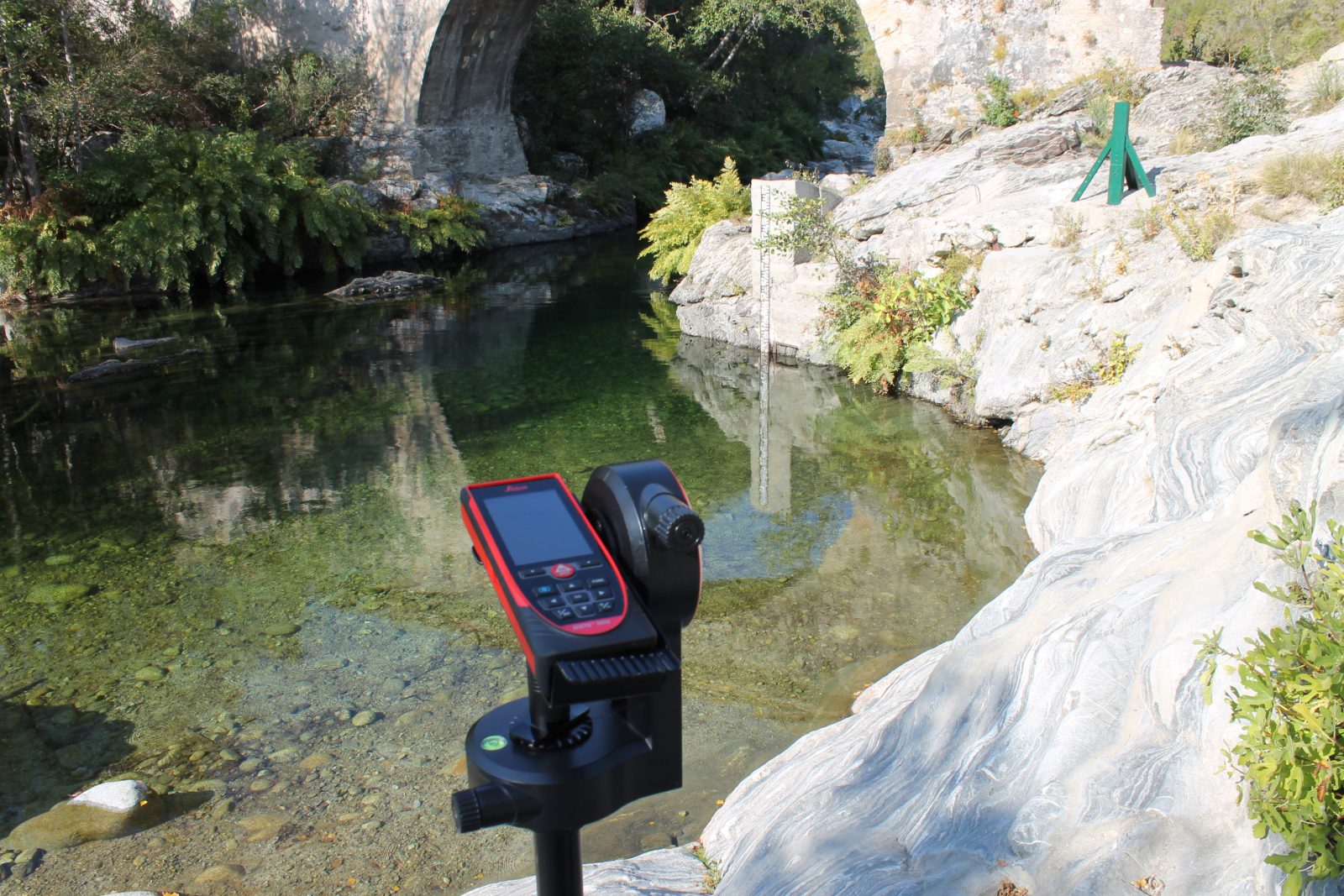
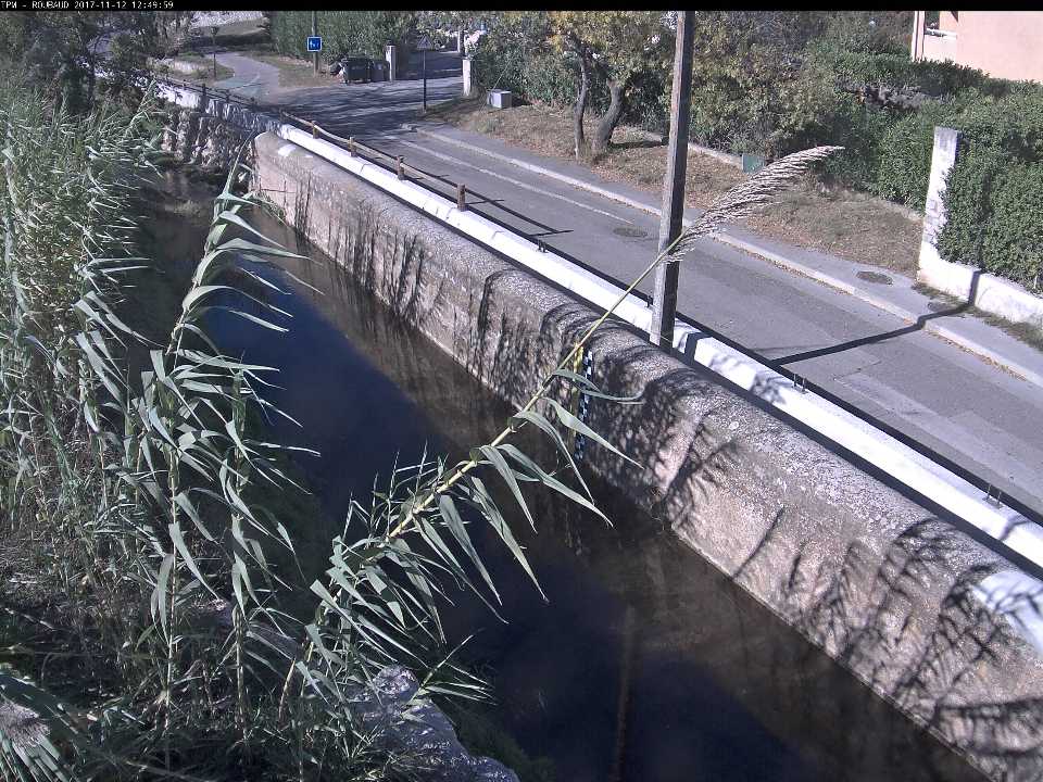
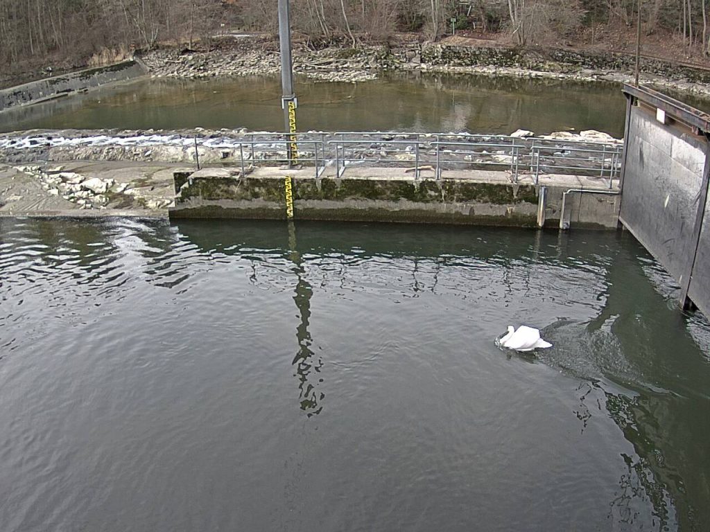
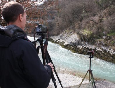
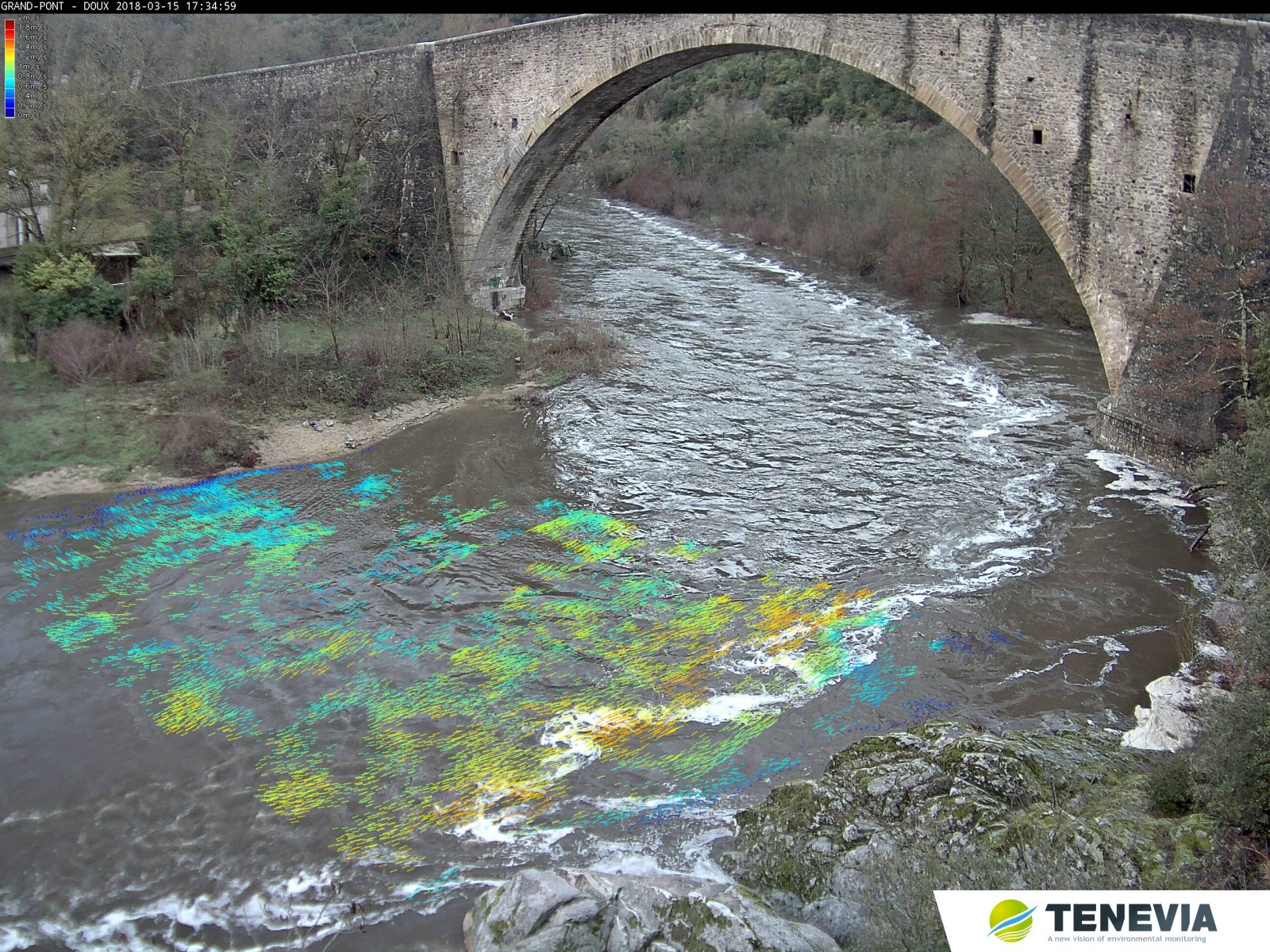
Examples of field surveys for CamFlow


FAQ AND DIRECTIONS FOR USE
How should I position and direct the camera ?
Several parameters must be considered when installing a CamFlow camera:
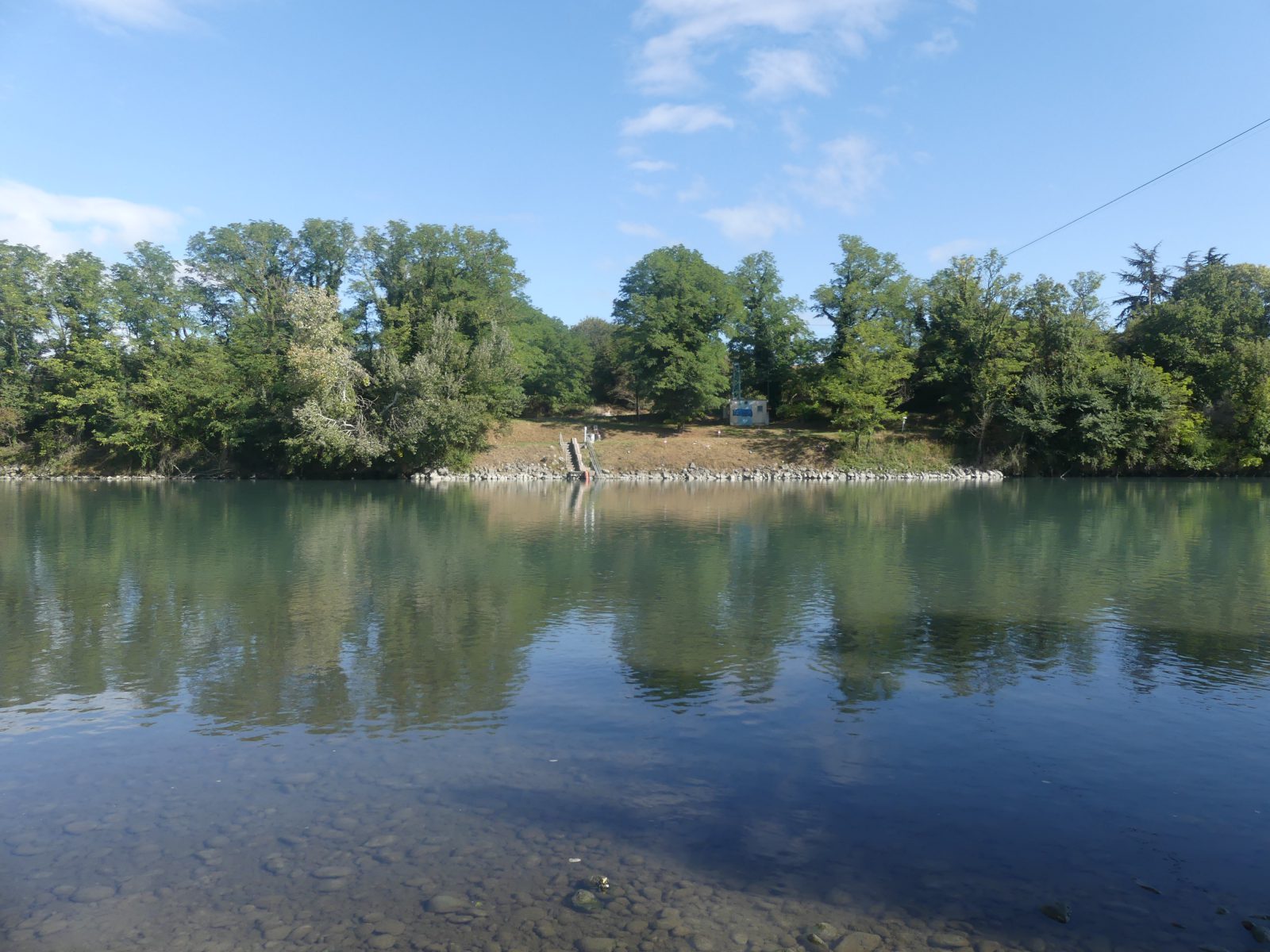
- Vision of both banks
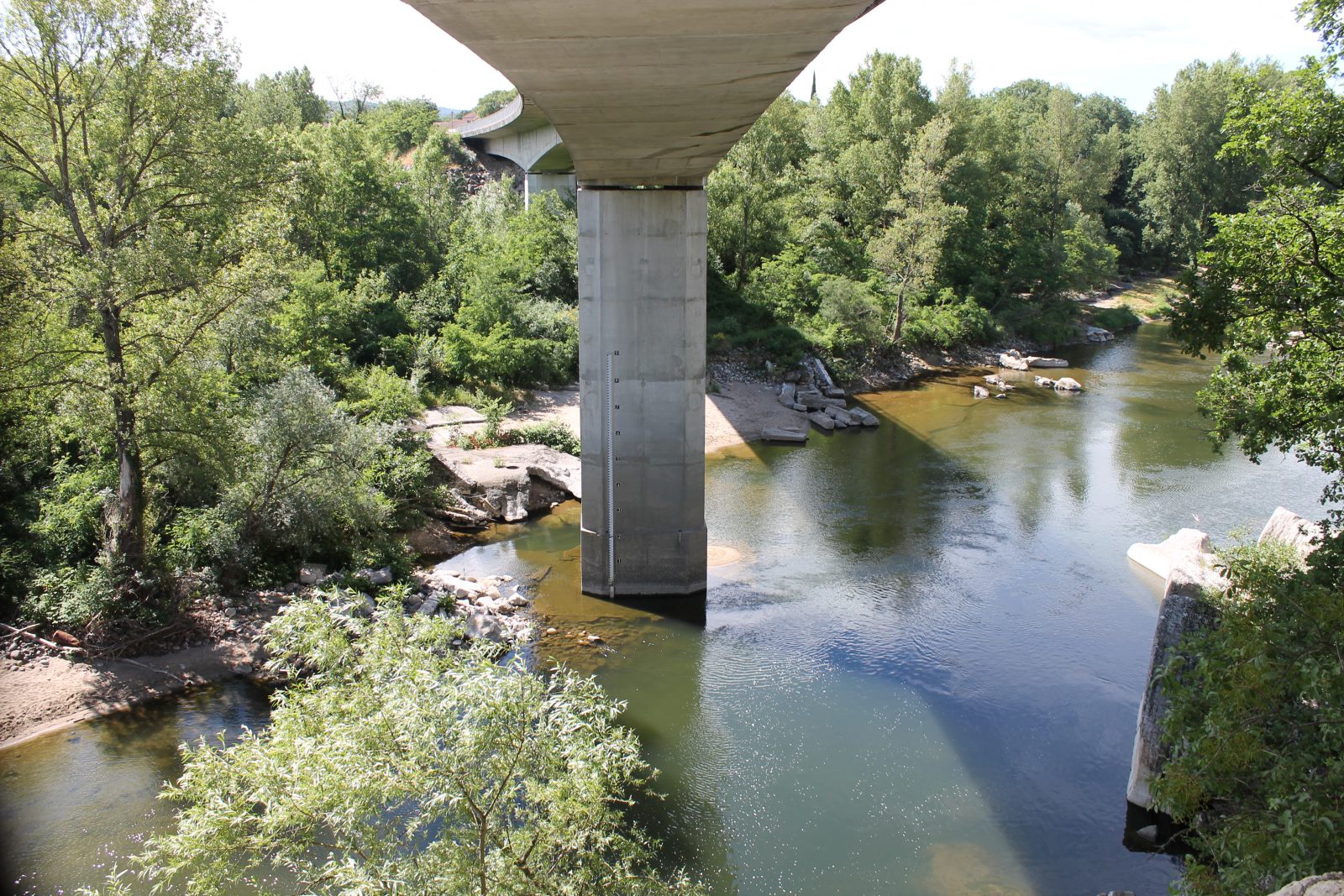
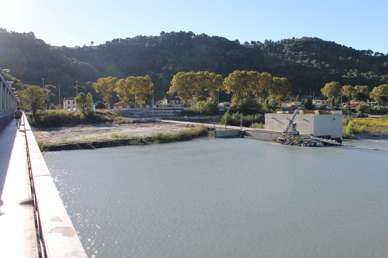
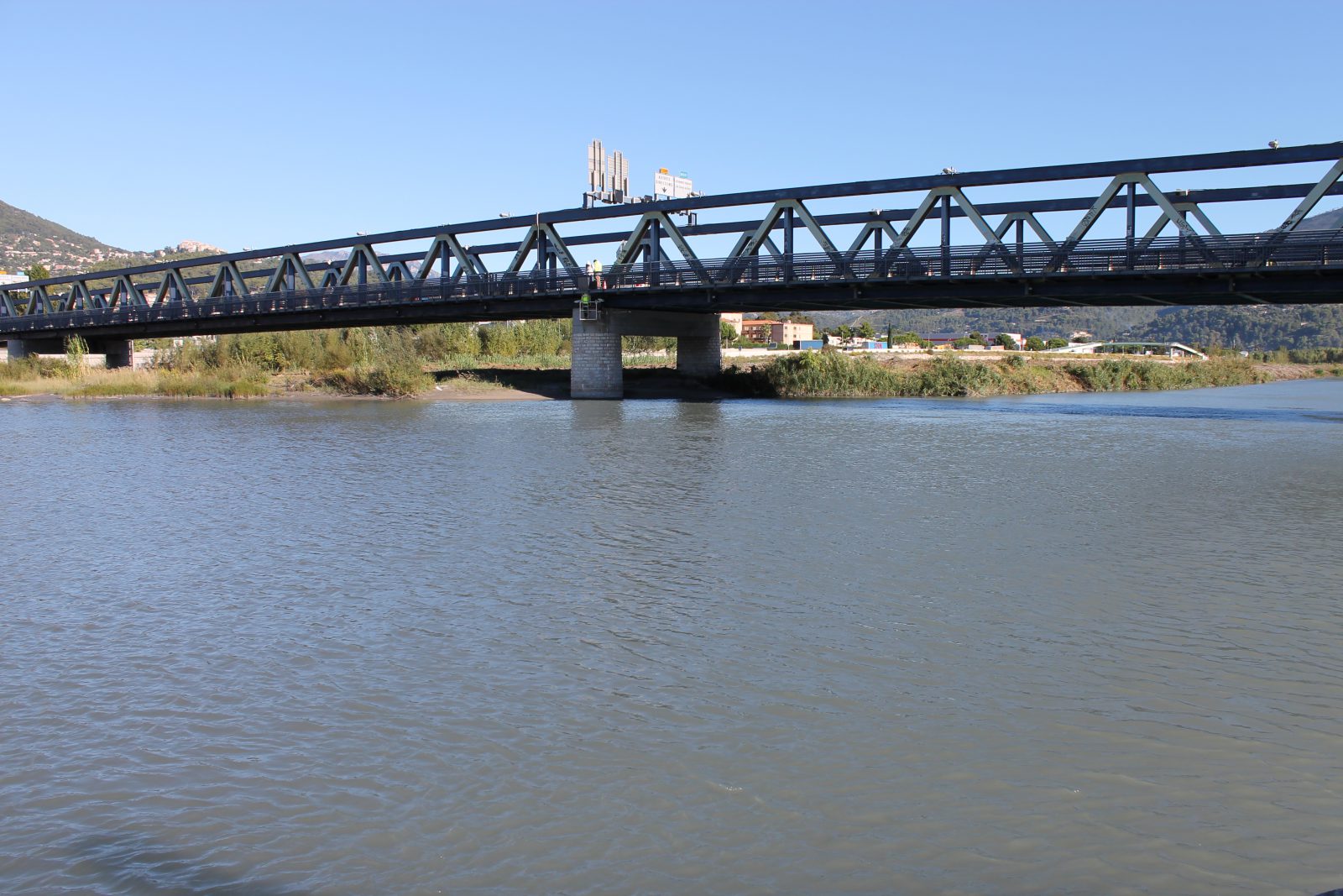
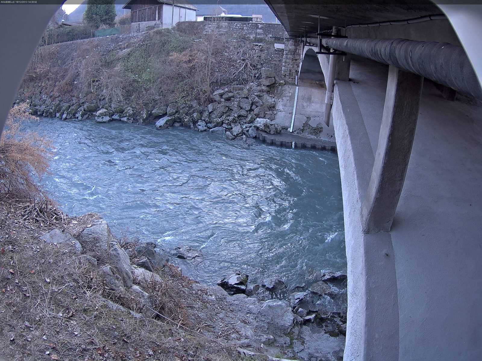
To guarantee optimum operation of the system, we recommend that both banks (right and left) be visible on the camera image. However, the camera can be installed with different configurations (opposite the flow on a bridge or on one of the two banks, as in the examples in the two camera images below).
- The presence of fixed reference points in the images
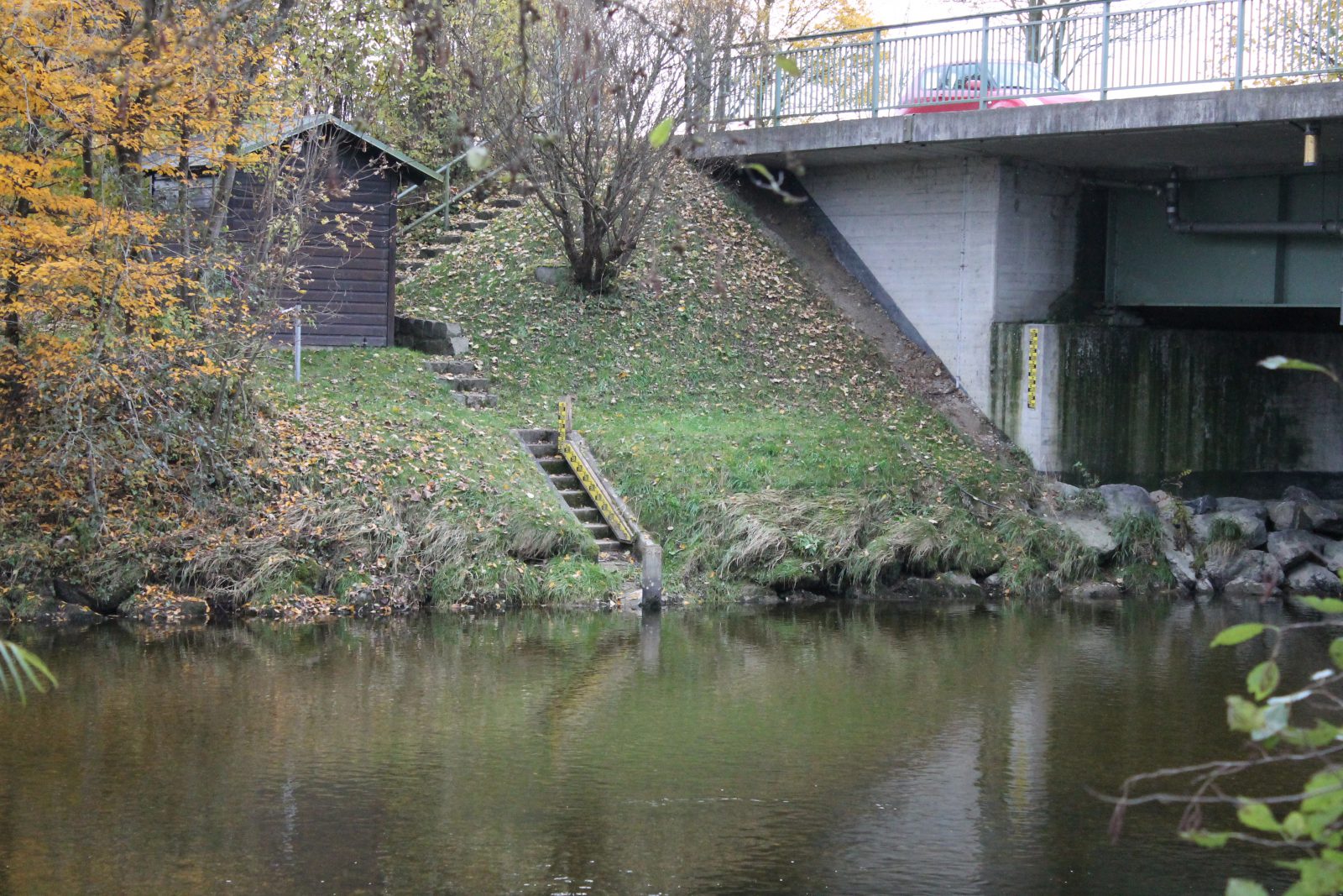
When processing the images, the CamFlow algorithms use set reference points that can be identified in the camera image. The presence of immobile, long-term geometric structures in the image, such as a bridge pier, a staff gauge or buildings is therefore necessary.
- The camera angle
The camera incident angle should not be too small for the entire range (higher than 10-15 degrees). Flood water levels should therefore be considered for the installation. In fact, if the camera is installed on the river bank, those constraints enable the measurement of surface velocities to the opposite bank. For further information, go to the Installation and Configuration section in the CamFlow’s technical characteristics.
N.B: If the water level measurements also come from the CamFlow camera, please also see the CamLevel instructions and recommendations.
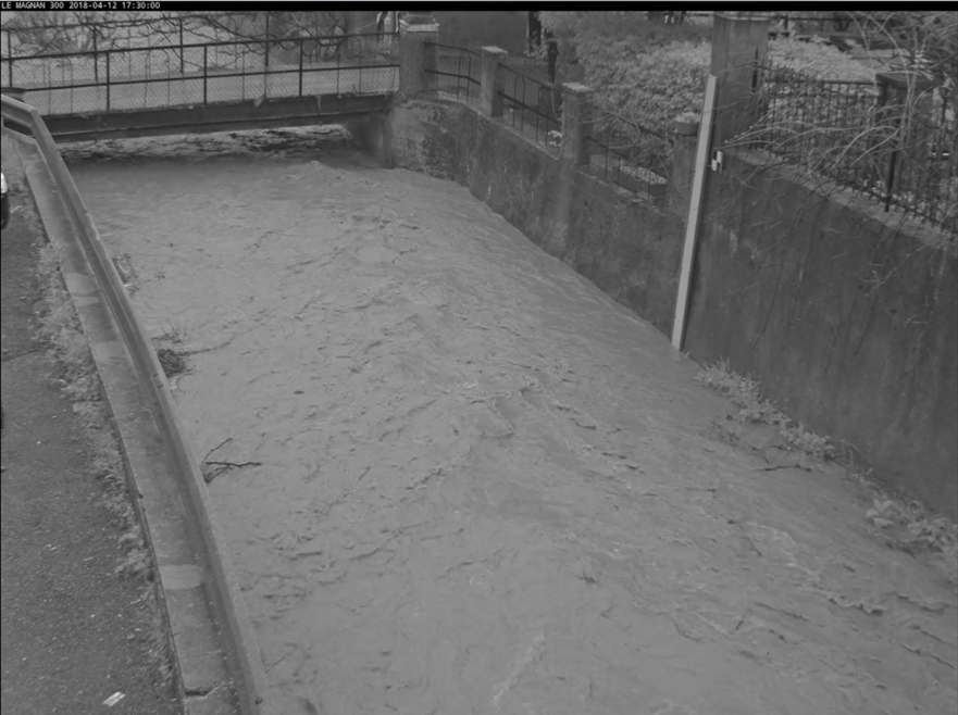
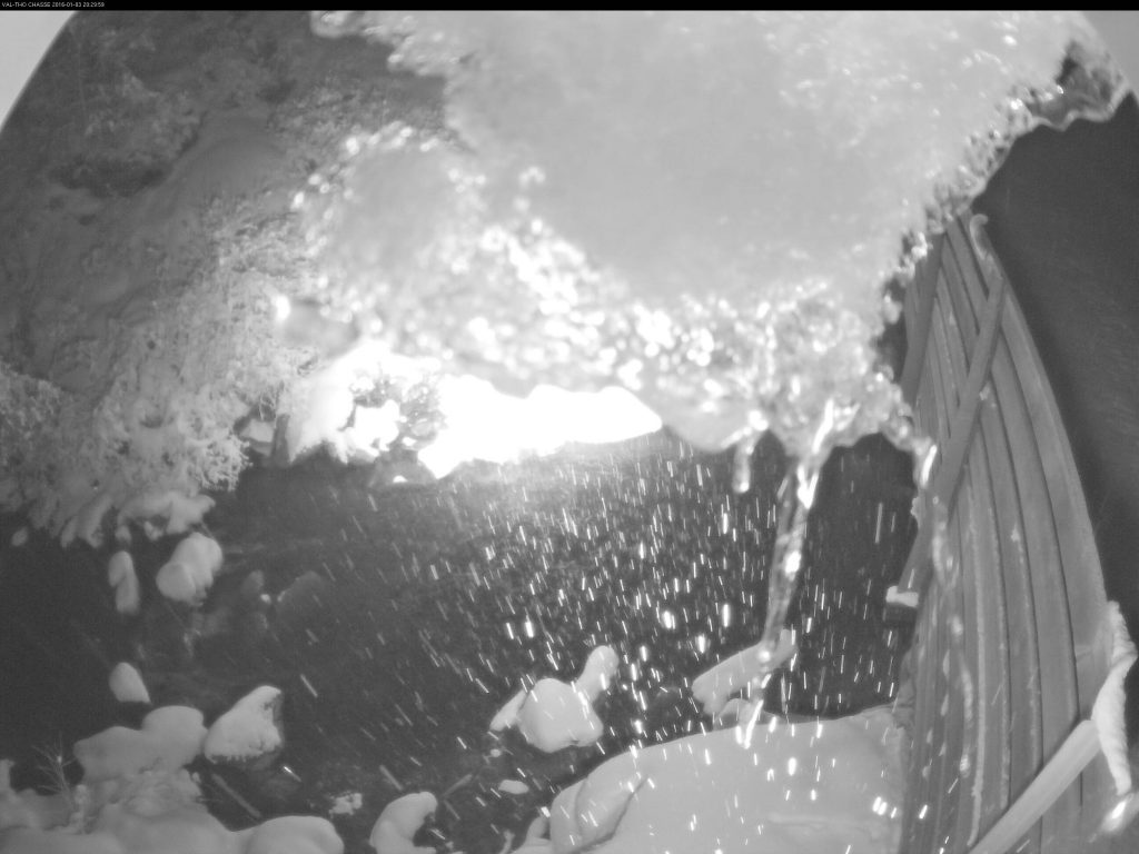
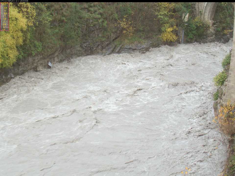
Does CamFlow operate at night ?
Measuring surface velocity is only possible at night when there is sufficient visibility. Infrared lighting is not sufficient at night to allow CamFlow to detect the water structures required for measurement.
However, in urban environments or on certain sites with adapted lighting, it may be possible to measure surface velocities and calculate discharge. For simple stage-discharge relationships, a rating curve is established and provides discharge estimates during the night.
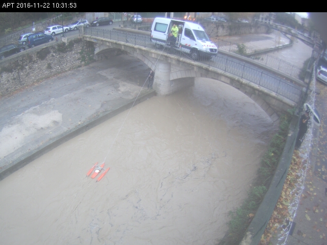
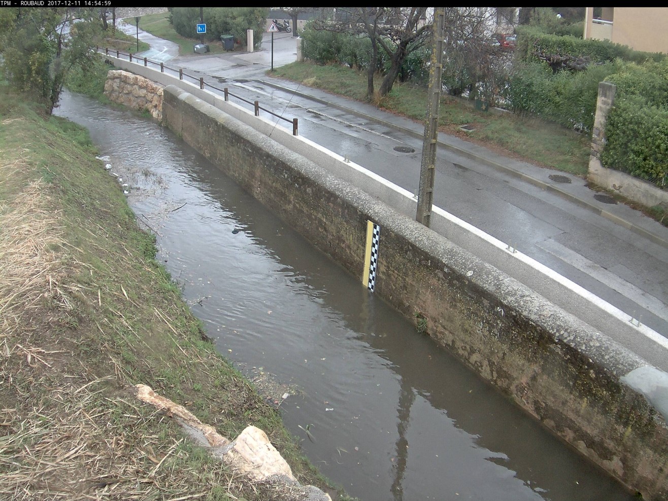
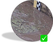
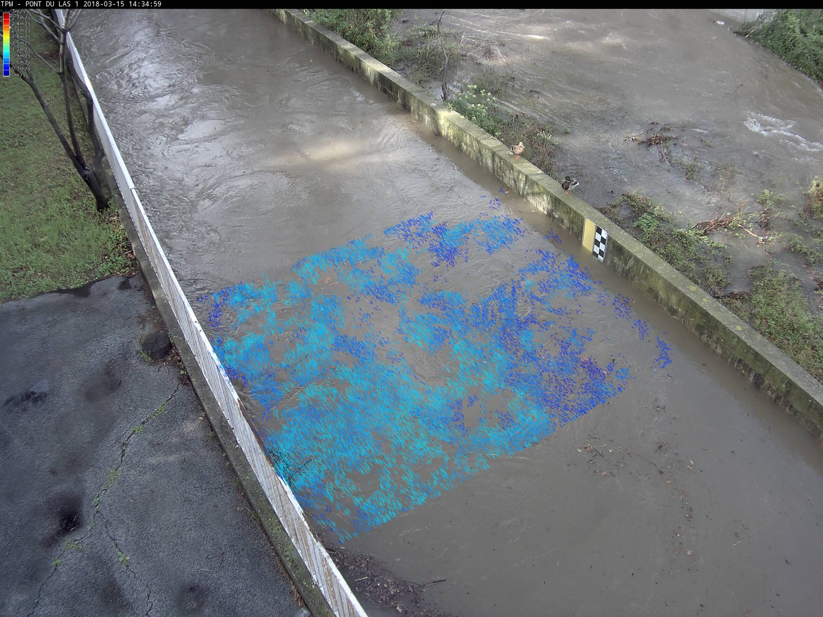
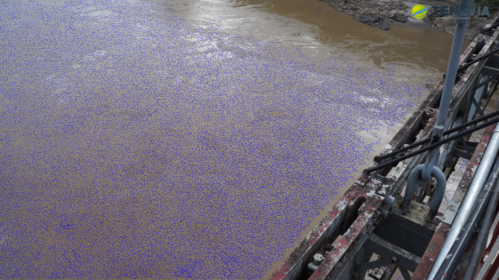
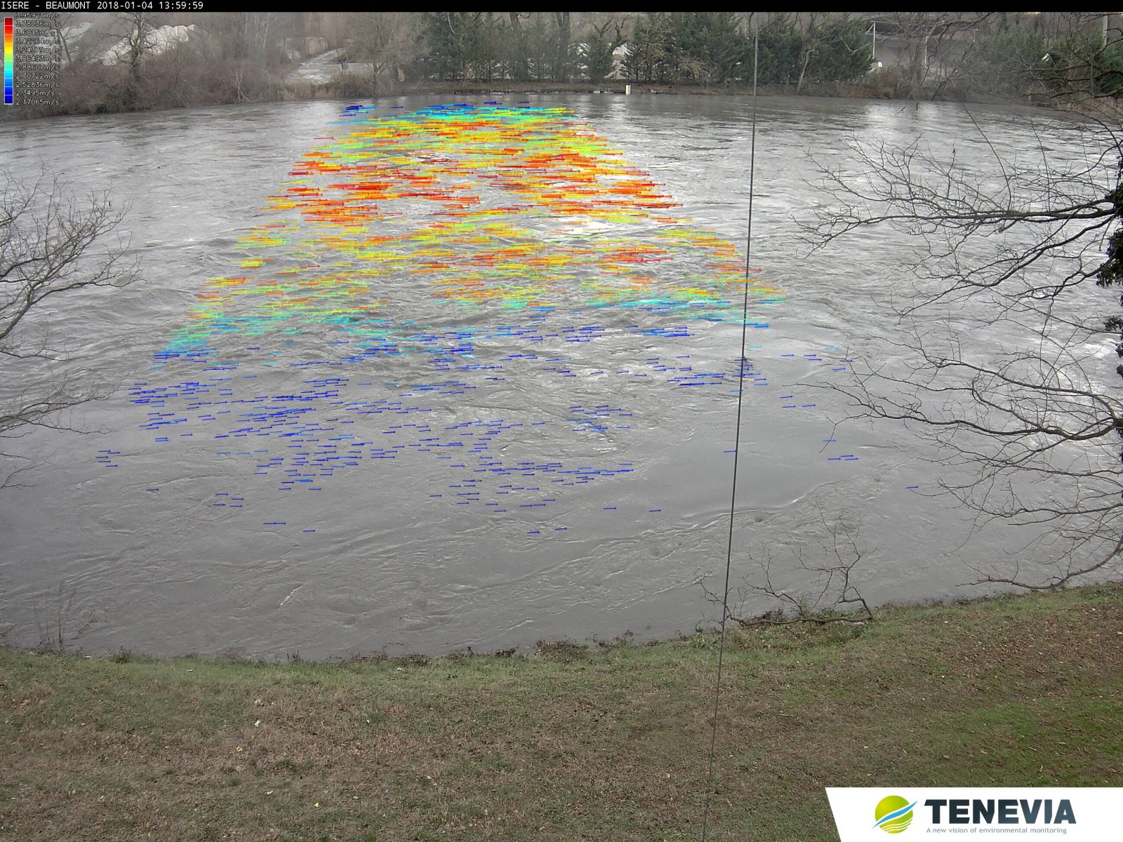
Result of measuring surface velocities at night during flooding of an intermittent stream prone to flash floods.
See RayTec’s range of infrared and white light projectors.
Does CamFlow require maintenance ?
Maintenance for CamFlow is mainly standard electronic maintenance on the image-taking device. However, bush clearing may be required if vegetation is corrupting the image.
Example of masking effect caused by a failure to clear vegetation.
Direct maintenance may also be required on the camera in certain cases, e.g. cobwebs on the glass or the formation of ice.
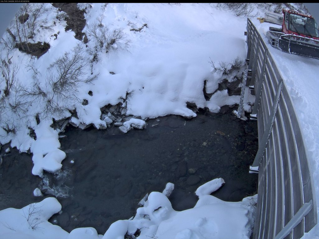
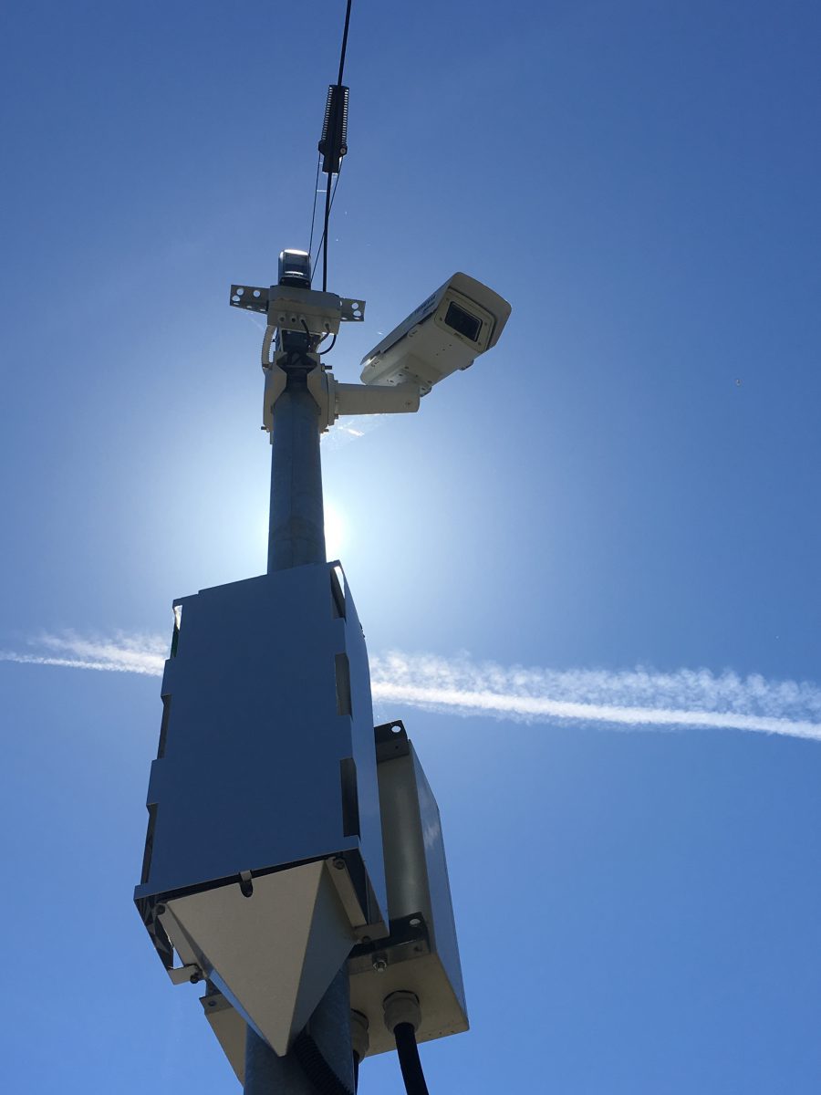
Example of ice formation on a CamFlow camera situated in the Alps at 2000m altitude.
Is CamFlow subject to the regulations on video-surveillance ?
CamFlow is not subject to the current French regulations on video-surveillance, since the camera is used in photo mode.
However, the user must study the current regulations on a case-by-case basis, particularly if the image-taking device is used for any other purpose. Axis cameras do in fact have several video streams (up to 4 simultaneously on some models), so they can be used for other purposes than hydrometry (web communication, police services, etc.)
Nevertheless, in most installation configurations, identification of individuals or license plates is impossible.
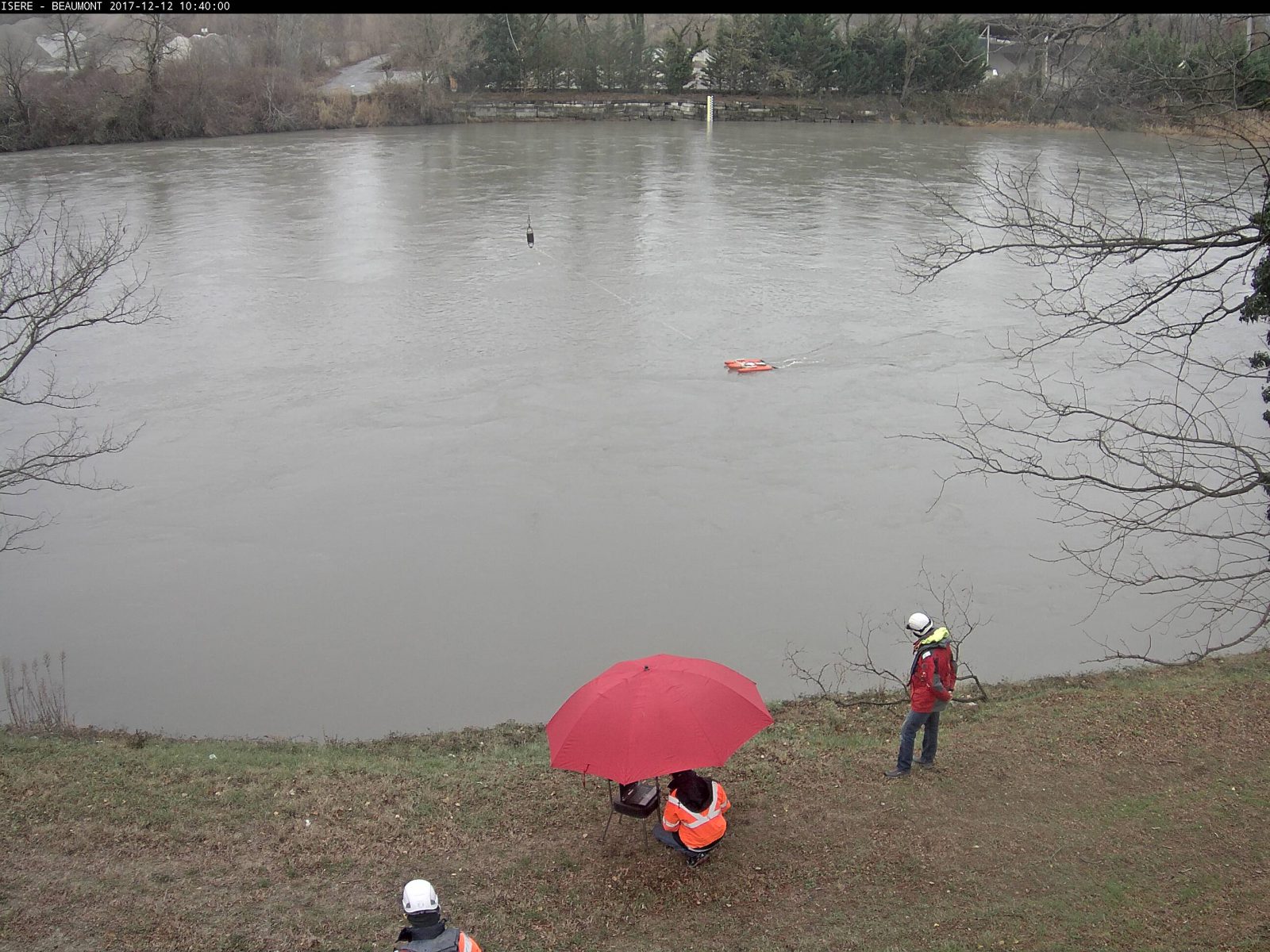
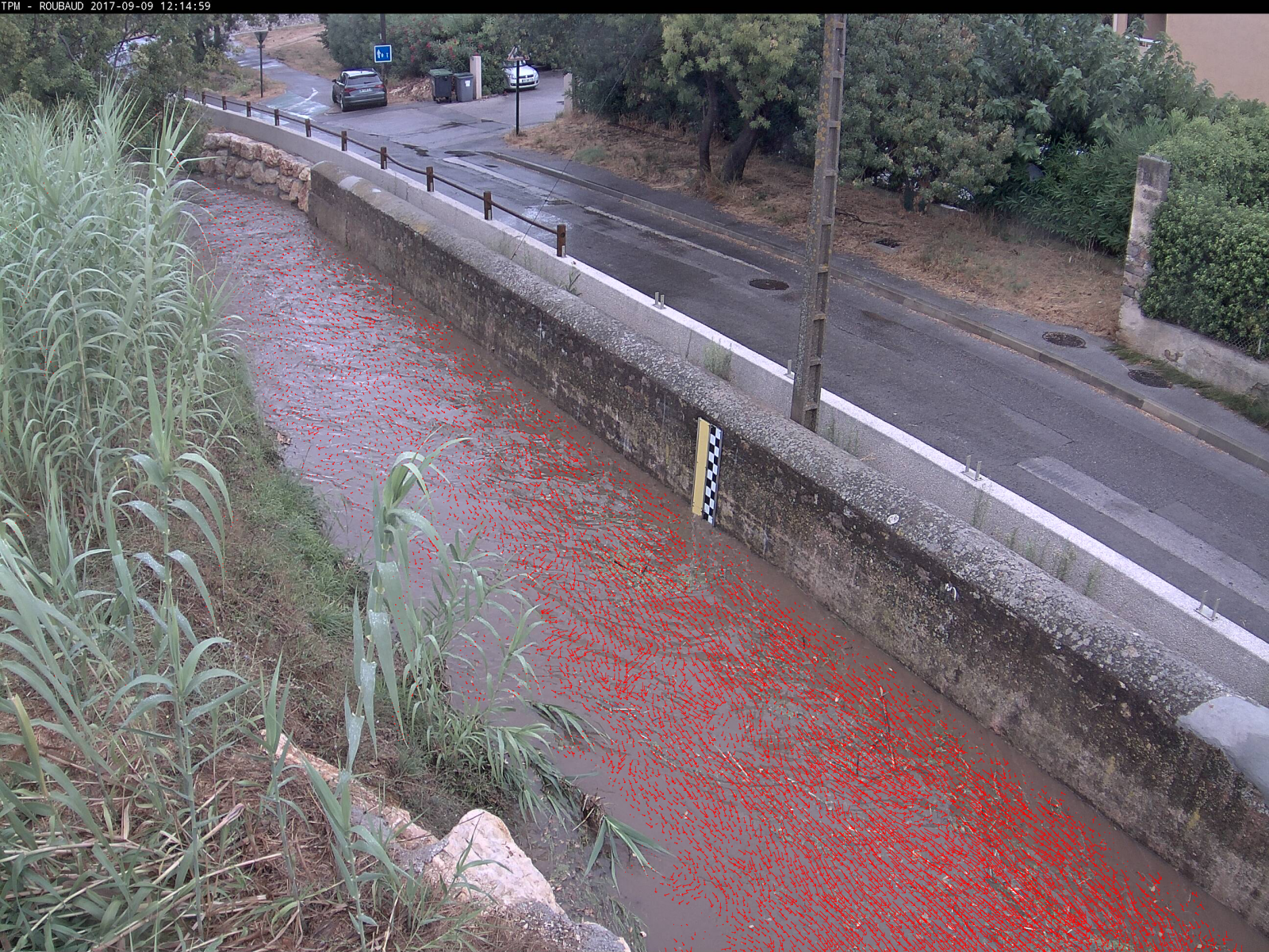
Example of an image from a CamFlow camera showing Flood Forecast Service field hydrometers gauging streamflow with a current meter
If required, the cameras can create a numeric mask (pixels masked on the image) for a sensitive industrial site or nearby housing with windows, balconies or terraces, for example.
What are the factors that can affect CamFlow’s precision
The CamFlow sensor’s precision depends on several factors:
- The camera’s optical characteristics (resolution, number of images per second, LUX rating, etc.);
- The distance between the camera and the measurement zones;
- The quality of the topographical survey containing the camera calibration points and the description of the flow section.
What factors can affect measurements ?
These are essentially of a visual nature. The measurement zones must of course be visible on the image. Some moving elements over the water’s surface are not reliable for flow measurement (e.g. animals, boats, etc.). Most of those perturbation factors are detected and filtered by CamFlow.
CamFlow also contains corrective functions for small movements of the camera. The wind may cause the camera to move slightly. However, these corrective functions cannot rectify major movements such as the dismounting of the camera or the instability of the support it is attached to. Mobile cameras are therefore not to be used for this type of purpose.
Can I adapt the measurement frequency ?
As with a standard camera, the user can define a measurement time step: 5 minutes, 10 minutes, ½ hour, hourly, daily (…). In cloud mode, as the processing time is around 1 minute, it is not recommended to go under that time line. For an energy-independent installation, the timeframe definition must obviously take the device’s electrical consumption into account.
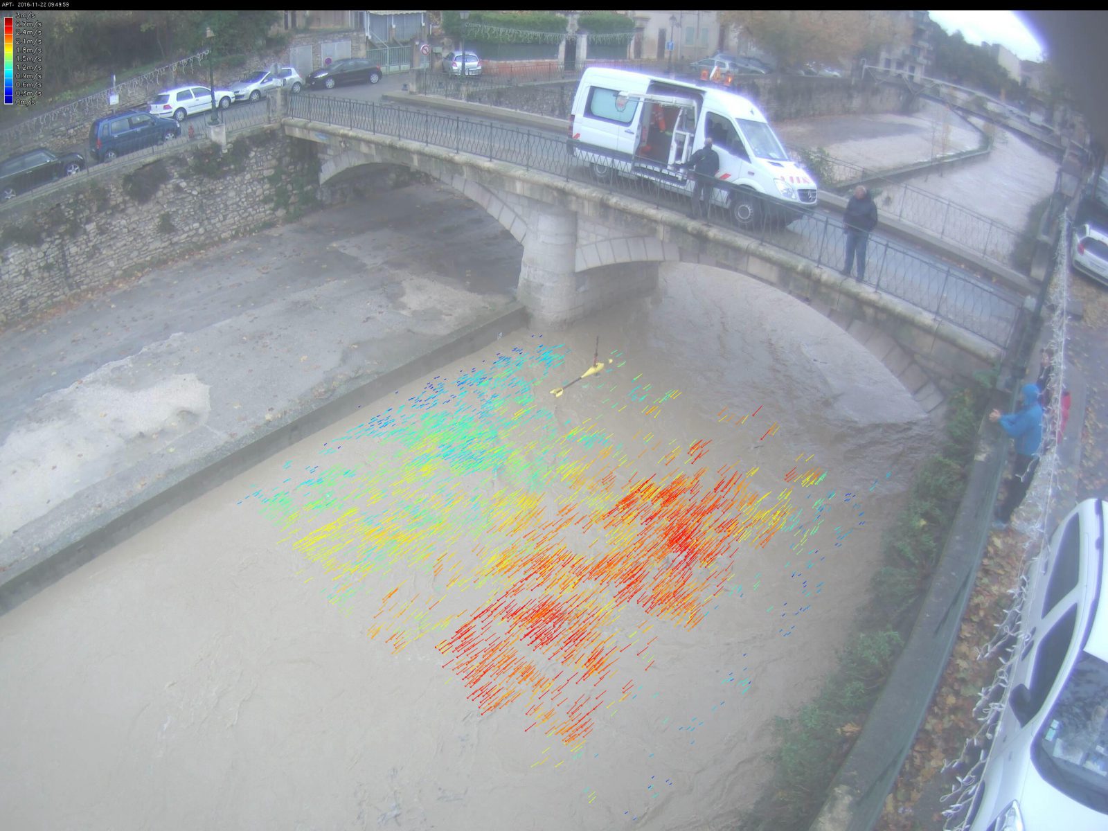
Measurements obtained with CamFlow


You can find examples here of equipment for monitoring water levels in different pre-configured or personalised packs according to each project. As an authorised retailer for Axis Communications, TENEVIA also proposes all the cameras and accessories available on the Axis website.
Do you need help with customising your equipment pack ?
- See the range of Axis products and select a camera: Use the Axis camera selector.
- Do you need an accessory for your image-taking device: SDXC card, PoE injector, infrared projector, mounting bracket ? The Axis accessory selector will help you to choose the equipment that is compatible with your camera.
Contact us