NICE: A CITY COMMITTED TO RISK MANAGEMENT
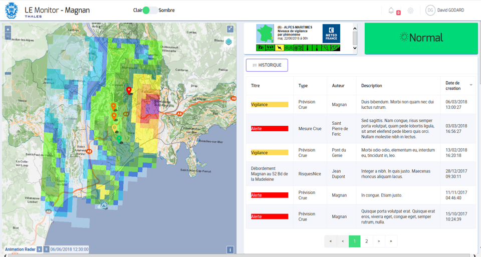
The commune of Nice in southeastern France is exposed to the risk of flooding, particularly due to its proximity to coastal rivers with a torrential hydrological regime, such as the Var, Paillon and Magnan rivers. If the local rainfall is relatively well known (thanks mainly to rainfall data and meteorological radars), hydrometric monitoring (knowledge of flows) varies from one river to another. At this time, only the Var and the Paillon are equipped with a real flood warning system (included in the City of Nice’s local response plan).
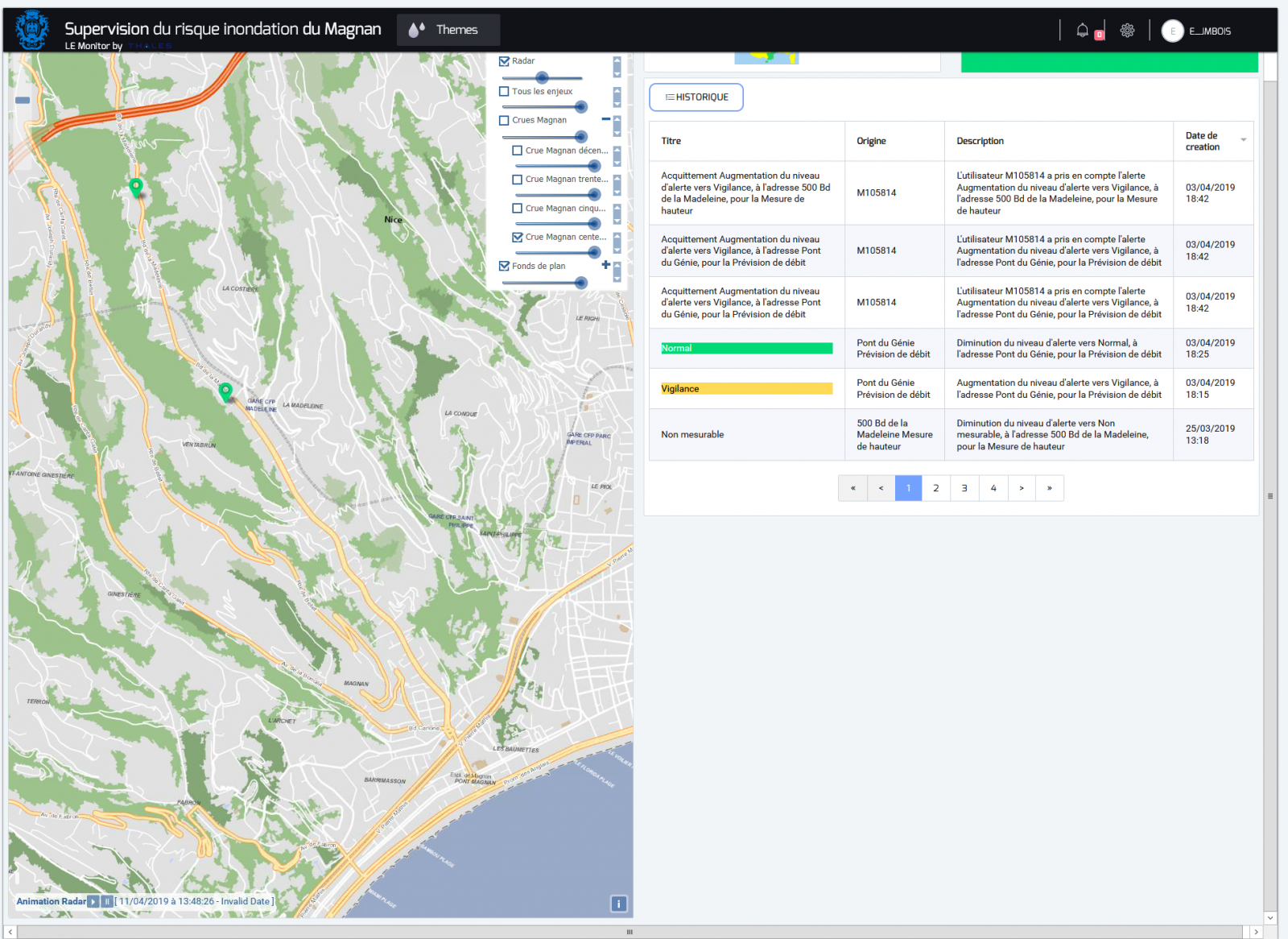
On the other hand, there is no warning system on the Magnan river because it is particularly difficult to understand due to its small catchment basin, which makes it very rapid to react to rain (around 15 minutes). It was equipped at the start of 2011, however. Two rain gauges and two stage gauges offer information on local rainfall in real time (stations operational since 2013) and the condition of the river (water height measurements and flow estimation). Nevertheless, this system is not sufficient to give an early warning to the local populations in the case of a sudden flood. Yet the Magnan catchment area, which has been increasingly built up (over 5000 inhabitants) over the past 40 years, now presents a number of challenges, particularly in its downstream part. It would therefore now seem crucial to implement a system that will anticipate and warn of any danger that could jeopardise the safety of people and property.
For its commitment to a global risk management process, the city of Nice has been named a “Model City” by the UN’s International Strategy for Disaster Reduction (UNISDR). As part of this commitment, the city continues to improve and modernise its monitoring and warning system by deploying innovative equipment on the Magnan’s catchment area. It is in this context that the City of Nice is participating in the PROTERINA 3-EVOLUTION project that comes under the EU’s “Maritimo” INTERREG programme.
![]()
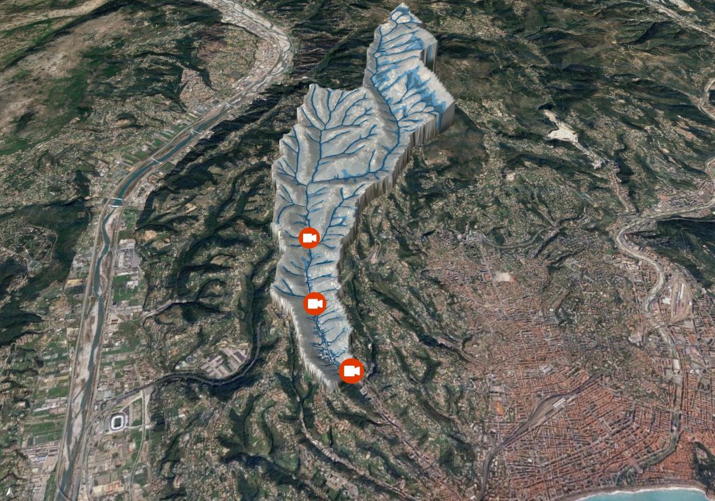
THE MAGNAN: A TORRENTIAL RIVER THAT FLOODS RAPIDLY
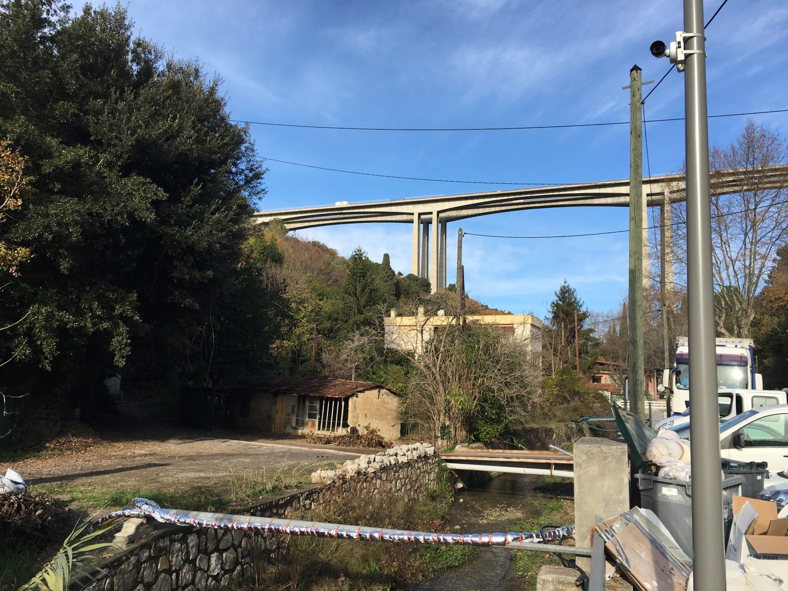
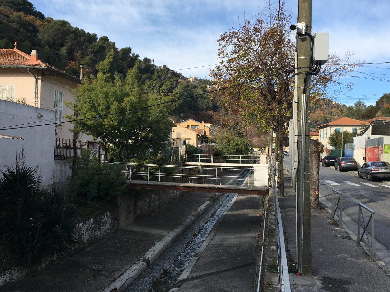
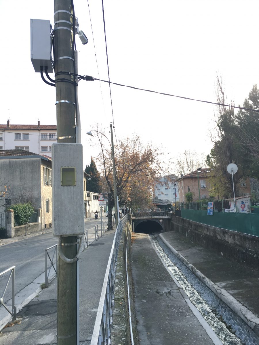
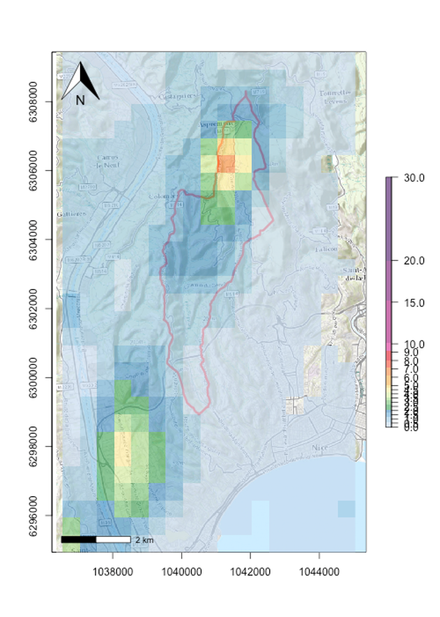
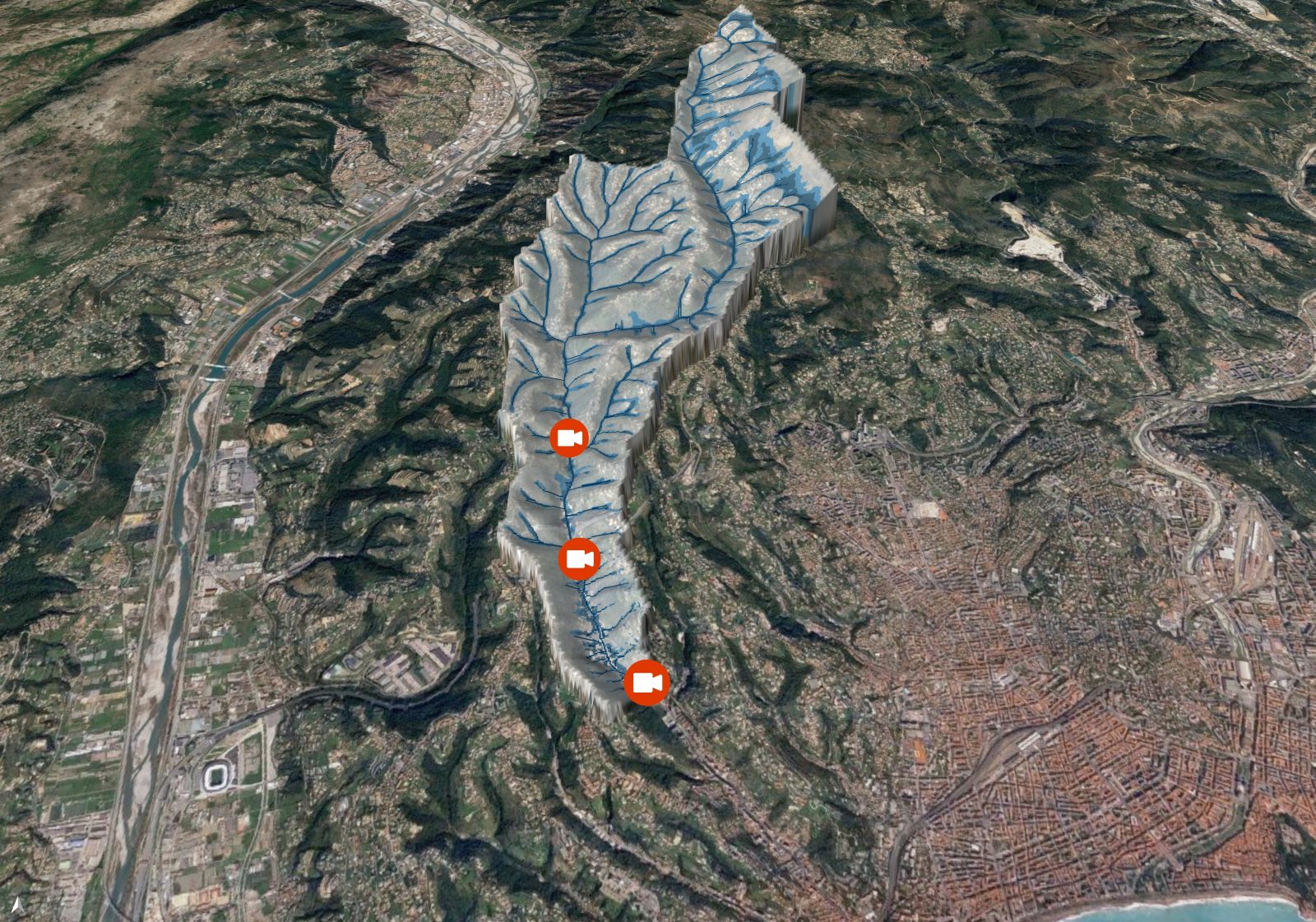
The Magnan is a non-federal river that runs to the west of Nice. It drains a catchment area of 18.3 km² characterised by steep slopes and a relatively short response time (around 15 minutes). If the flow is low for most of the year, it is affected by rapid and violent floods during heavy rainfall. The upstream part of the basin is quite natural while the downstream area is heavily built up and offers a number of challenges. In this part, the river runs along the Boulevard de la Madeleine on the left bank first of all in an open channel that becomes narrower as it reaches its outlet into the Mediterranean. A study of the fluvial dynamics of the Magnan valley, carried out by HYDRATEC in 2012, made it possible to define characteristic flows and hydrographs for the Magnan for 10-year, 30-year, 50-year and 100-year design floods using design rainfall. These hydrographs, injected into a hydraulic model, characterised the Magnan valley’s vulnerability.
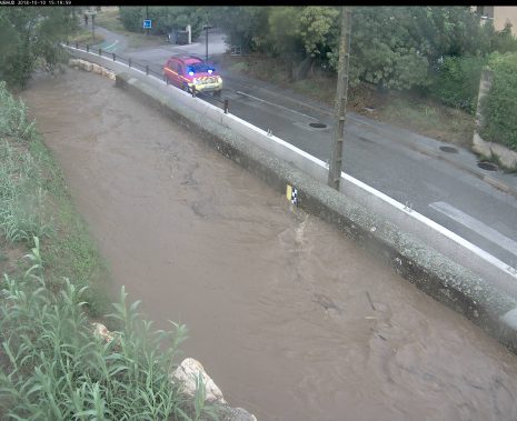
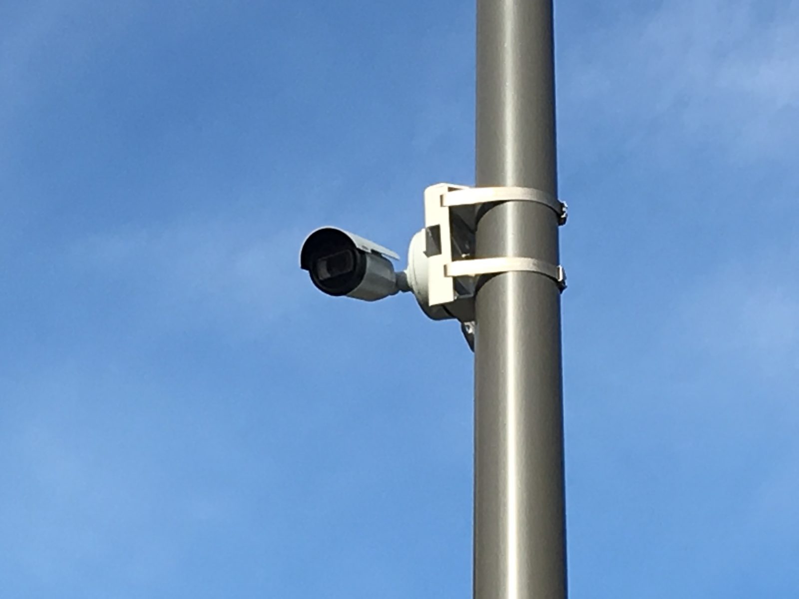
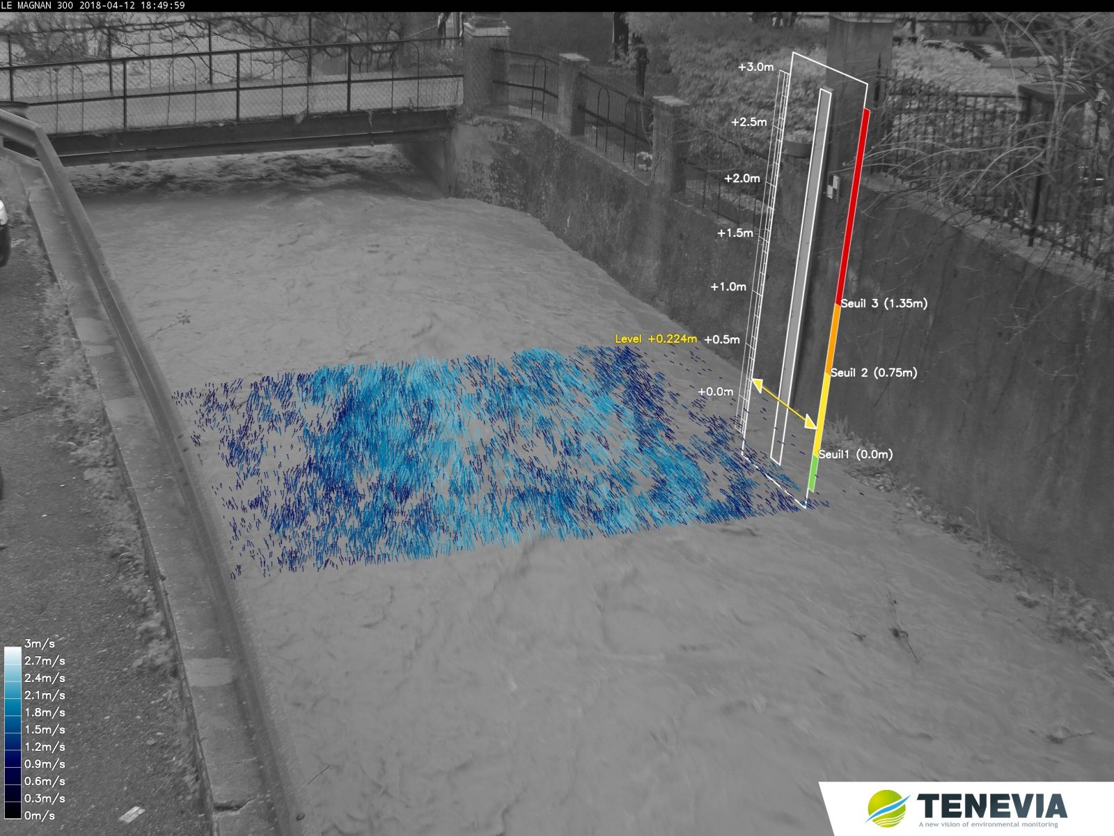
SMART CAMERAS TO MONITOR THE RIVER
Choosing to equip the coastal river with smart cameras meets the three main objectives here:
- To validate hydrometric information in the case of a flood simply and instantly, since the camera image with additional augmented reality information facilitates an understanding of the situation by the crisis decision-makers.
- To deploy a non-intrusive measuring system that is adapted to intermittent waterways and can bear considerable variability of measurement range.
- To have a system that can be developed over time and is easy to maintain. Using a camera for measurement requires little maintenance and lasts a long time. The system deployed on the Magnan is easy to re-set if the measurement section evolves and allows other useful data to be supplied to managers, such as an assessment of the risk of logjams, for example.
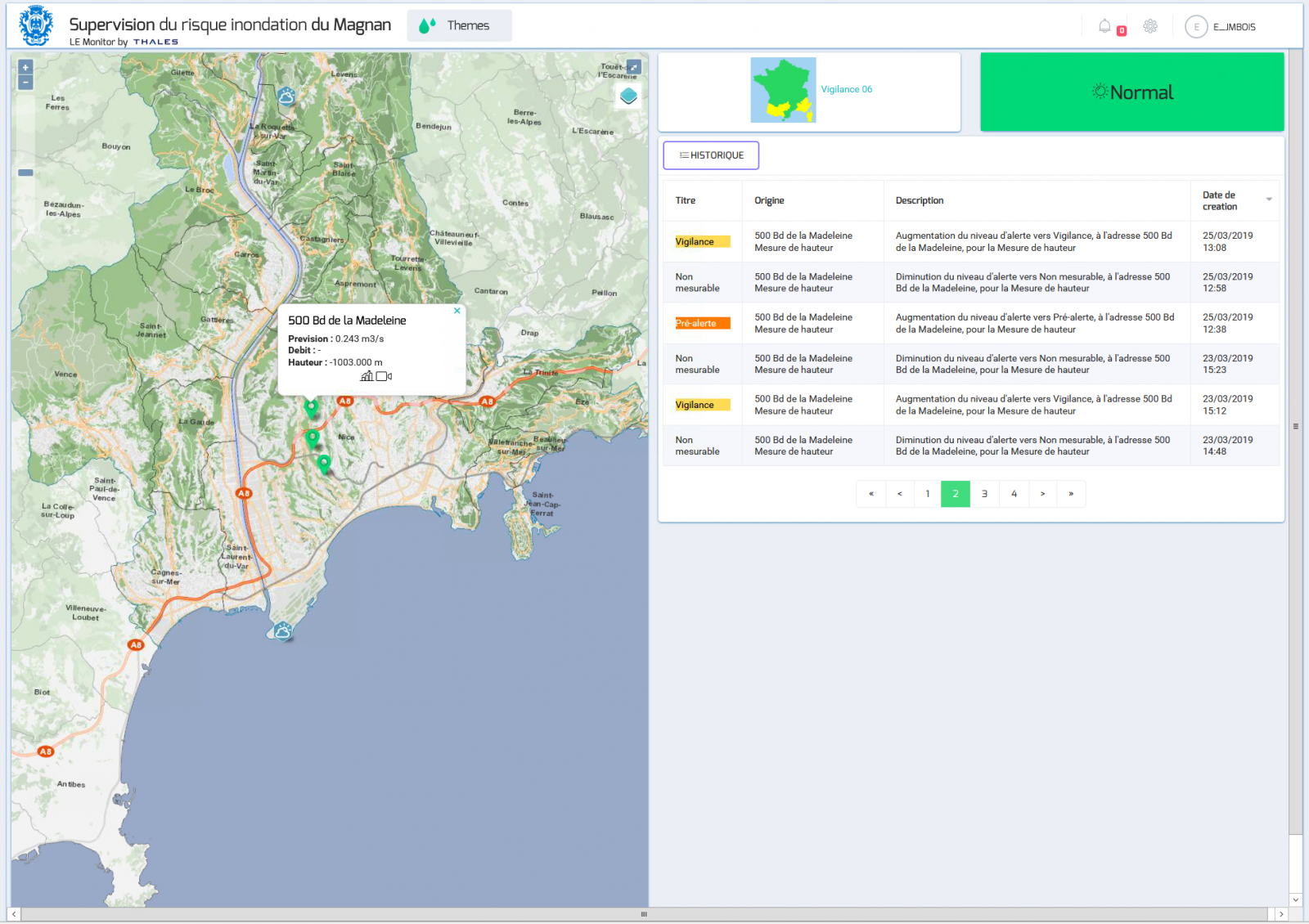
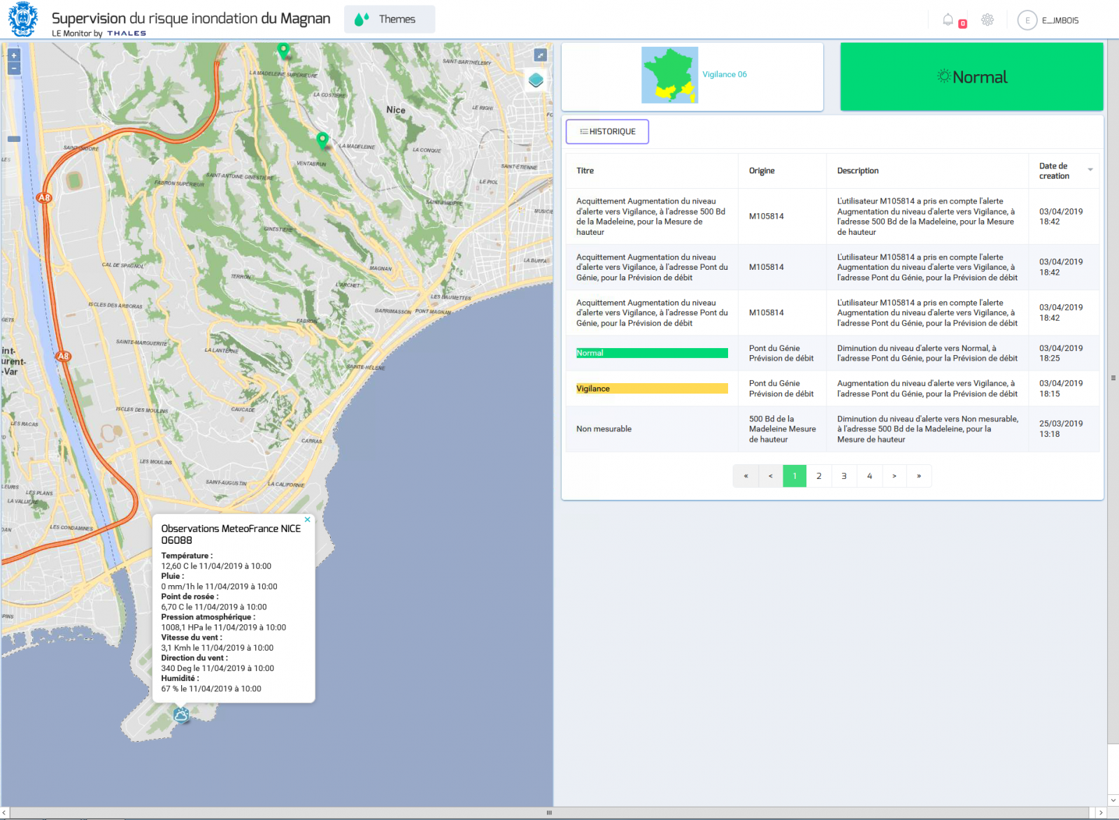
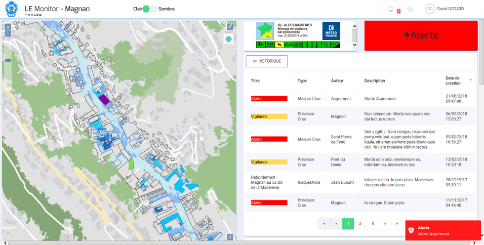
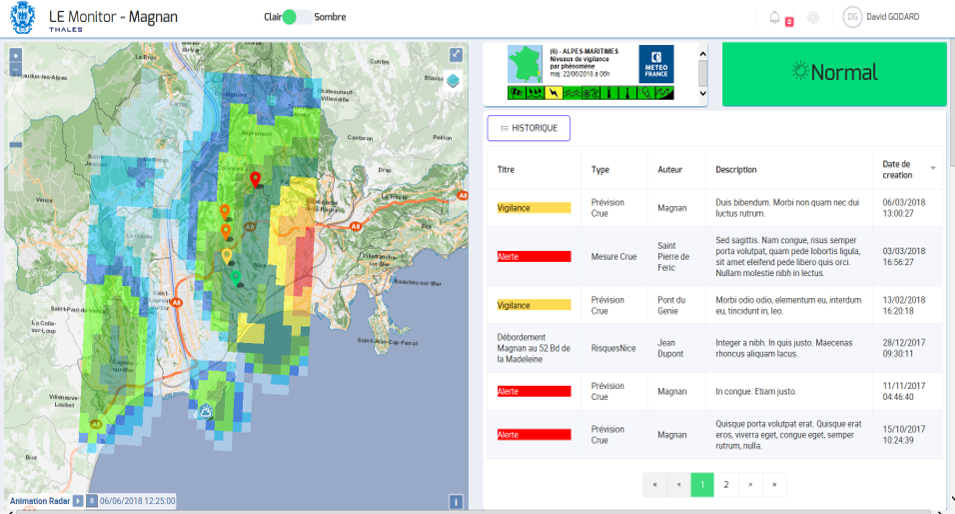
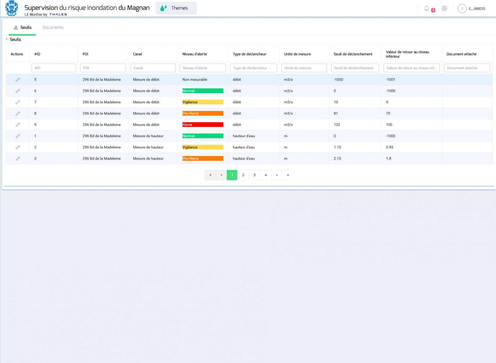
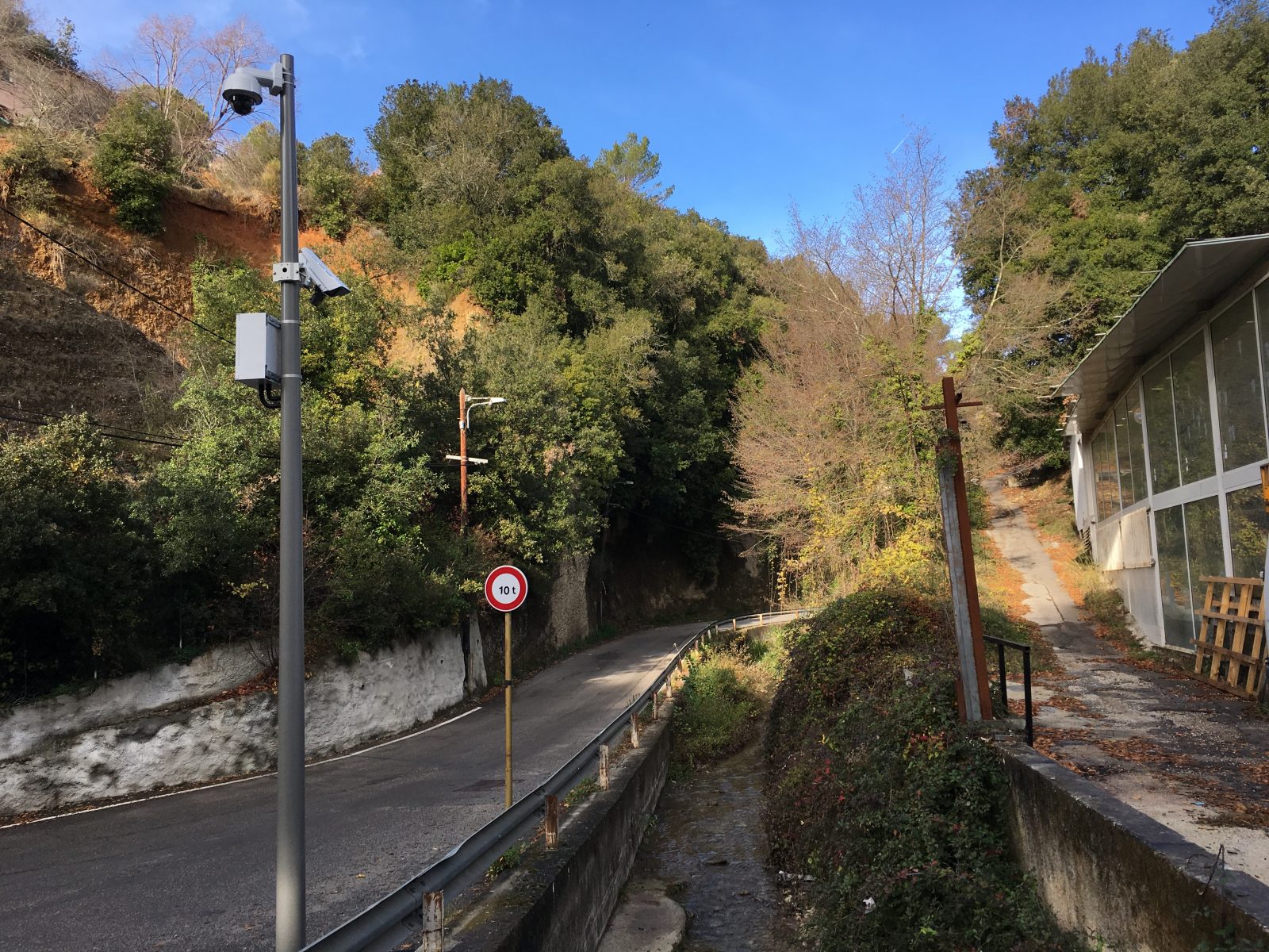
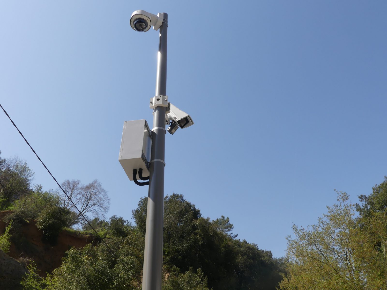
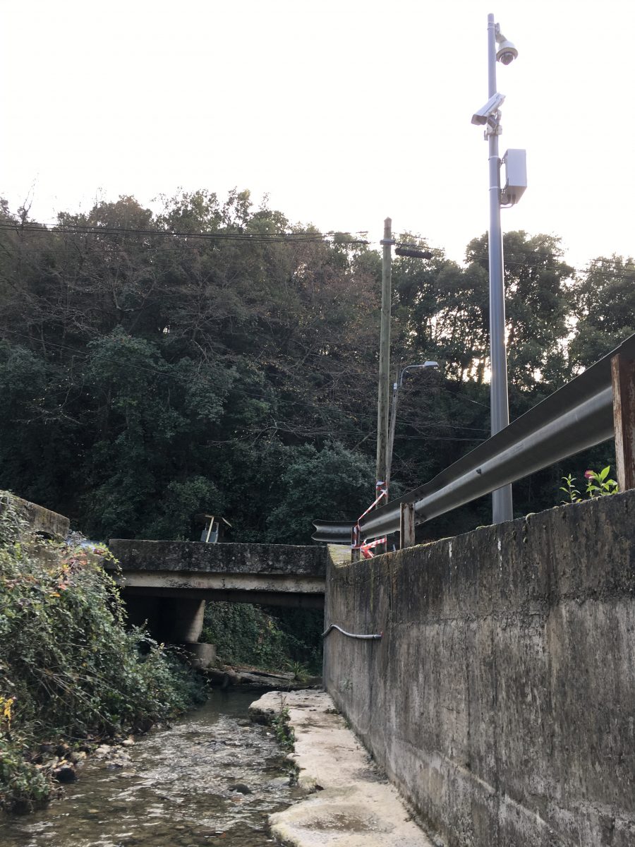
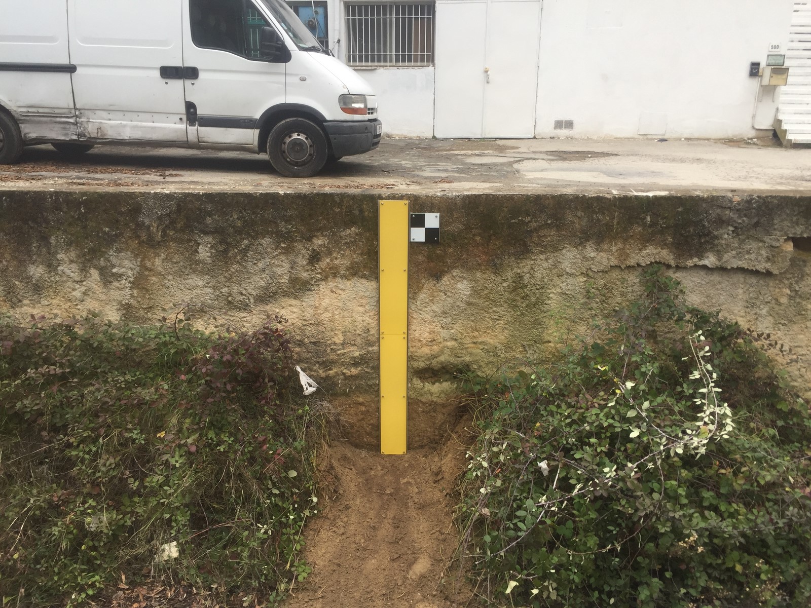
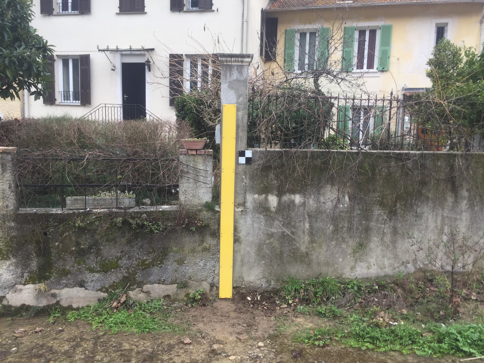
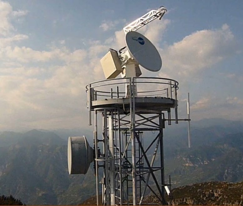
Two CamLevel sensors and a CamFlow sensor have also been deployed on the river (Upstream – Intermediate – Downstream). They send the river’s real time water levels (CamLevel) and flows (CamFlow) to the authorities. The equipment chosen for the project corresponds to the River30LS Pack (Axis P1447-LE camera) for the upstream and intermediate sections and to the River50LS Pack (Axis P1367-E camera) for the wider section.
A SELF-ADJUSTING FORECASTING MODEL
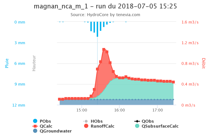
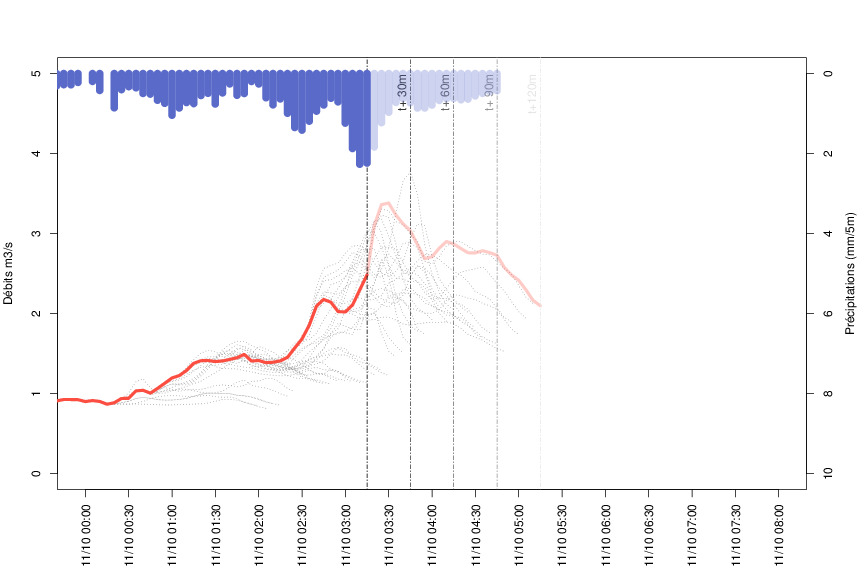
The Magnan, like all the coastal rivers in the region, is strongly influenced in its hydrological behaviour by the Mediterranean climate. At a low water level most of the time, it can however produce considerable runoff during rainy episodes and cause flooding. To anticipate this risk as much as possible, the city of Nice uses the TENEVIA HydroCore® forecasting model with its real-time data assimilation function (i.e. the advanced level HydroCore).
HydroCore is a rainfall-flow model used to forecast the evolution of rivers in response to the forecast precipitation and temperatures. Basing itself on the topography of the area where it is installed (via a numerical field model), HydroCore adapts to the specificities of the terrain and soil. Each catchment area is therefore considered with its particularities. Moreover, this simulator (or model) offers considerable operational capacities, thanks especially to its real-time self-adjusting functionality. It actually uses the hydrometric data from three sensor cameras installed on the river to assess and, if necessary, correct and improve its flow forecasts, so that the simulator is always “on the right track”.
To respond to the rapid character of Mediterranean storms, the HydroCore simulator uses spatial measurements and rainfall forecasts on the river Magnan, sent from a dual-polarisation weather radar. Produced by Novimet, these runoff curve numbers allow a precise anticipation of the risk of heavy rainfall in the very short term (1 ½ hrs), thereby making it possible to detect a storm cell very close to the catchment (i.e. Now Casting). This data is then backed up by the measurements taken by the ground network of rain gauges installed on the catchment drained by the Magnan. This therefore gives HydroCore the most accurate rainfall chronology which enables it in turn to offer the most accurate forecast of the river’s reaction.
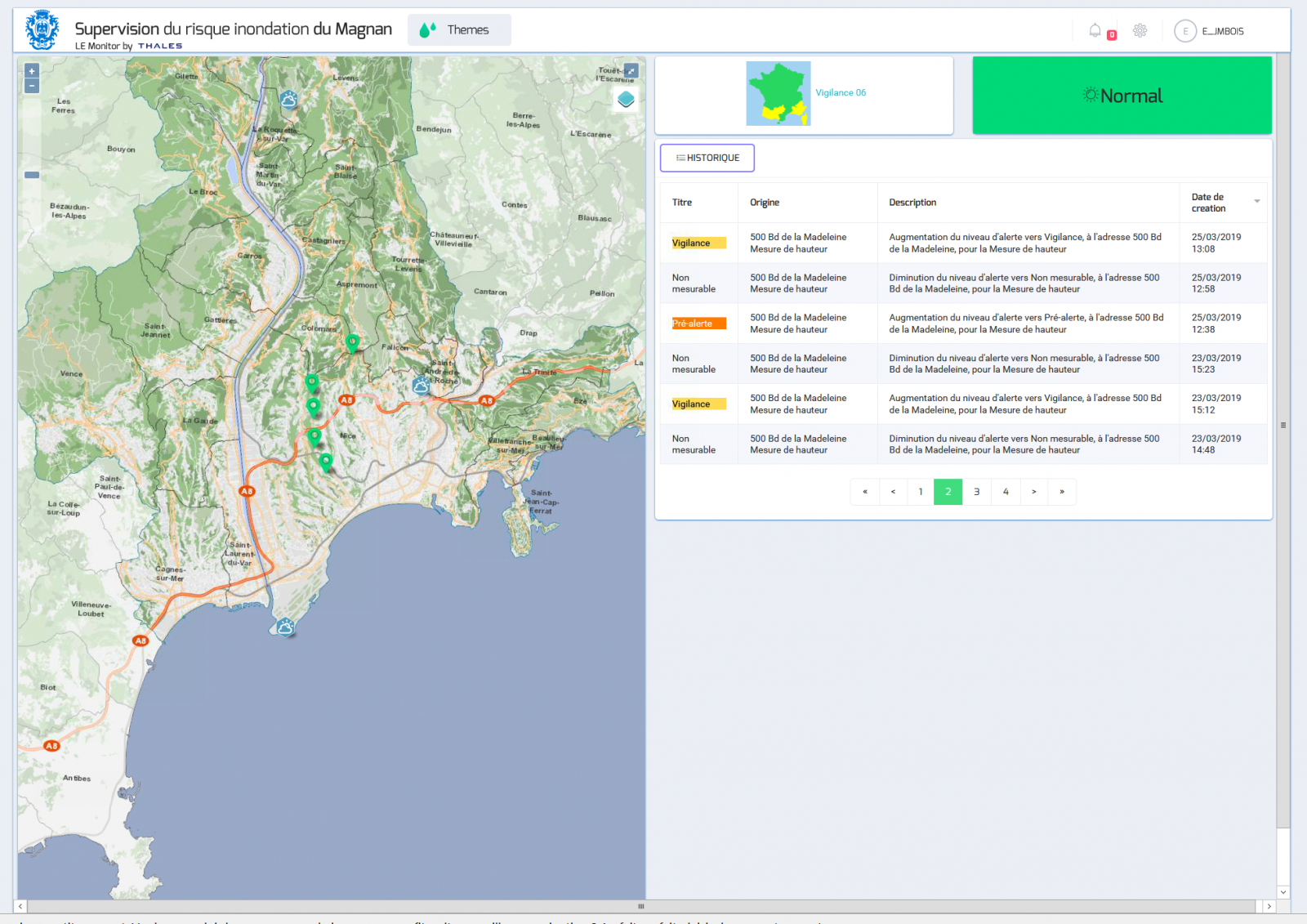
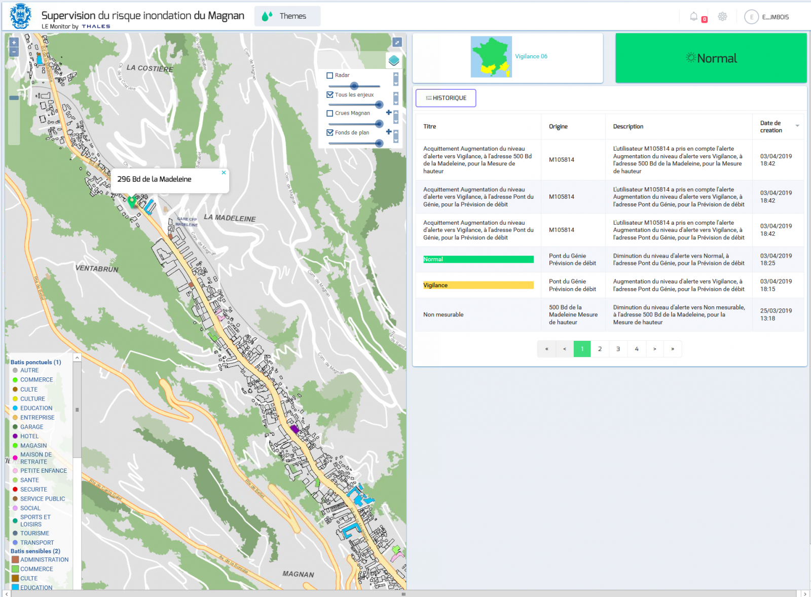
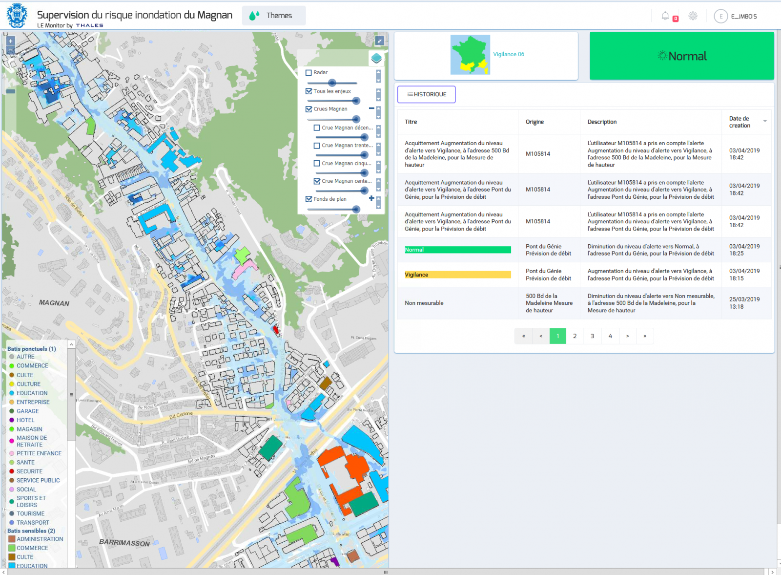
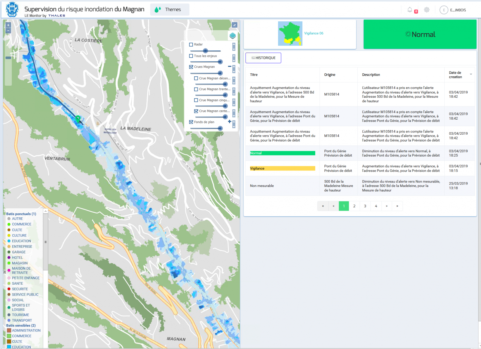
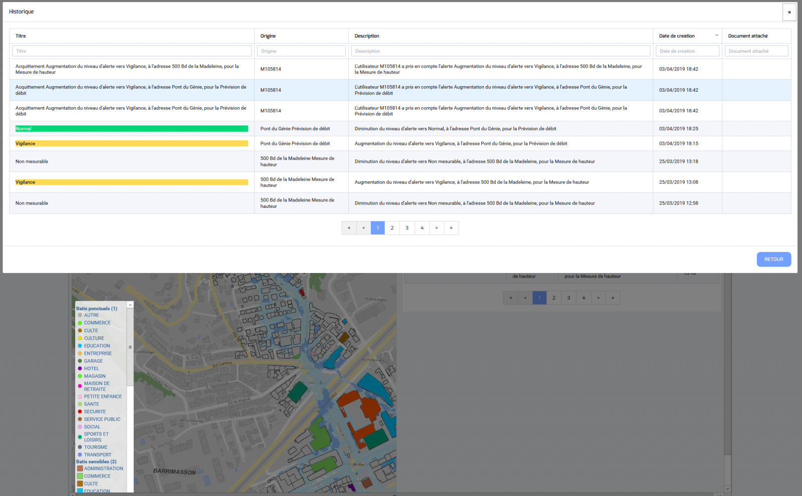
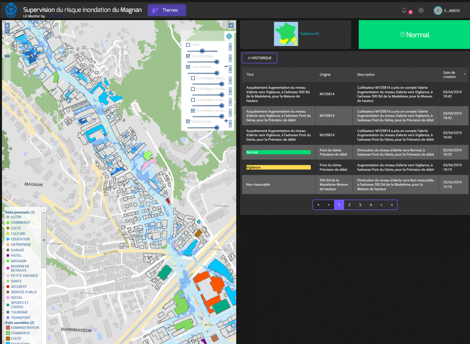
INTEROPERABLE TOOLS TO FACILITATE DATA SUPERVISION
The city of Nice wanted to get even better use from the hydrometeorological data produced on the Magnan catchment using a customised supervisor. Developed by Thalès, this supervisor centralises the data produced by the TENEVIA sensor cameras and the HydroCore simulator. Using the API TENEVIA app, the hydrometric data, hydrological forecasts and camera images can be easily and directly integrated into the external supervisor.
In the context of the Magnan project, the city of Nice gave access to its data warehouse for easier data flow centralisation and management. It contains in particular the meteorological data, the data produced by TENEVIA and the measurements taken by the sensors that are already installed in the city.