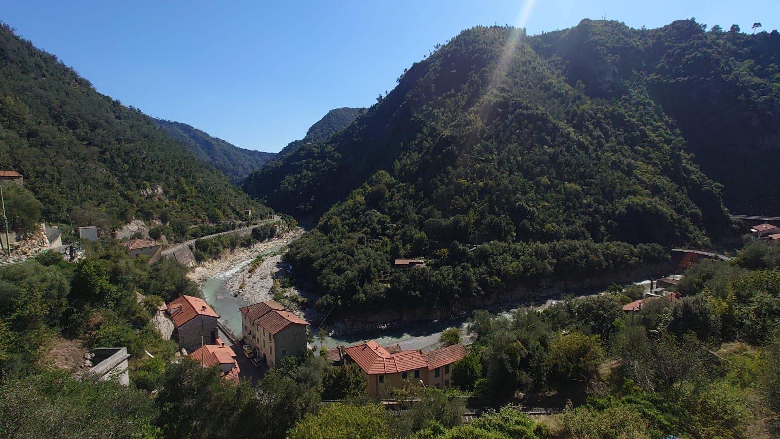
A Mediterranean river valley subject to extreme flooding
The Vésubie and Roya valleys were heavily impacted by the the Mediterranean storm Alex on October 2th-3rd 2020. Up to 450 to 500 mm of cumulated rainfall were recorded in the area and the resulting flash floods caused countless damage.
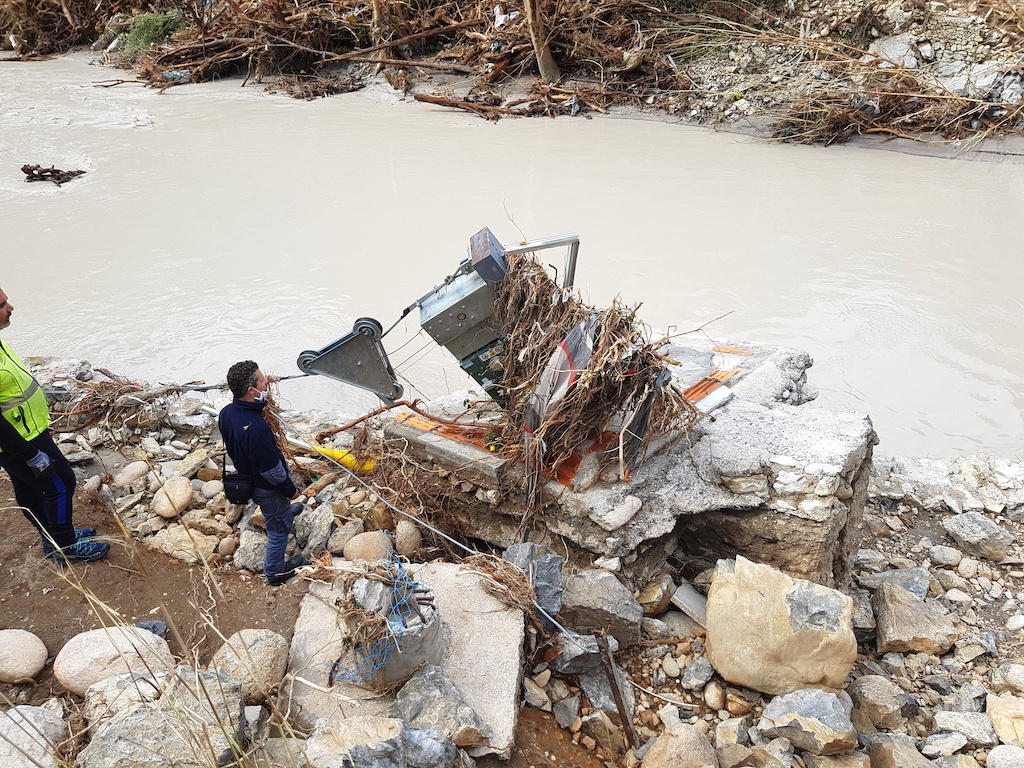
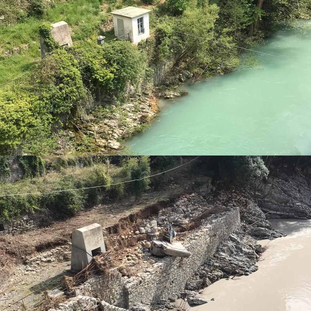
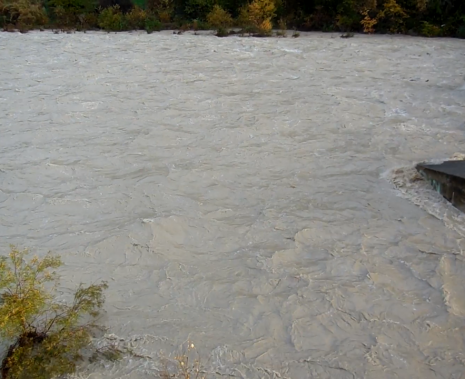
The hydrometric station of Airole on the Roya river recorded more than 8 meters and was completely destroyed. The water level pressure sensor was damaged and the cableway system used for stream gauging was washed away by the flood. A topographical survey, carried out on October 7th 2020 in order to detect the traces of the flood and estimate its maximum height, have shown flood traces just over 11 meters above the hydrometric zero. The highest levels recorded before 2020 were 7.02 meters (November 4th, 2014) and 6.90 meters (November 11th, 1970).
Gauging extreme events has always been challenging in this valley. Moreover, significant flood events also come along with substantial variations of the river section profile causing frequent rating curve shifts.
However, the experience from the Alex storm emphasized the need of having reliable discharge measurements. ARPAL, the Regional Agency for Environmental Protection Ligure (Agenzia Regionale per la Protezione dell’Ambiente Ligure) therefore initiated a renovation project.
Renovation of the Airole hydrometric station
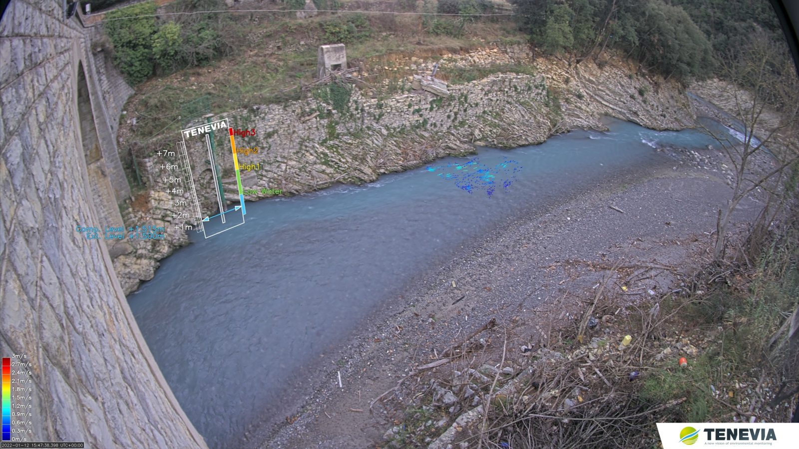
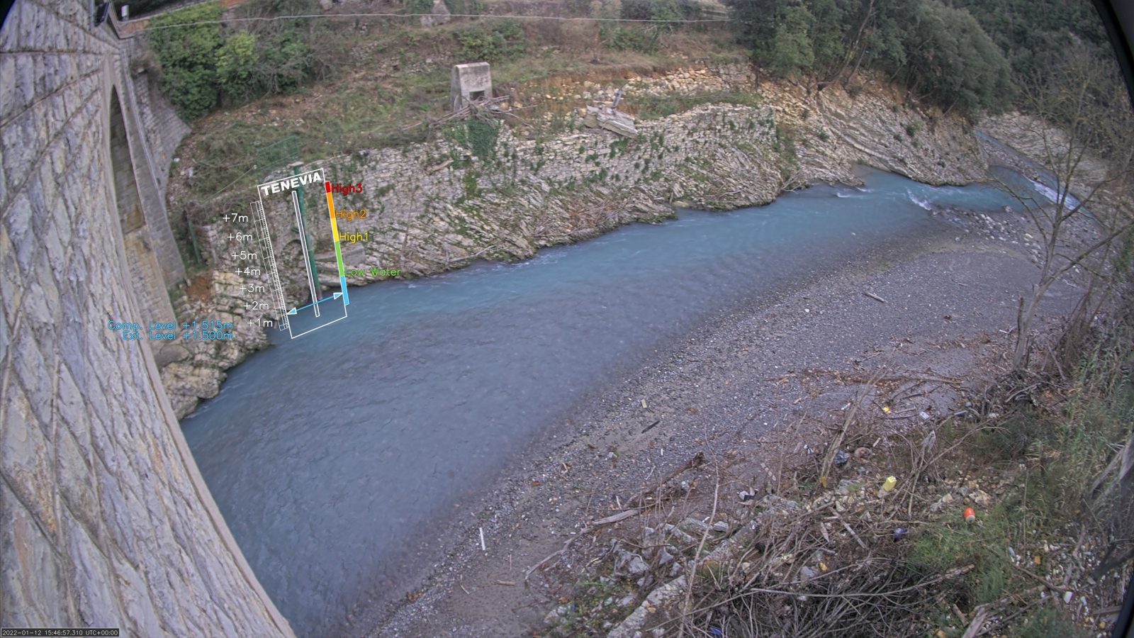
Given the ability of image velocimetry techniques to provide streamwise surface velocity measurements and discharge calculations, ARPAL decided to install a smart hydrometric camera. TENEVIA and MTX partnered in order to address this need.
TENEVIA developde mesure des vitesses de sruface par analyse d’images and commercializes softwares for the real-time and off-line measurement of river flows using fixed and mobile cameras. MTX develops or integrates but also installs and maintains environmental monitoring stations (sensors, data loggers, energy and transmission etc).
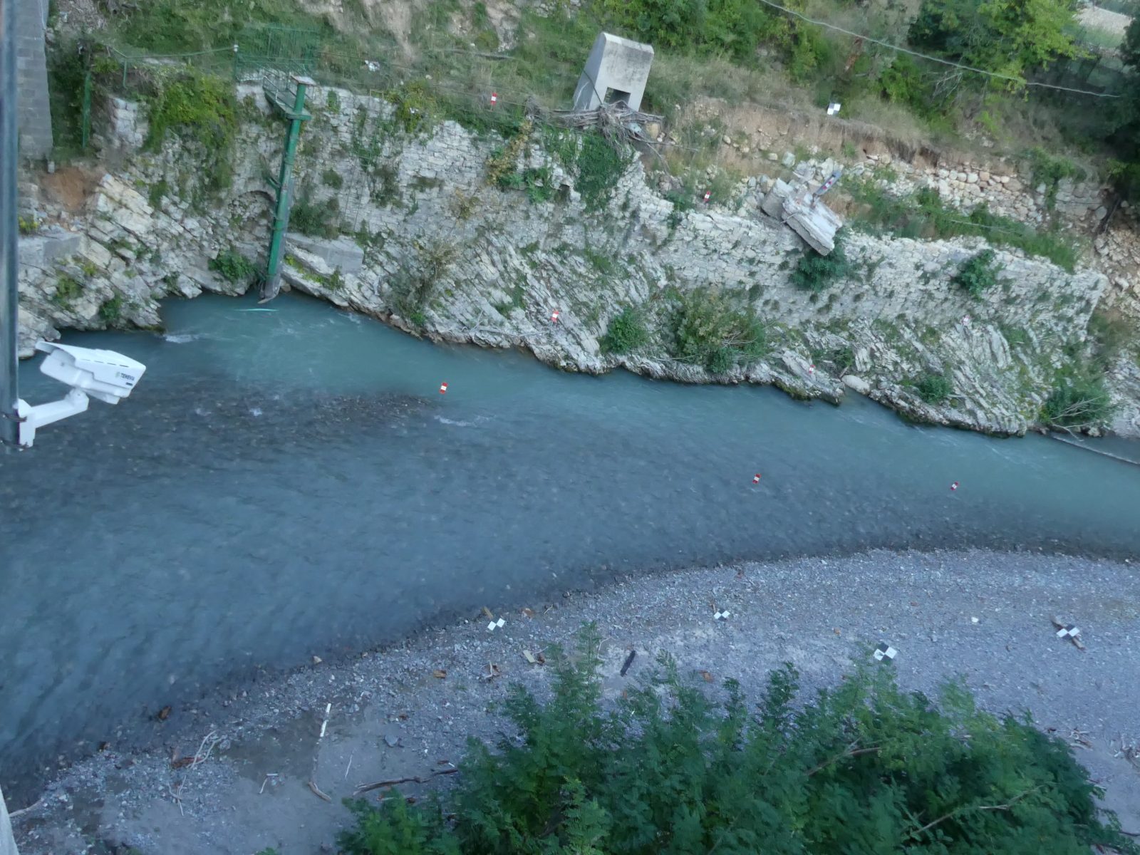
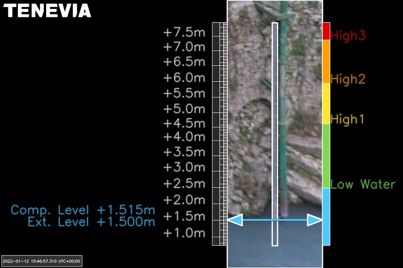
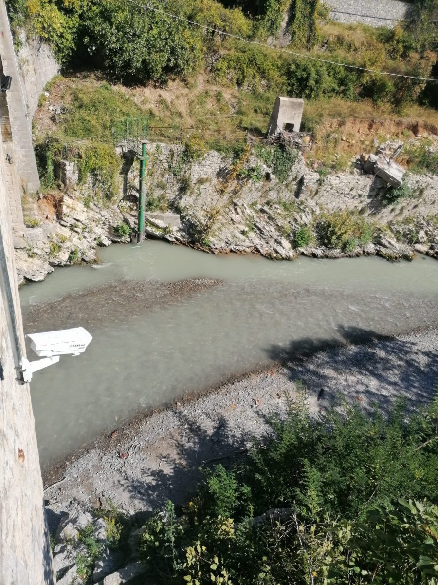
A station integrating an AXIS Communication P1378-LE and MTX MeteoDAS was installed. TENEVIA CamFlow-Edge software is running onsite using the camera computational ressources (Embedded processing, i.e Edge computing). The camera gets get the water level measured by the water level sensor already installed on site and process the image sequences onboard in order to measure surface velocities and compute discharge.
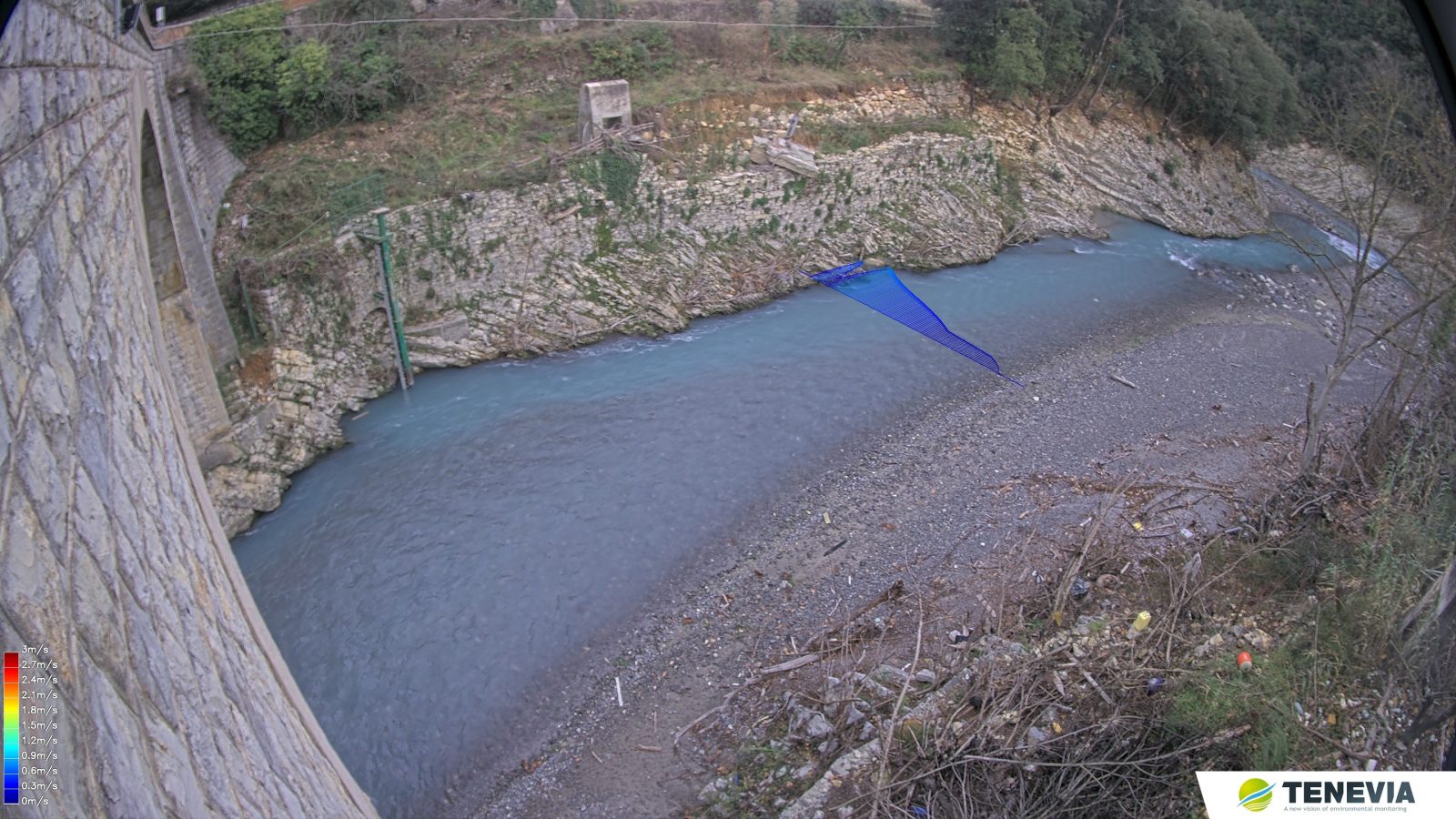
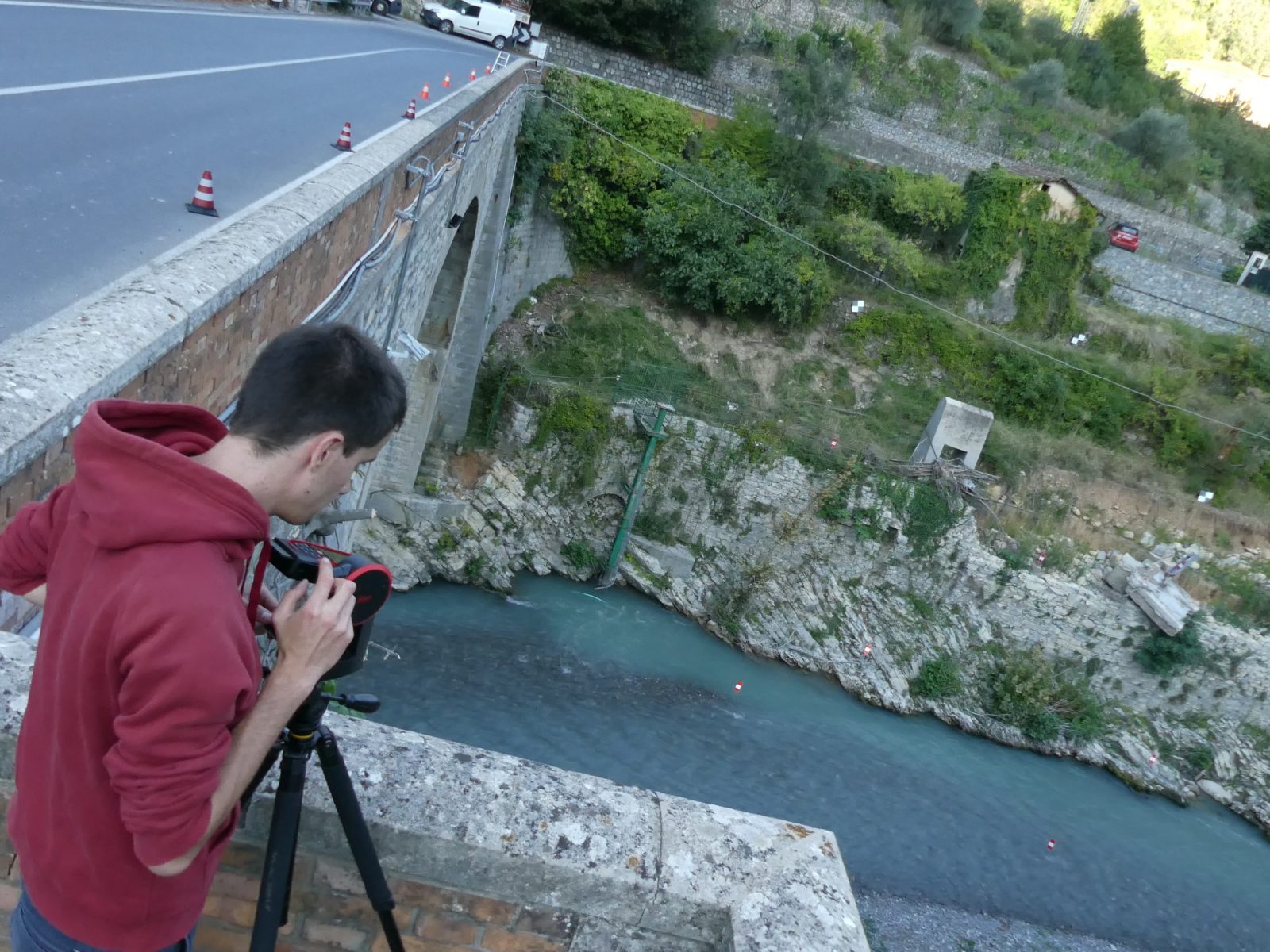
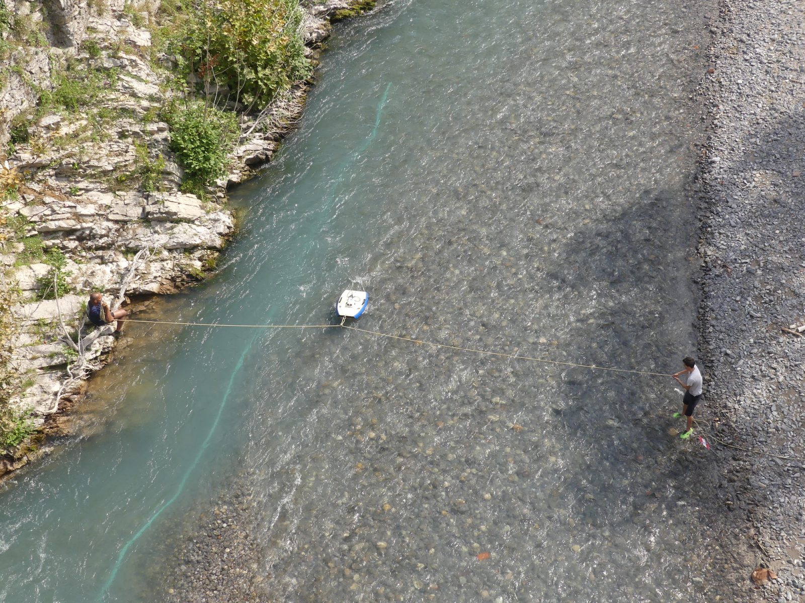
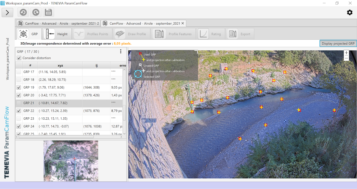
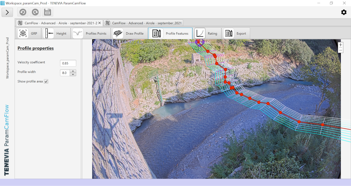
Topographic and bathymetric data were gathered by TENEVIA for the system calibration. They were combined and processed with the ParamCamFlow software in order to elaborate CamFlow-Edge xml configuration file. The entire workflow integrating field data gathering and the use of ParamCamFlow software was shown to ARPAL and MTX in order to enable efficient, autonomous and sustainable operations.
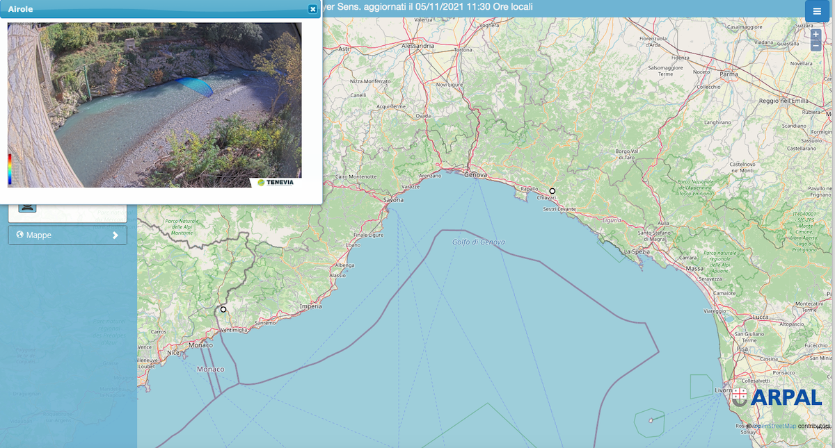
The system is now fully operational. Measurements and augmented images are gathered by the data logger, integrated to ARPAL hydrometerologic database and made available in their supervision system. The calculated discharge values will be used, in combination with traditional gauging to continuously update the site rating curve and river section. MTX will also continue to carry out maintenance operations on the station.
Calibration of the measuring device
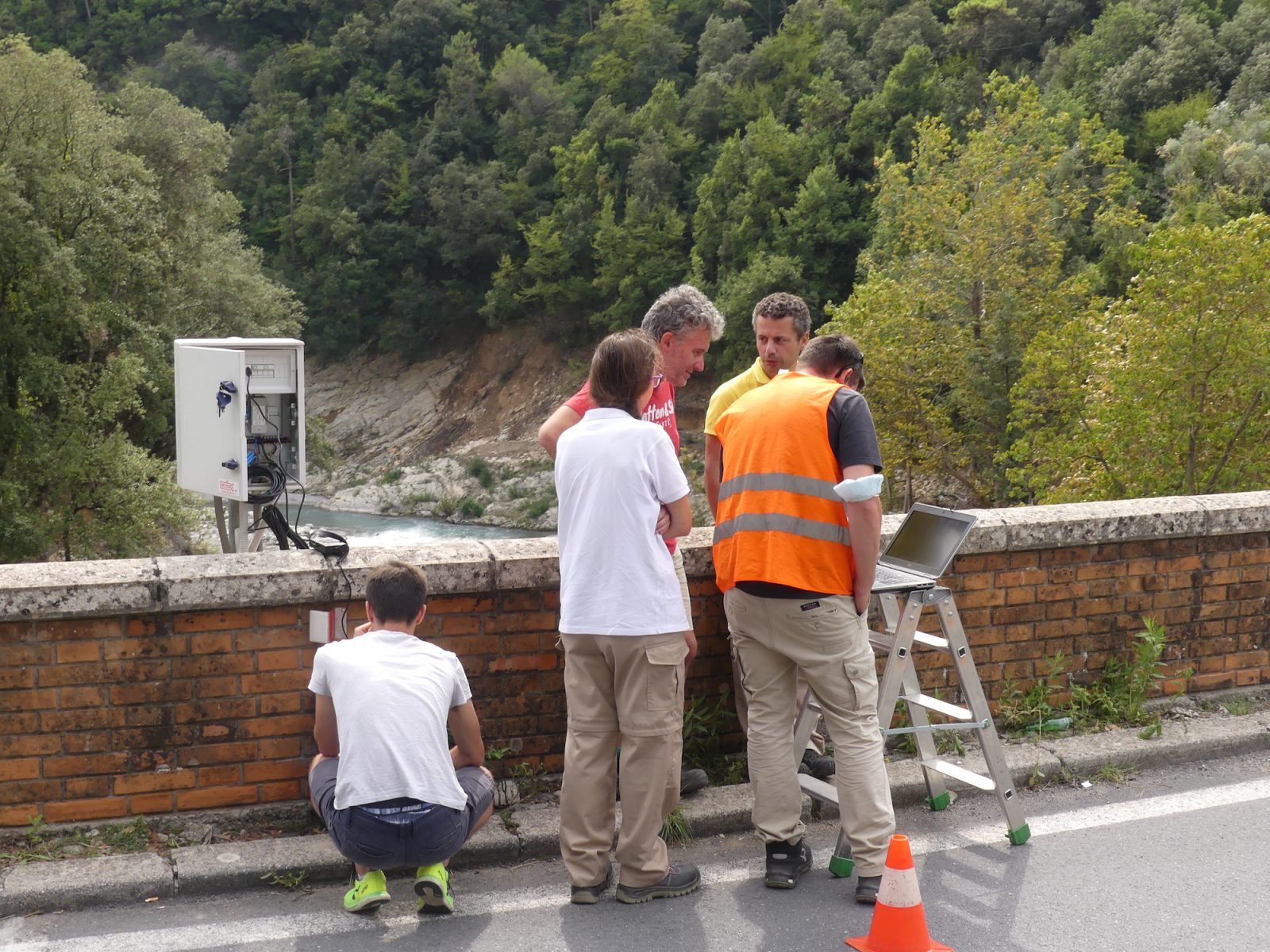
Renovation of the Roya station in Airole with the CamFlow measurement solution