USING A CAMERA TO ASSESS USER NUMBERS ON THE GUIL RIVER
The main river in the Queyras valley in the Hautes-Alpes department is the Guil. To reconcile the preservation and development of this rural mountain area, the French government and regional authorities created the Queyras Regional Nature Park in 1977. Today, the Queyras Park’s missions consist mainly of:
- Preserving and enhancing the natural and cultural heritage,
- Encouraging economic development and the quality of life,
- Developing the region,
- Informing inhabitants and visitors and raising awareness,
- Carrying out experimental or innovative actions.
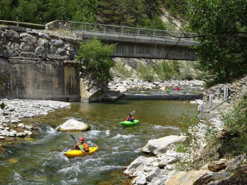
With its exceptional natural environment, the Queyras is undergoing an increase in visitor numbers. The practice of outdoor sports (skiing, paragliding, hiking, white water sports, etc.) represents one of the region’s main activities. In particular, fresh-water leisure activities such as fishing, rafting, canoeing and kayaking, hydrospeed, etc. are highly successful in the Guil valley. These activities must therefore be added to the many uses of water (hydropower, artificial snow production, drinking water…) that may have an impact on the correct balance of the aquatic environment and give rise to conflicts of use. This is why the Queyras National Park decided to monitor white water sports on the valley’s main waterway, the river Guil, as one of its missions.
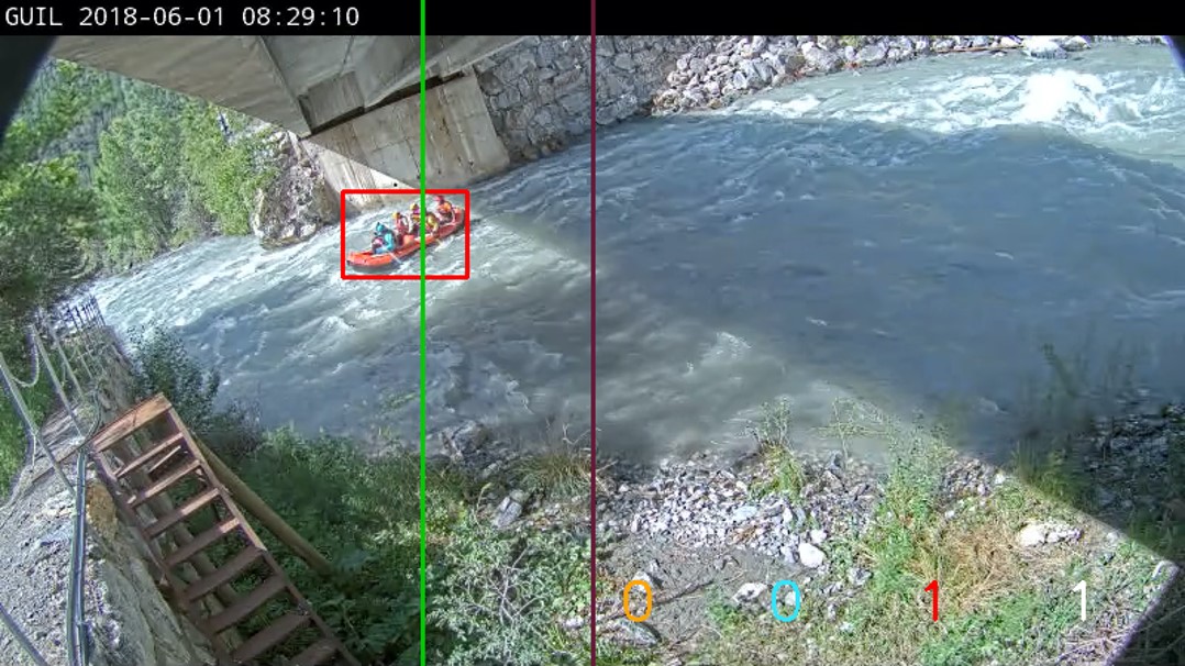
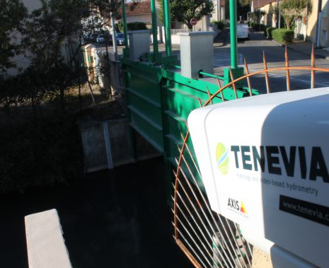
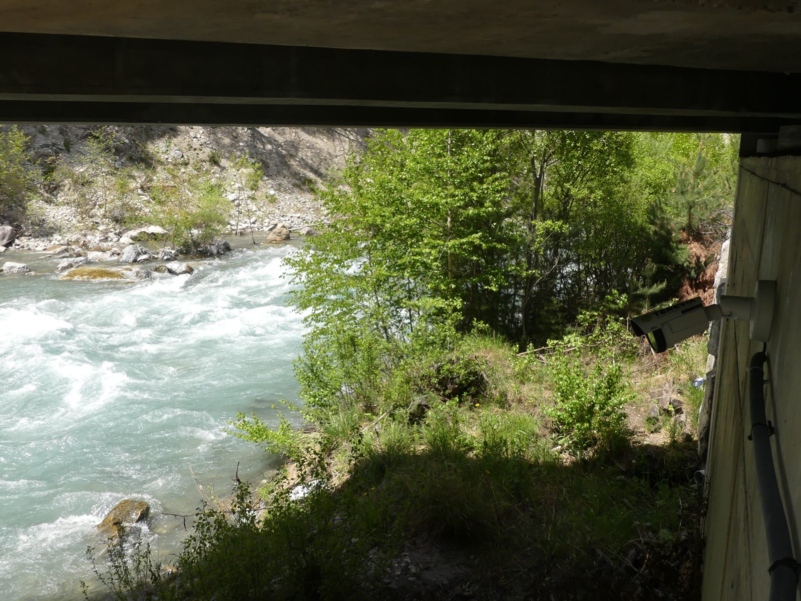
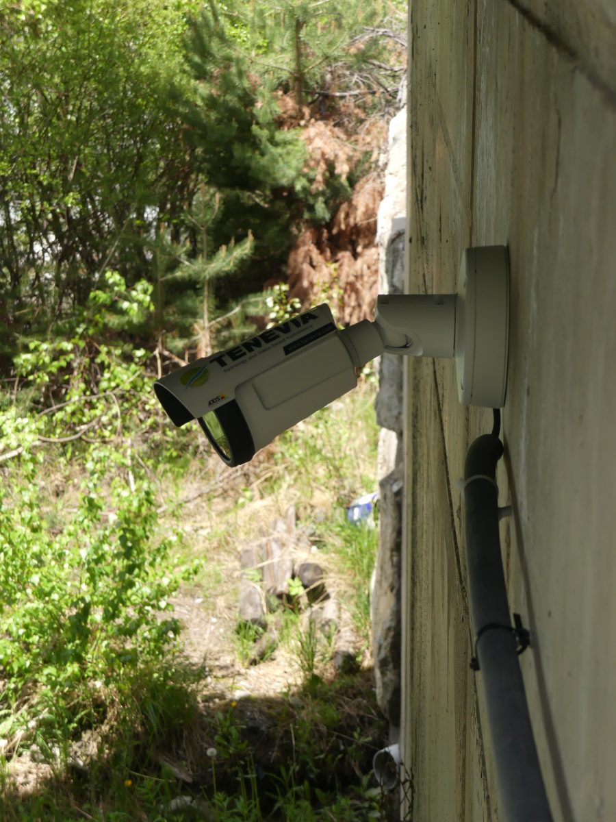
To meet the need for instrumentation, the Queyras National Park authorities asked TENEVIA to implement an innovative device that could detect, count and classify watercraft on the Guil using camera images. In partnership with EDF, the Queyras National Park installed an Axis P1447-LE camera. TENEVIA extended the functionalities of its image processing algorithm library, on which its CamLevel et CamFlow sensors, in particular, are based. Using deep learning type computer vision and artificial intelligence techniques, TENEVIA created its CamBoat solution, specifically for the detection of watercraft through camera images. Over and above the detection functionality, this new sensor allows the watercraft to be classified into three categories that are found on the Guil site: rafts, kayaks and hydrospeeds. Counting performance levels noted are around 90%. This good result means that the Queyras National Park can now envisage rolling out the TENEVIA CamBoat® solution on other sites for a better understanding of activity dynamics.
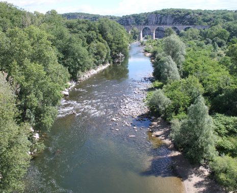
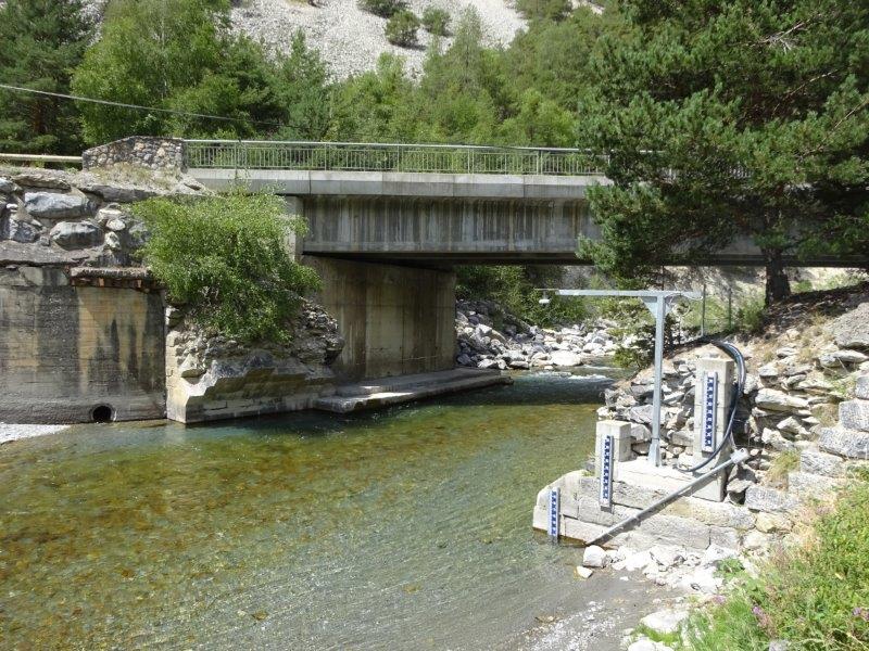
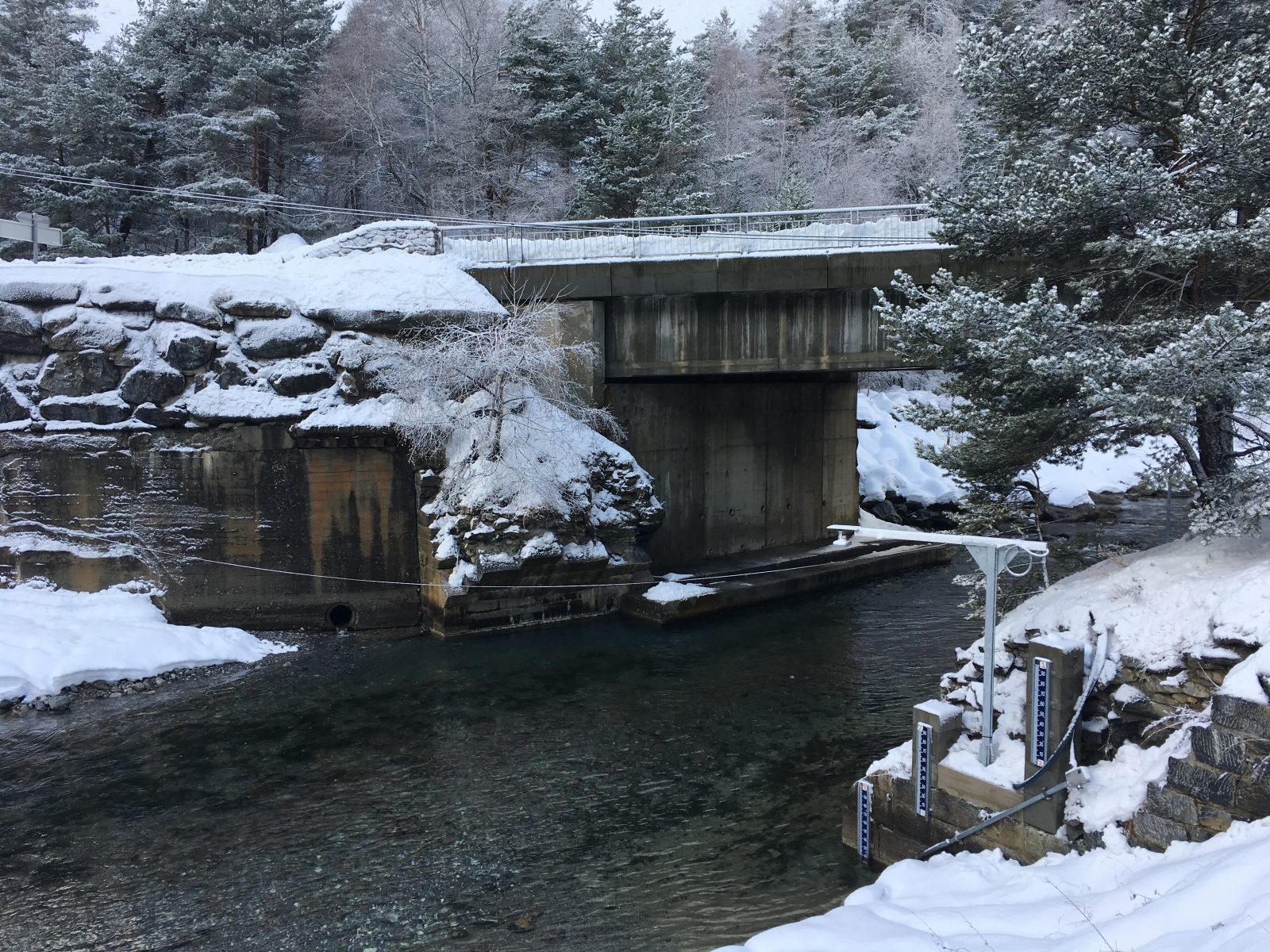
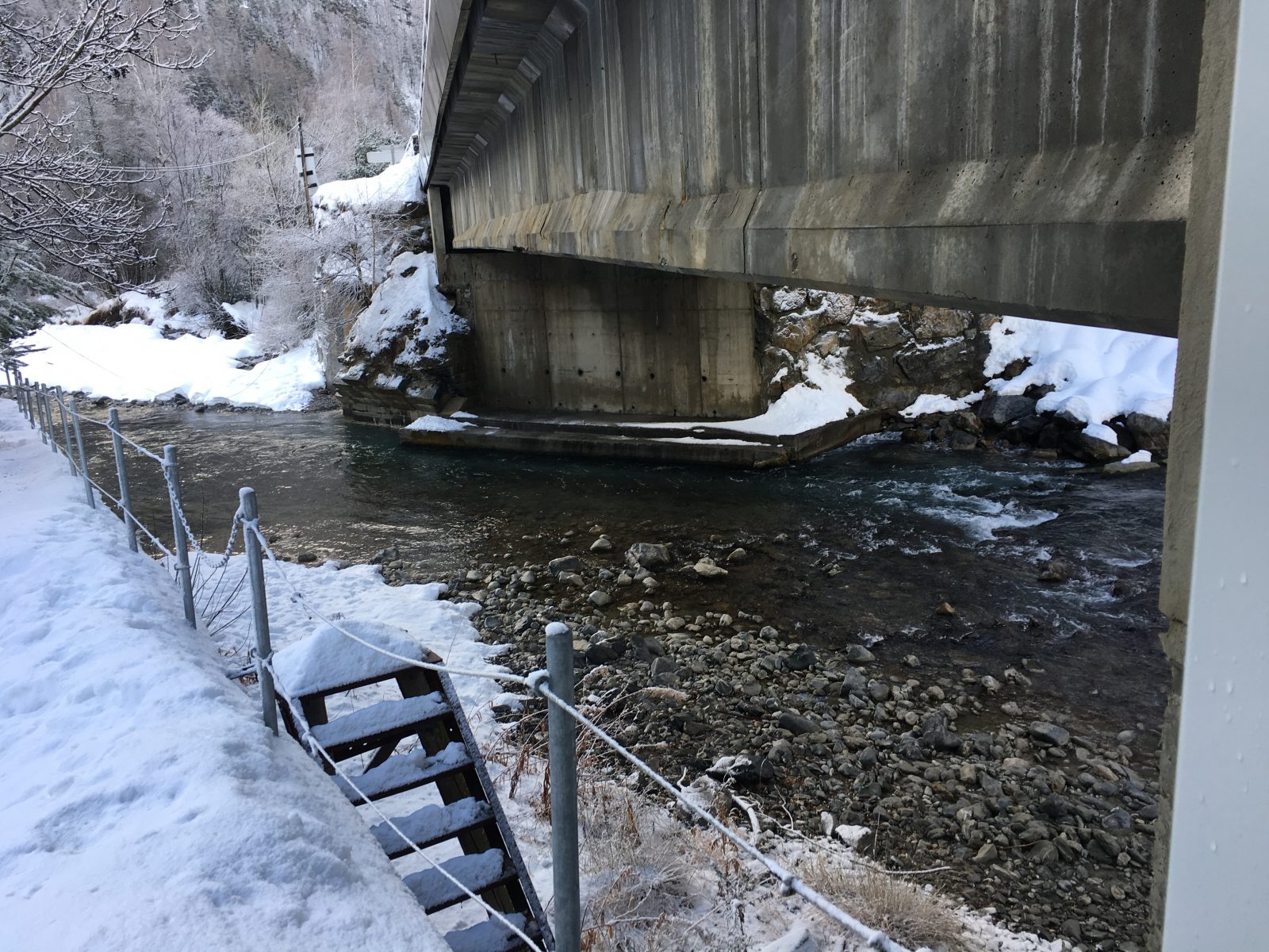
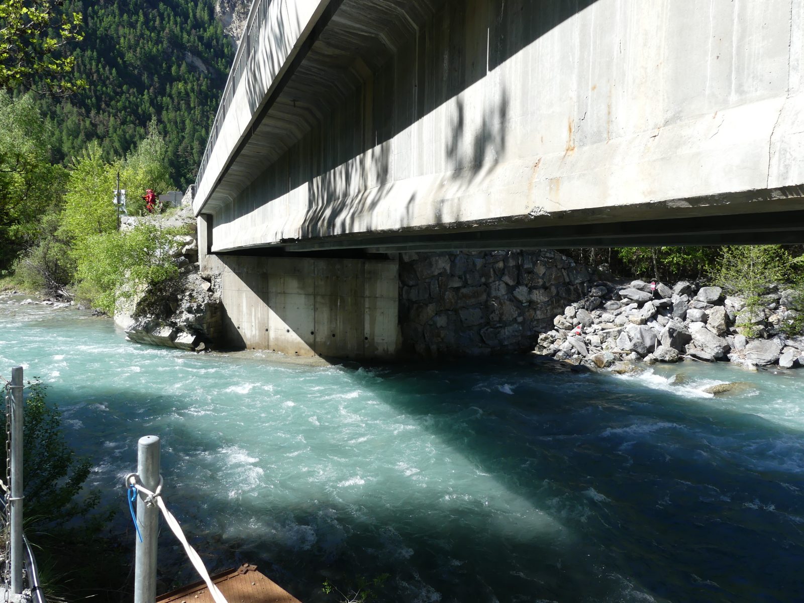
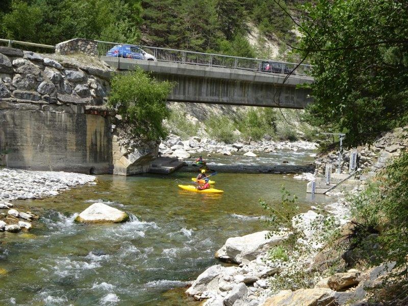
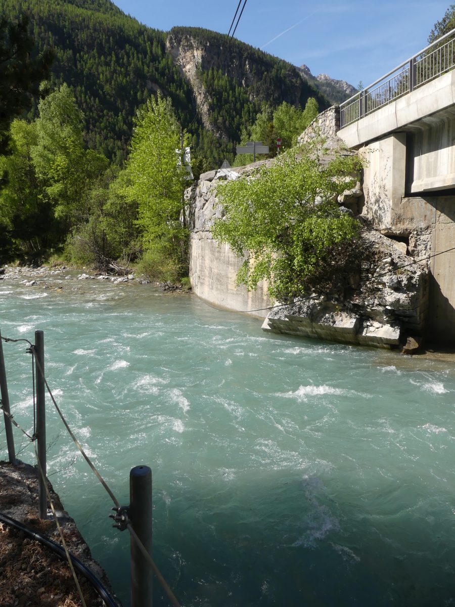
PHOTOS OF THE EQUIPPED SITE (CREDITS: QUEYRAS NATIONAL PARK / TENEVIA)
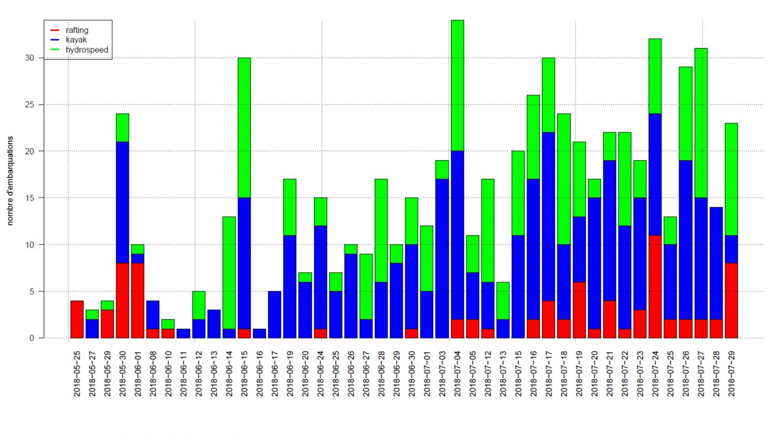
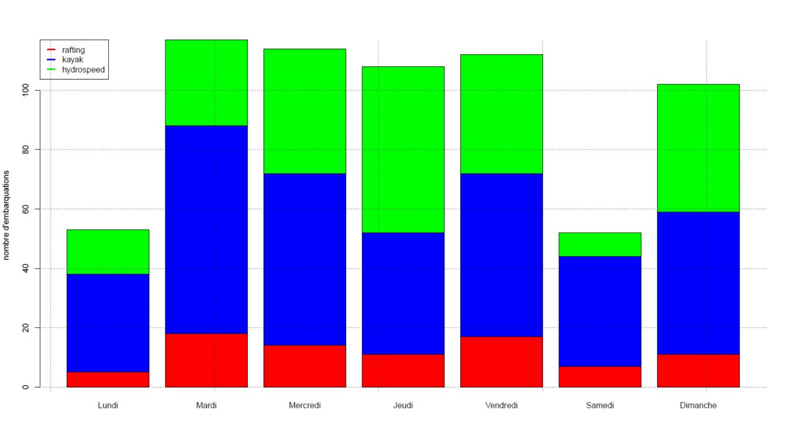
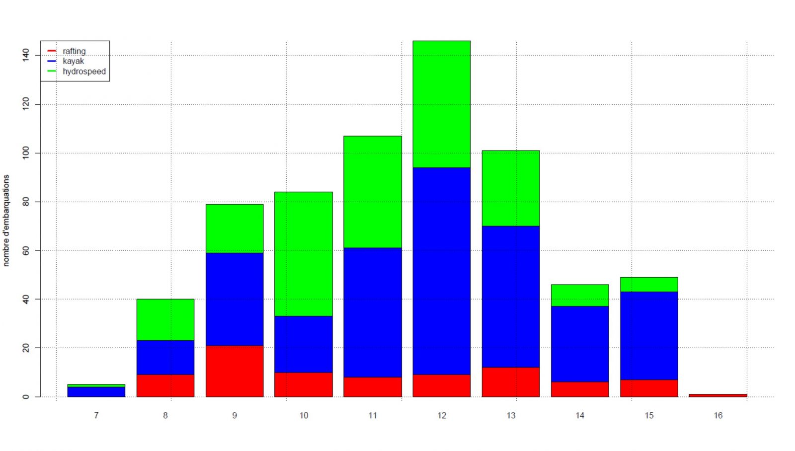
RESULTS & MEASUREMENTS